MyTopo
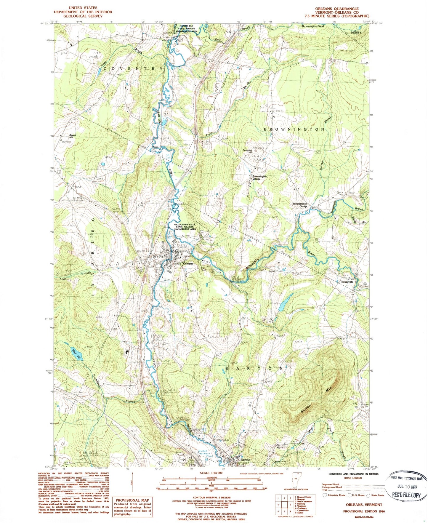
Classic USGS Orleans Vermont 7.5'x7.5' Topo Map
Couldn't load pickup availability
Historical USGS topographic quad map of Orleans in the state of Vermont. Map scale may vary for some years, but is generally around 1:24,000. Print size is approximately 24" x 27"
This quadrangle is in the following counties: Orleans.
The map contains contour lines, roads, rivers, towns, and lakes. Printed on high-quality waterproof paper with UV fade-resistant inks, and shipped rolled.
Contains the following named places: Abbot Lot Cemetery, Alder Brook, Athenian Hall, Barton Ambulance Squad, Barton Mountain, Barton Post Office, Belview Campground, Brownington Branch, Brownington Center, Brownington Center Cemetery, Brownington Central School, Brownington Village, Brownington Village Cemetery, Brownington Village Historic District, Burton Hill School, Butternut Hill, Center Cemetery, Coventry Center School, Day Brook, Day School, Dutton Brook, Evansville, Heath Cemetery, Heath School, Hogtrough Brook, Jones Memorial Library, Lake Region Union High School, Maple Street Cemetery, Mount Pleasant Cemetery, Mud Pond, North Browington School, North Cemetery, Old Stone House, Old Stone House Library, Orleans, Orleans County, Orleans County Grammar School, Orleans County Historical Society Building, Orleans County Historical Society Museum, Orleans Elementary School, Orleans Emergency Unit, Orleans Fire Department, Orleans Golf Course, Orleans Post Office, Orleans Town Hall, Paine Site Number 1 Dam, Paine Site Number Two Dam, Pleasant View Cemetery, Prospect Hill, Revoir Hill, Saint Pauls Cemetery, Saint Theresa Cemetery, South Bay State Wildlife Management Area, Town of Barton, Trout Brook, Village of Orleans, Wells Brook, Willoughby Falls State Wildlife Management Area, Willoughby River, ZIP Codes: 05822, 05825