MyTopo
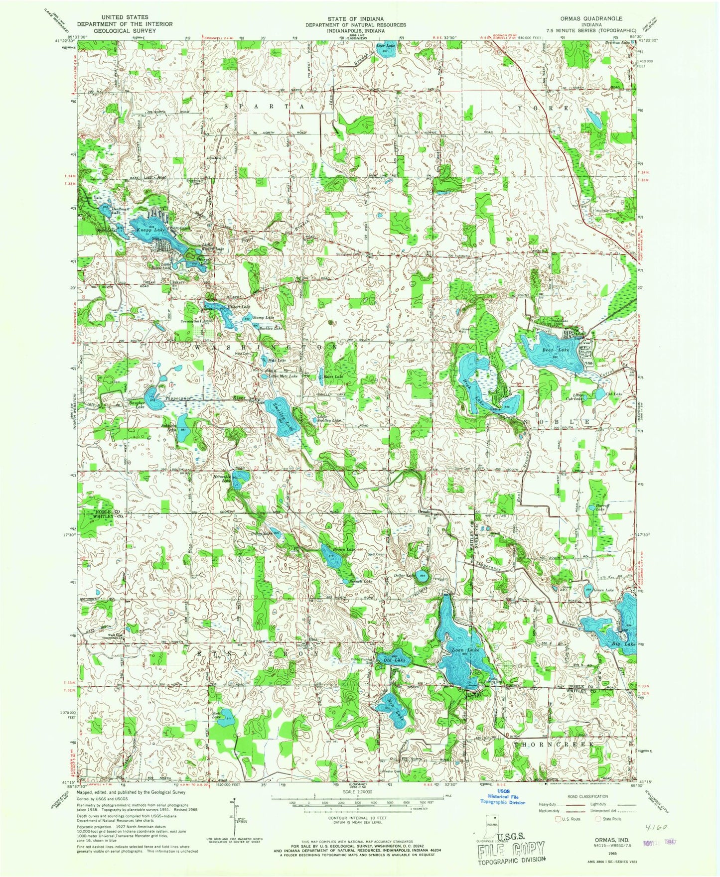
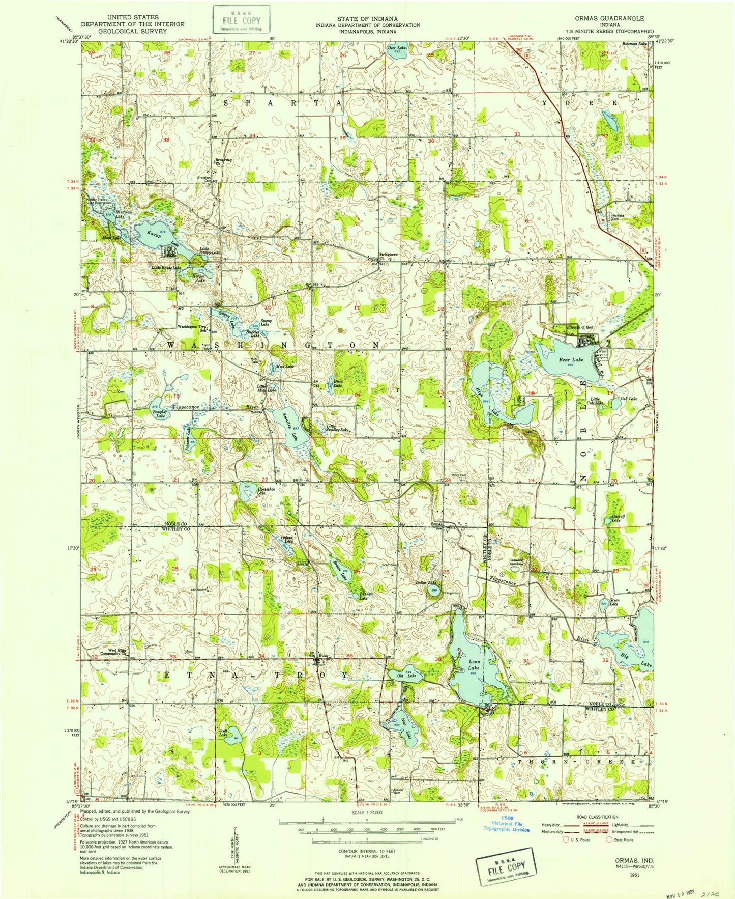
Classic USGS Ormas Indiana 7.5'x7.5' Topo Map
Couldn't load pickup availability
Historical USGS topographic quad map of Ormas in the state of Indiana. Map scale may vary for some years, but is generally around 1:24,000. Print size is approximately 24" x 27"
This quadrangle is in the following counties: Noble, Whitley.
The map contains contour lines, roads, rivers, towns, and lakes. Printed on high-quality waterproof paper with UV fade-resistant inks, and shipped rolled.
Contains the following named places: Baugher Lake, Beal Branch, Bear Lake, Bear Lake Chapel, Beers Lake, Bennett Lake, Big Lake, Broadway Cemetery, Broadway Church, Brown Lake, Buckles Lake, Carrol Creek, Cub Lake, Deer Lake, Dollar Lake, Etna, Friskney Ditch, Gaff Ditch, Gilbert Lake, Green Lake, Harper Lake, Harroff Lake, High Lake, Hindman Lake, Horseshoe Lake, Iden Branch, Indian Lake, Johnson Lake, Knapp Lake, Little Bause Lake, Little Cub Lake, Little Knapp Lake, Little Metz Lake, Little Smalley Lake, Loon Lake, Metz Cemetery, Metz Lake, Moss Lake, New Lake, Old Lake, Ormas, Pioneer Trails Camp, Piper Branch, Scott Cemetery, Scott Lake, Smalley Lake, Smith Ditch, Stump Lake, Thorn Cemetery, Township of Etna-Troy, Township of Washington, Washington Center, West Etna Community Church, Winters Ditch, Wolflake Cemetery, ZIP Code: 46760