MyTopo
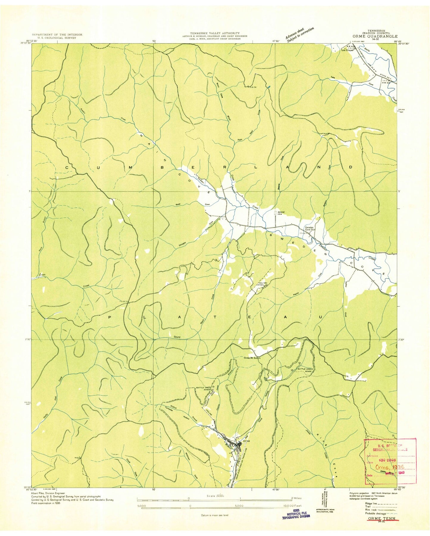
Classic USGS Orme Tennessee 7.5'x7.5' Topo Map
Couldn't load pickup availability
Historical USGS topographic quad map of Orme in the state of Tennessee. Typical map scale is 1:24,000, but may vary for certain years, if available. Print size: 24" x 27"
This quadrangle is in the following counties: Franklin, Marion.
The map contains contour lines, roads, rivers, towns, and lakes. Printed on high-quality waterproof paper with UV fade-resistant inks, and shipped rolled.
Contains the following named places: Collins Cove, Snake Pond, Straight Cove, The Cowbones, The Levels, Turnpike Point, Walled Spring, Ballard Point, Beene Cemetery, Beene Cove, Billy Goat Cliff, Bolton Point, Cave Spring, Chitty Cove, Crooked Tree Hollow, Deerstand Hill, Dogwood Spring, Falling Cliff, Fishtrap Point, Franklin-Marion State Forest, Gilliam Cove, Goat Rock, Gourdneck Cove, Holly Spring, Horseshoe Point, Hotel Point, Jackson Point, Kelley Cove, Lodge, Main Cove, Nancy Winn Cove, Old Shop Hollow, Orme, Orme Mountain, Orme Mountain School, Panther Cove, Payne Cove, Price Ridge, Rattlesnake Spring, Red Hill, Red Pond, Rocky Narrows, Rogers Cove, Rose Cove, Sandy Narrows, Sweden Cove School, Thomas Cemetery, Wildcat Spring, Clayton Camp Branch, Battle Creek Mines, Battle Creek Mines, Bolten Mines, Right Hand Prong Winn Creek, Tate Cove Creek, Wildcat Branch, North Branch Cross Creek, Tate Cove, Lous Chapel, Sweetens Cove Primitive Baptist Church, The Crossroads, Orme Mountain Cemetery, Orme School (historical), Beene Cove Branch, Kelly Cove Branch, Rogers Cove Branch, Straight Cove Branch, Goardneck Cove Branch, Nancy Winn Cove Branch, Payne Number 1 Mine, Town of Orme, Commissioner District 1, South Pittsburg Mountain Volunteer Fire Department, Orme Volunteer Fire Department, Sweetens Cove Volunteer Fire Department, Collins Cove, Snake Pond, Straight Cove, The Cowbones, The Levels, Turnpike Point, Walled Spring, Ballard Point, Beene Cemetery, Beene Cove, Billy Goat Cliff, Bolton Point, Cave Spring, Chitty Cove, Crooked Tree Hollow, Deerstand Hill, Dogwood Spring, Falling Cliff, Fishtrap Point, Franklin-Marion State Forest, Gilliam Cove, Goat Rock, Gourdneck Cove, Holly Spring, Horseshoe Point, Hotel Point, Jackson Point, Kelley Cove, Lodge, Main Cove, Nancy Winn Cove, Old Shop Hollow, Orme, Orme Mountain, Orme Mountain School, Panther Cove, Payne Cove, Price Ridge, Rattlesnake Spring, Red Hill, Red Pond, Rocky Narrows, Rogers Cove, Rose Cove, Sandy Narrows, Sweden Cove School, Thomas Cemetery, Wildcat Spring, Clayton Camp Branch, Battle Creek Mines, Battle Creek Mines, Bolten Mines, Right Hand Prong Winn Creek, Tate Cove Creek, Wildcat Branch, North Branch Cross Creek, Tate Cove, Lous Chapel, Sweetens Cove Primitive Baptist Church, The Crossroads, Orme Mountain Cemetery, Orme School (historical), Beene Cove Branch, Kelly Cove Branch, Rogers Cove Branch, Straight Cove Branch, Goardneck Cove Branch, Nancy Winn Cove Branch, Payne Number 1 Mine, Town of Orme, Commissioner District 1, South Pittsburg Mountain Volunteer Fire Department, Orme Volunteer Fire Department, Sweetens Cove Volunteer Fire Department


