
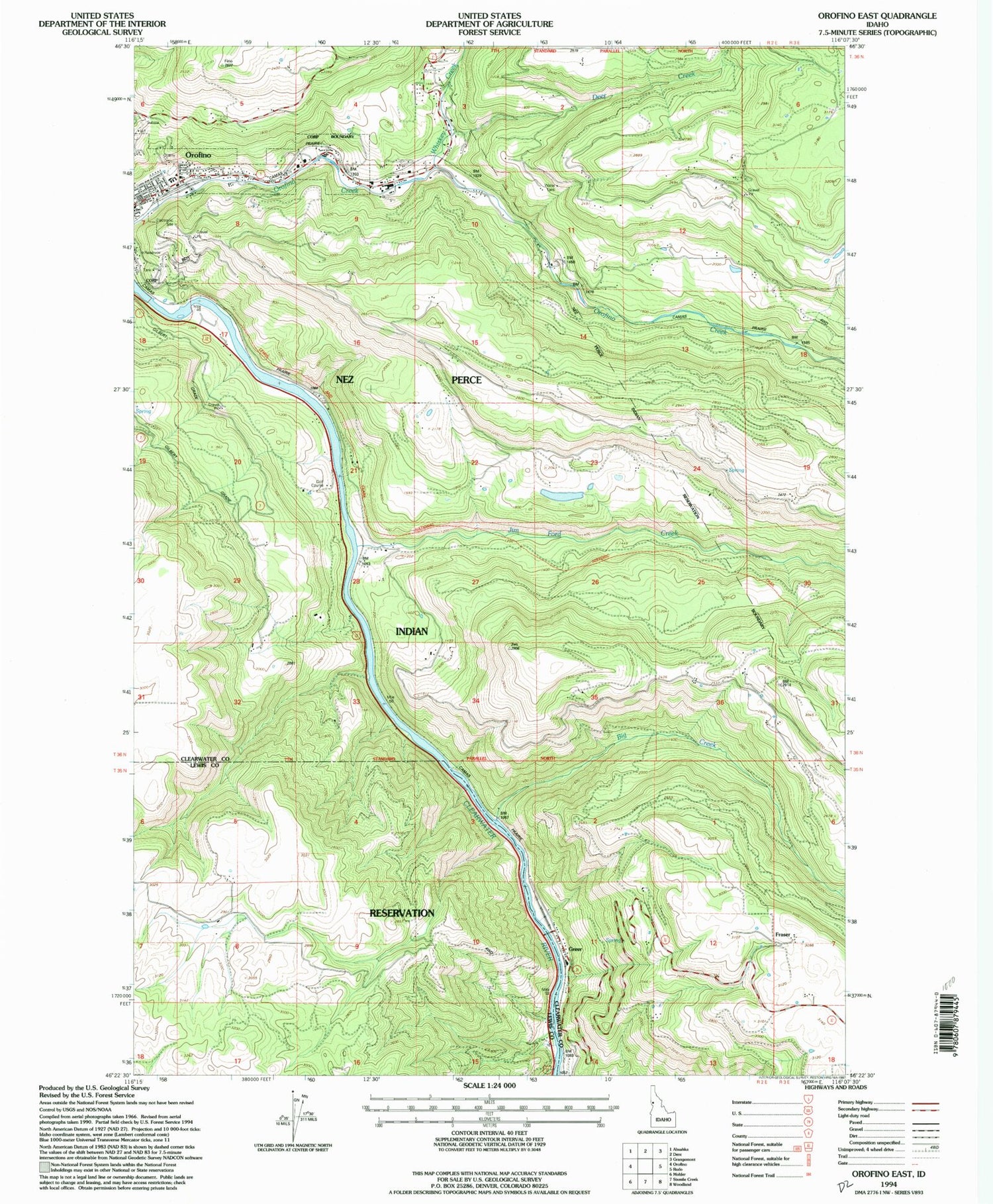
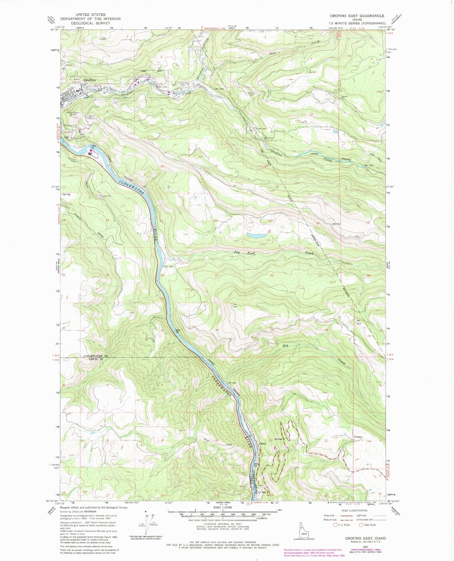
MyTopo
Classic USGS Orofino East Idaho 7.5'x7.5' Topo Map
Regular price
$16.95
Regular price
Sale price
$16.95
Unit price
per
Couldn't load pickup availability
Historical USGS topographic quad map of Orofino East in the state of Idaho. Map scale may vary for some years, but is generally around 1:24,000. Print size is approximately 24" x 27"
This quadrangle is in the following counties: Clearwater, Lewis.
The map contains contour lines, roads, rivers, towns, and lakes. Printed on high-quality waterproof paper with UV fade-resistant inks, and shipped rolled.
Contains the following named places: Big Creek, Blake, Brunning, Deer Creek, Fraser, Greer, Greer Access Area, Hill Cemetery, Jim Ford Creek, KLER-AM (Orofino), KLER-FM (Orofino), Konkolville, Orofino Elementary School, Upper Fords Creek Rural Fire Department, Whiskey Creek, ZIP Code: 83544


