MyTopo
Classic USGS Oronto Bay Wisconsin 7.5'x7.5' Topo Map
Couldn't load pickup availability
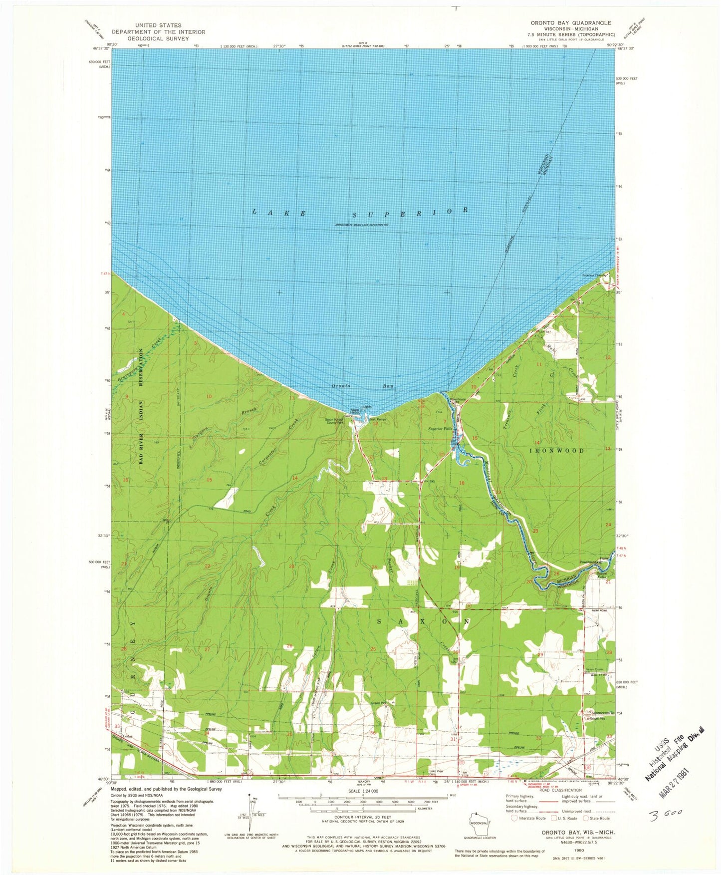
Historical USGS topographic quad map of Oronto Bay in the states of Wisconsin, Michigan. Map scale may vary for some years, but is generally around 1:24,000. Print size is approximately 24" x 27"
This quadrangle is in the following counties: Gogebic, Iron.
The map contains contour lines, roads, rivers, towns, and lakes. Printed on high-quality waterproof paper with UV fade-resistant inks, and shipped rolled.
Contains the following named places: Carpenter Creek, Cedar, Flink Creek, Graveyard Creek, Lake View Cemetery, Legion County Park, Maki Creek, Montreal River, Oronto Bay, Oronto Creek, Parker Creek, Peterson Chapel, Saxon Airport, Saxon Falls, Saxon Falls Hydro Generating Station, Saxon Harbor, Saxon Harbor County Park, Saxon Union Church, Spoon Creek, Sturgeon Branch, Superior Falls, Superior Falls Flowage, Superior Falls Hydro Generating Station, Town of Saxon, Treasure Creek