
MyTopo
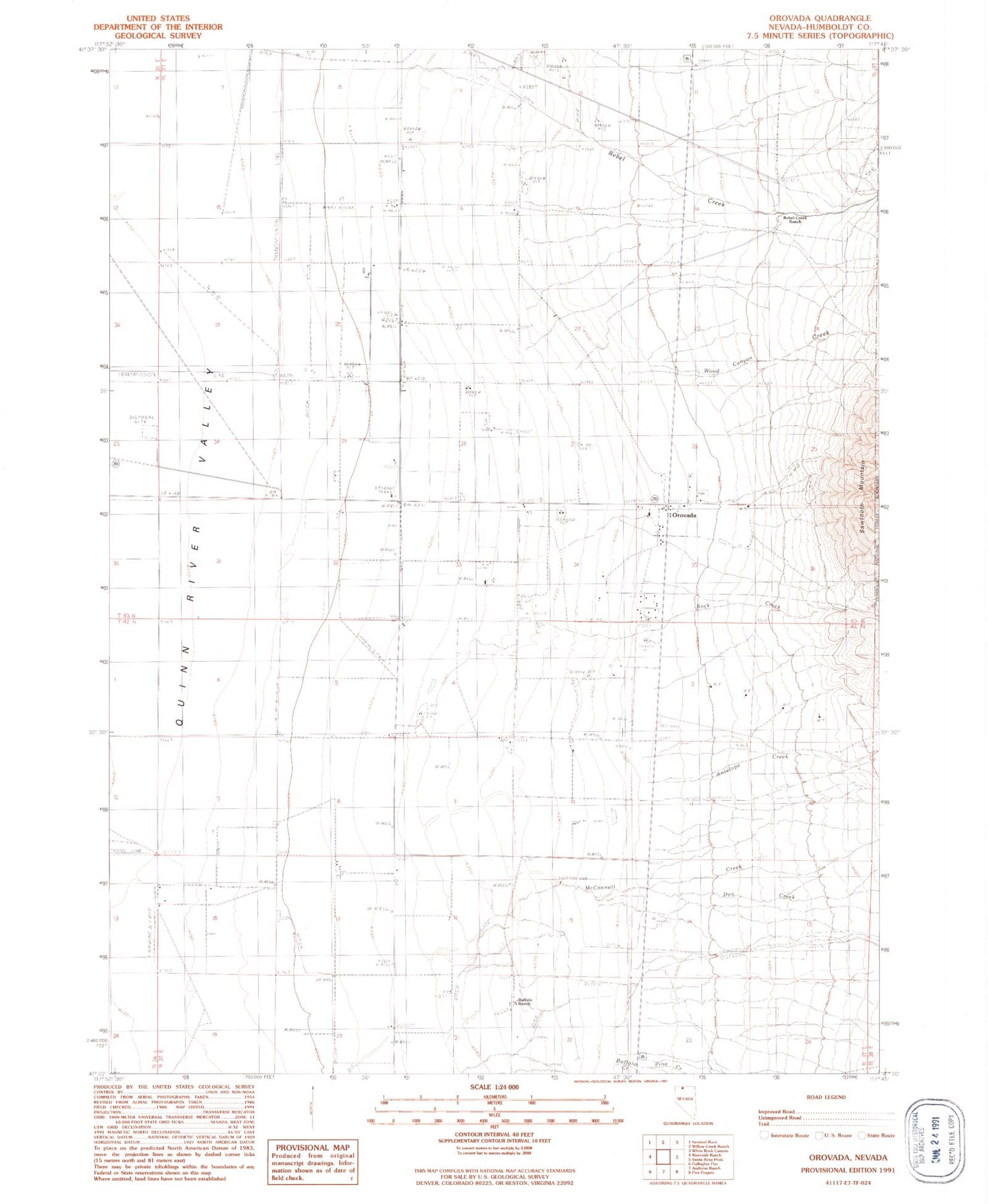
Classic USGS Orovada Nevada 7.5'x7.5' Topo Map
Couldn't load pickup availability
Historical USGS topographic quad map of Orovada in the state of Nevada. Map scale may vary for some years, but is generally around 1:24,000. Print size is approximately 24" x 27"
This quadrangle is in the following counties: Humboldt.
The map contains contour lines, roads, rivers, towns, and lakes. Printed on high-quality waterproof paper with UV fade-resistant inks, and shipped rolled.
Contains the following named places: Antelope Creek, Buffalo Creek, Buffalo Meadows, Buffalo Ranch, Buffalo Springs, Dog Creek, Golden Acres Ranch, Halfway Spring, McConnell Creek, Orovada, Orovada Cemetery, Orovada Census Designated Place, Orovada Elementary School, Orovada Fire Protection District, Orovada Post Office, Pine Creek, Pine Grove Airport, Rebel Creek, Rebel Creek Post Office, Rebel Creek Ranch, Rock Creek, Rock Creek Ranch, Wood Canyon Creek


