MyTopo
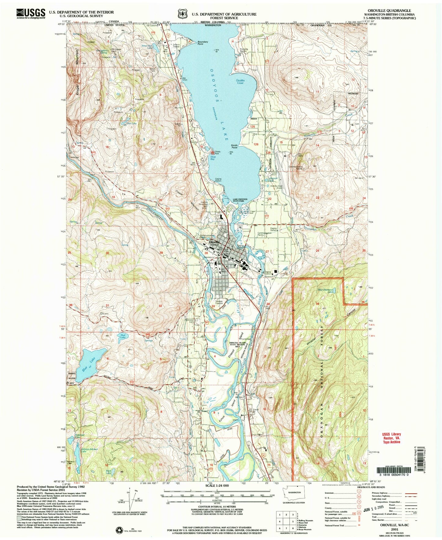
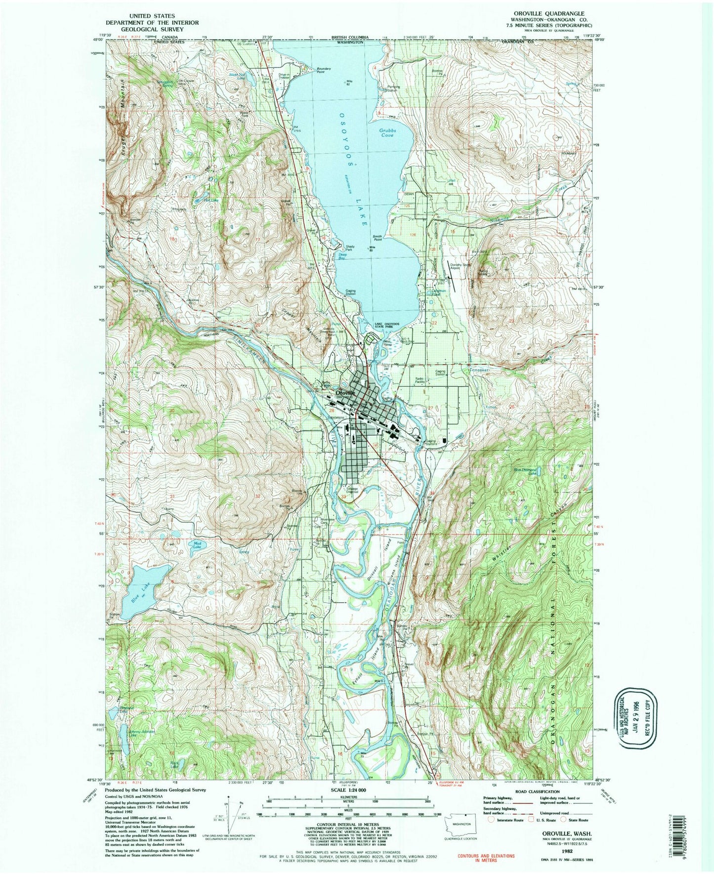
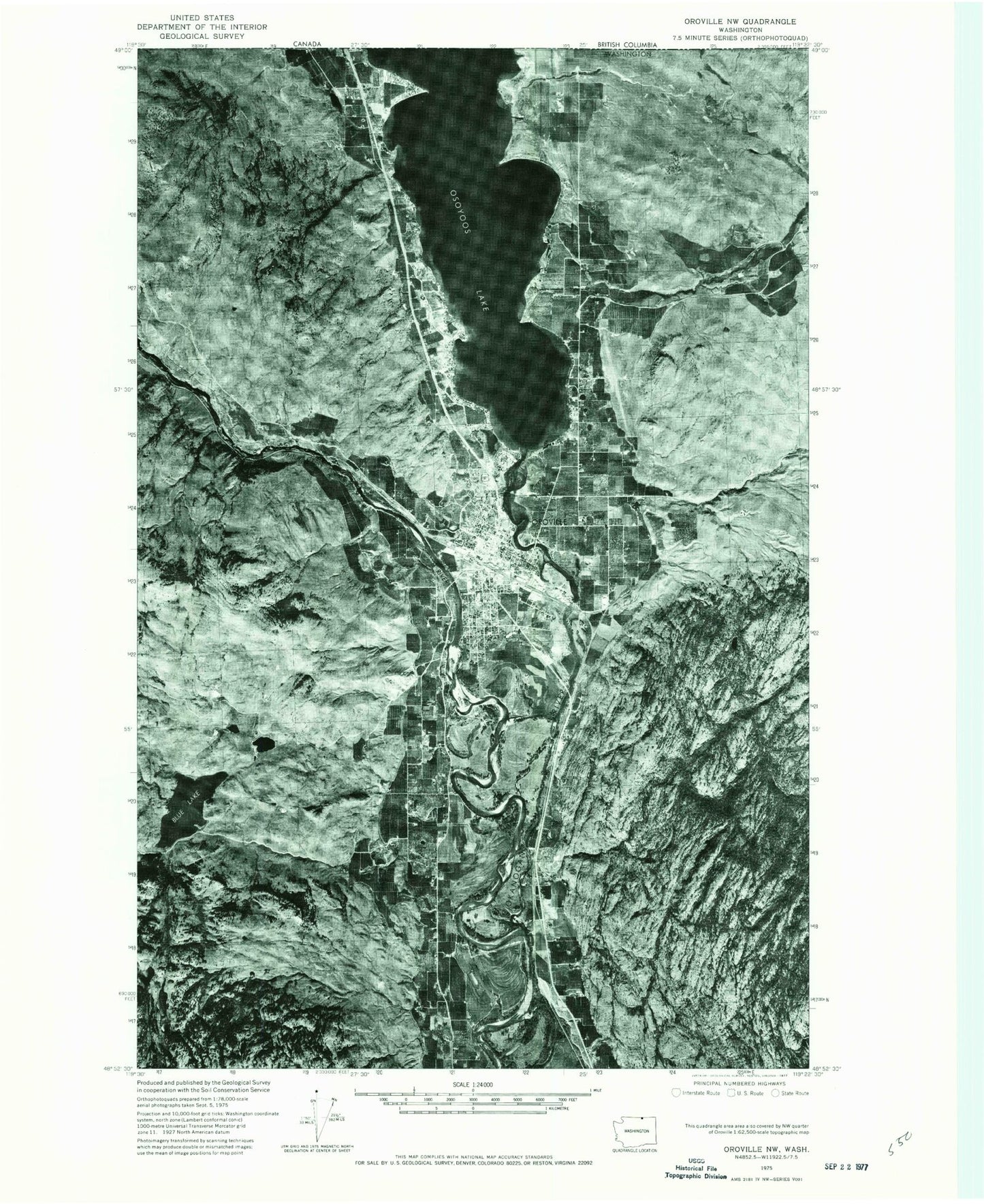
Classic USGS Oroville Washington 7.5'x7.5' Topo Map
Couldn't load pickup availability
Historical USGS topographic quad map of Oroville in the state of Washington. Map scale may vary for some years, but is generally around 1:24,000. Print size is approximately 24" x 27"
This quadrangle is in the following counties: Okanogan.
The map contains contour lines, roads, rivers, towns, and lakes. Printed on high-quality waterproof paper with UV fade-resistant inks, and shipped rolled.
Contains the following named places: Blue Diamond Lake, Blue Lake, Boundary Point, City of Oroville, City of Oroville Fire Department, Deep Bay, Dorothy Scott Airport, Driscoll Island, Eyhott Island, Faith Lutheran Church, Grubbs Cove, Hot Lake, Immaculate Conception Church, Johnny Johnson Lake, Kruger Mountain, Lake Osoyoos State Park, Lehrman Pond, Mud Lake, Ninemile Creek, OK Copper Mine, Oroville, Oroville - Osoyoos Port of Entry, Oroville Ambulance, Oroville Assembly of God Church, Oroville City Hall, Oroville Community Bible Church, Oroville Community Library, Oroville Elementary School, Oroville Free Methodist Church, Oroville Golf Club, Oroville Middle - High School, Oroville Police Department, Oroville Post Office, Oroville Sewage Treatment Plant, Oroville Substation, Oroville Train Depot Museum, Oroville United Methodist Church, Osoyoos Lake, Pentecostal Church of God, Pentland Lake, Riverview Cemetery, Rock Lake, Scott Seaplane Anchorage, Shady Park, Silver Nail Lake, Similkameen River, Smith Point, Smugglers Spring, The Church of Jesus Christ of Latter Day Saints, Tonasket Creek, Trinity Episcopal Church, Valley Christian Fellowship Church, Whistler Canyon, Williams Island, Zosels Mill Pond, Zosels Mill Pond Dam