MyTopo
Classic USGS Orpha Wyoming 7.5'x7.5' Topo Map
Couldn't load pickup availability
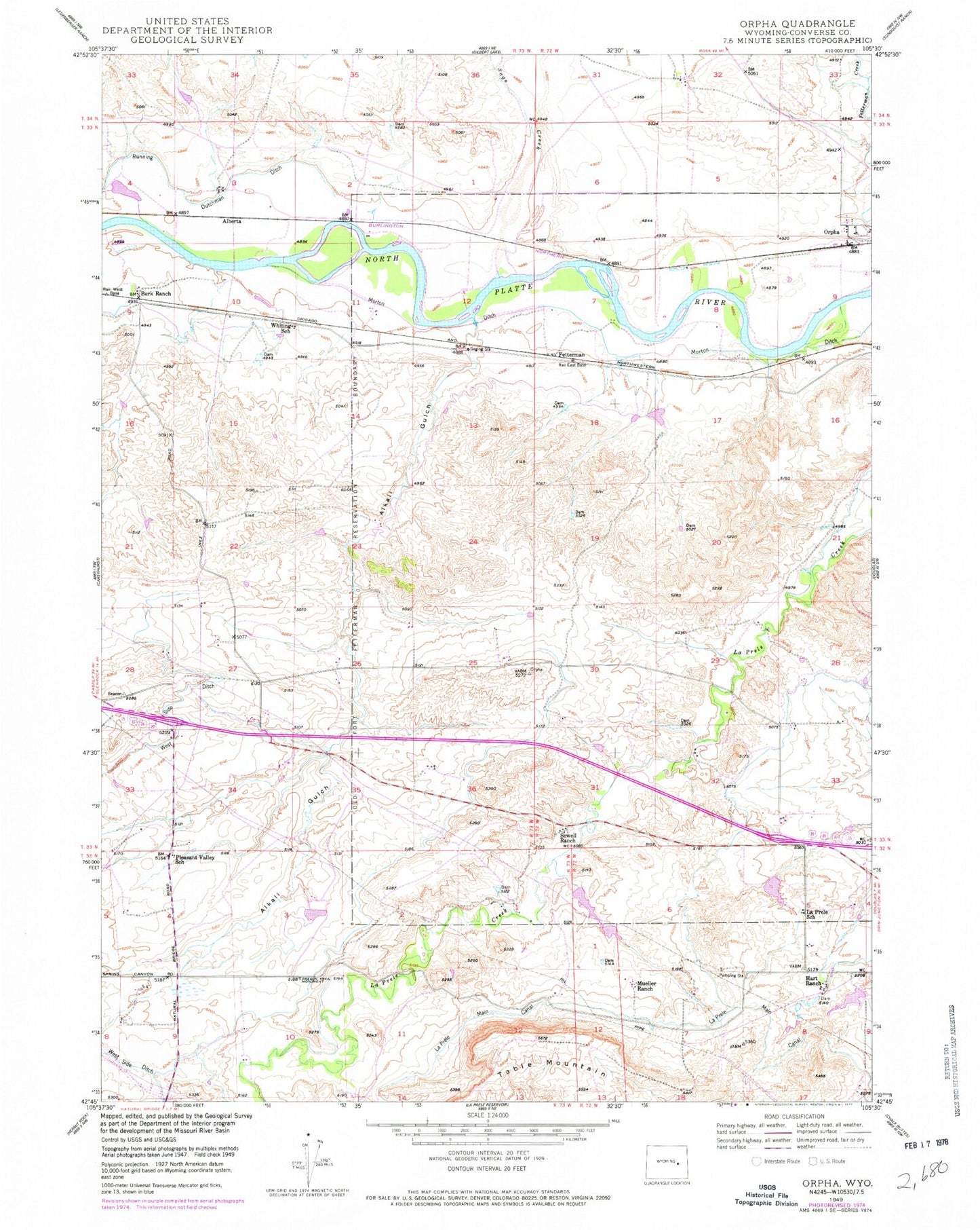
Historical USGS topographic quad map of Orpha in the state of Wyoming. Map scale may vary for some years, but is generally around 1:24,000. Print size is approximately 24" x 27"
This quadrangle is in the following counties: Converse.
The map contains contour lines, roads, rivers, towns, and lakes. Printed on high-quality waterproof paper with UV fade-resistant inks, and shipped rolled.
Contains the following named places: Alberta, Alkali Gulch, Burk Ranch, Chamberlain Brothers Ranch Airport, East Side Number 2 Dam, East Side Number 3 Dam, East Side Reservoir Number 2, East Side Reservoir Number 3, Fetterman, Hart Ranch, Inez Mine, Infant Geyser, La Prele Main Canal, LaPrele School, Moore Dam, Moore Reservoir, Mueller Ranch, Nichols Reservoir Number 2, Nichols Reservoir Number 2 Dam, Oregon Trail Monument, Orpha, Pleasant Valley School, Sage Creek, Sewell Ranch, Slichter Mine, Table Mountain, Whiting School