MyTopo
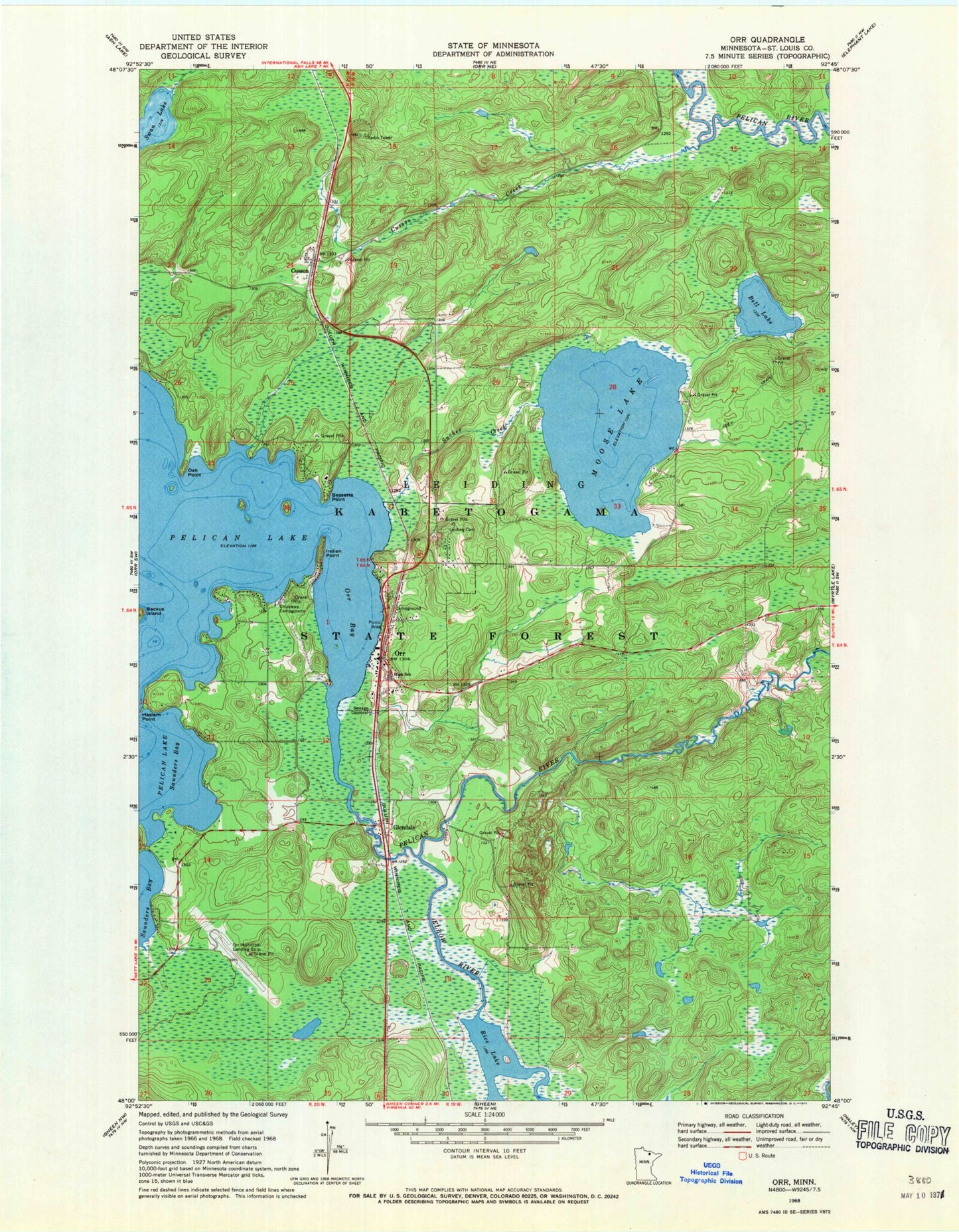
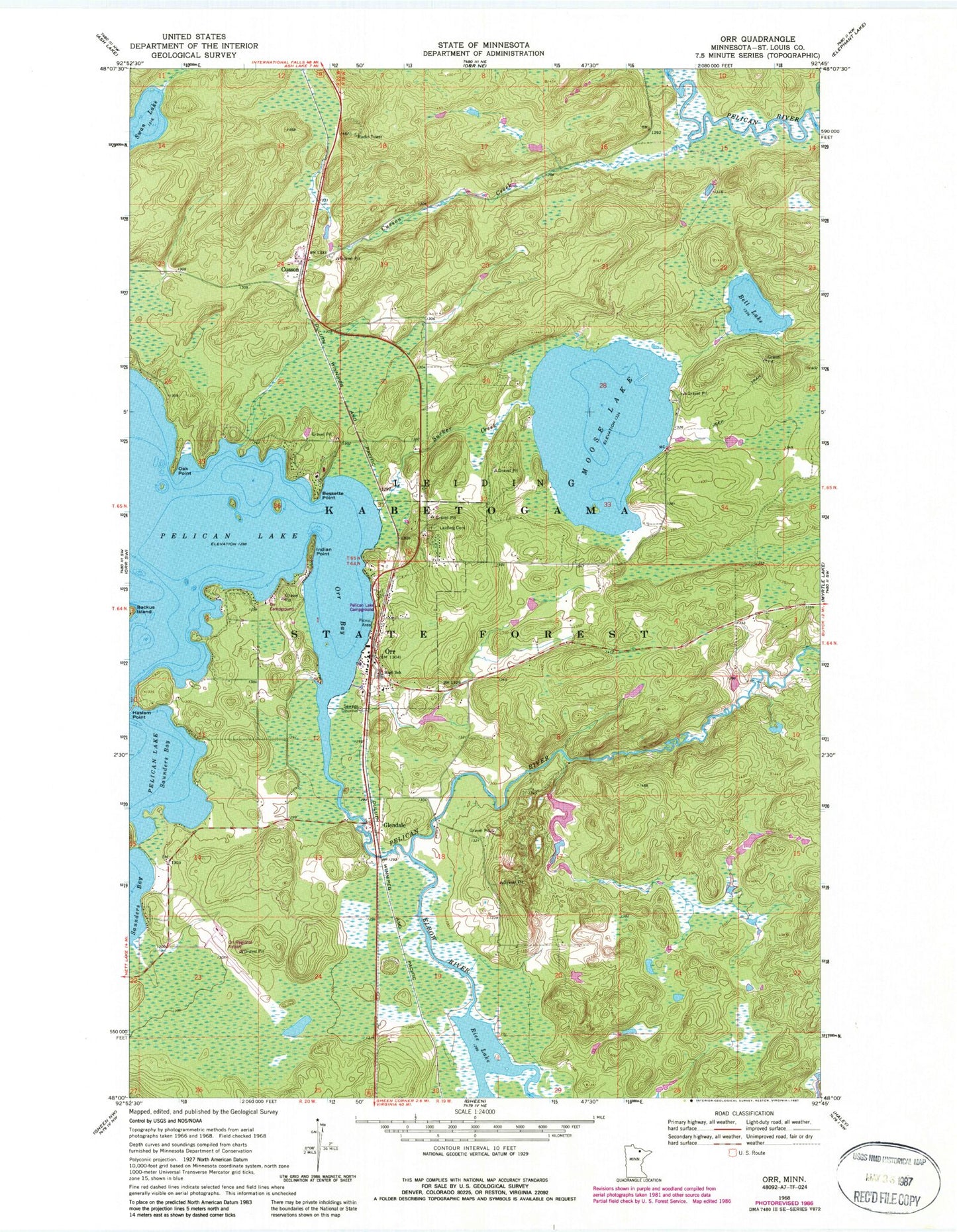
Classic USGS Orr Minnesota 7.5'x7.5' Topo Map
Couldn't load pickup availability
Historical USGS topographic quad map of Orr in the state of Minnesota. Map scale may vary for some years, but is generally around 1:24,000. Print size is approximately 24" x 27"
This quadrangle is in the following counties: St. Louis.
The map contains contour lines, roads, rivers, towns, and lakes. Printed on high-quality waterproof paper with UV fade-resistant inks, and shipped rolled.
Contains the following named places: Bell Lake, Bessette Point, Calvary Lutheran Church, Chippewa Campground, City of Orr, Cusson, Cusson Creek, Cusson Post Office, Cusson Station, Elbow River, Glendale, Haslam Point, Holy Cross Church, Indian Point, Indian Point Segment, Lakeview Baptist Church, Leiding Cemetery, Mobile United Methodist Church, Moose Lake, Oak Point, Orr, Orr Ambulance Service, Orr Bay, Orr Campground, Orr Post Office, Orr Regional Airport, Orr Roadside Parking Area, Orr Volunteer Fire Department, Pelican Lake Campground, Pelican Lake Dam, Pelican Lake Seaplane Base, Pine Acres Resort and Campground, Rice Lake, Sucker Creek, Sugarbush Segment, Swan Lake, Township of Leiding, Wilbur Luoma Pond, Wilbur Luoma Pond Dam