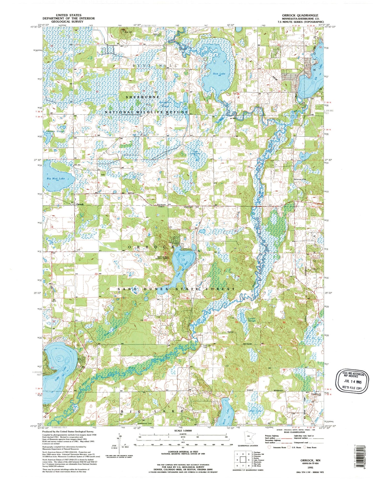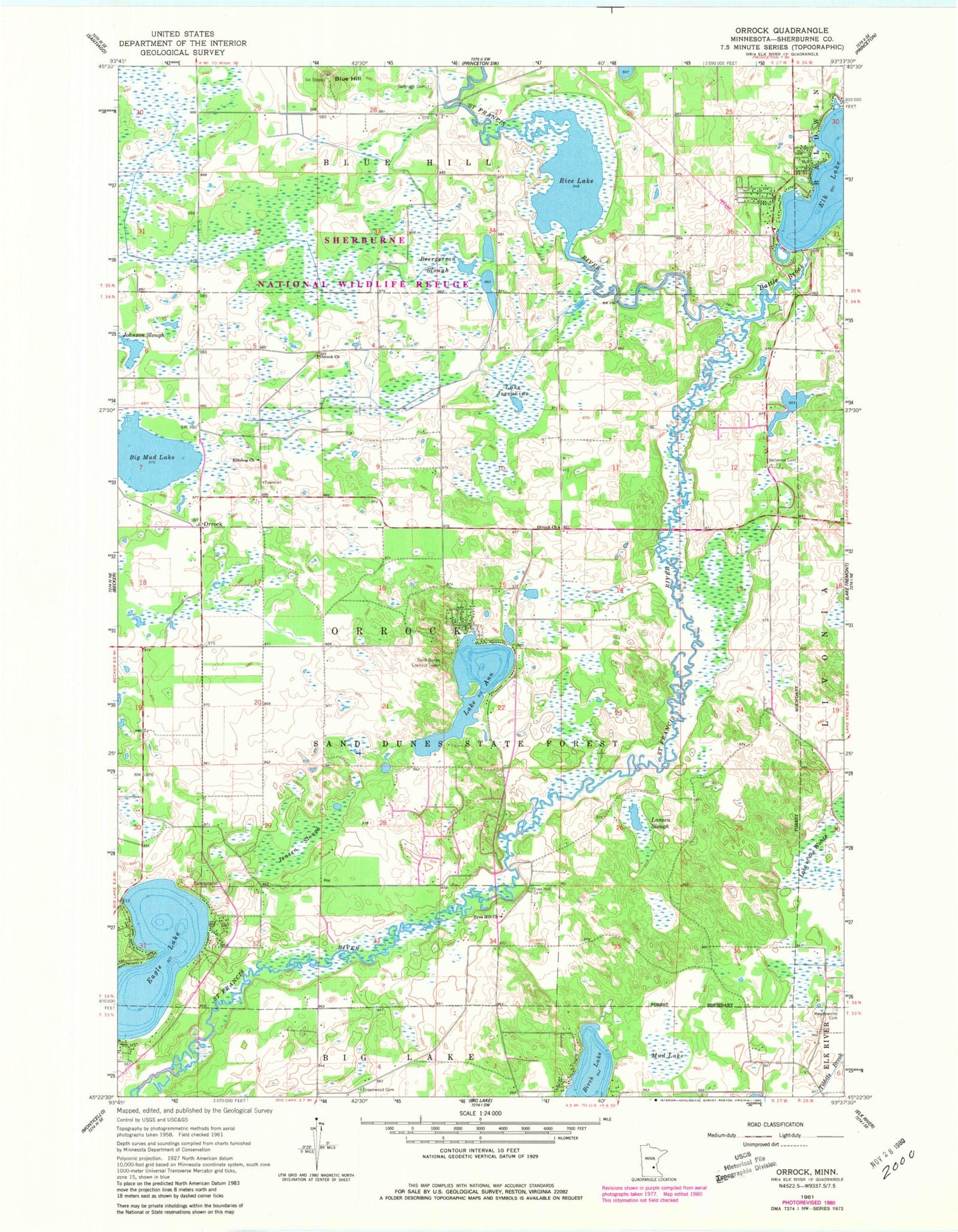
MyTopo
Classic USGS Orrock Minnesota 7.5'x7.5' Topo Map
Couldn't load pickup availability
Historical USGS topographic quad map of Orrock in the state of Minnesota. Typical map scale is 1:24,000, but may vary for certain years, if available. Print size: 24" x 27"
This quadrangle is in the following counties: Sherburne.
The map contains contour lines, roads, rivers, towns, and lakes. Printed on high-quality waterproof paper with UV fade-resistant inks, and shipped rolled.
Contains the following named places: Lake Ann, Battle Brook, Beergerson Slough, Bellwood Cemetery, Big Mud Lake, Birch Lake, Blue Hill, Eidskog Church, Elk Lake, Galbriath Cemetery, Greenwood Cemetery, Jensen Slough, Lake Josephine, Larsen Slough, Meadowville - Meadowvale Cemetery, Mud Lake, Orrock Church, Orrock Church, Rice Lake, Sherburne National Wildlife Refuge, Svea Hill Cemetery, Svea Hill Church, Lake of the Woods, Orrock, Sand Dunes Lookout Tower, KXLI-TV (Saint Cloud), Township of Orrock, Eagle Lake, Sherburne National Wildlife Refuge Pool 7B Dam, Pool 7, Sherburne National Wildlife Refuge Pool 14a Dam, Pool 14, Sherburne National Wildlife Refuge Pool 17 Dam, Pool 17, Sherburne National Wildlife Refuge Pool 18B Dam, Pool 18, Sherburne National Wildlife Refuge Pool 19 Dam, Pool 19, Sherburne National Wildlife Refuge Pool 20 Dam, Pool 20, Sherburne National Wildlife Refuge Pool 28 Dam, Pool 28, Abundant Life Christian Center, Orrock Post Office (historical), Sand Dunes State Forest, Community Covenant Church, Grace Assembly of God Church, Camp in the Woods, Two Stone Cemetery