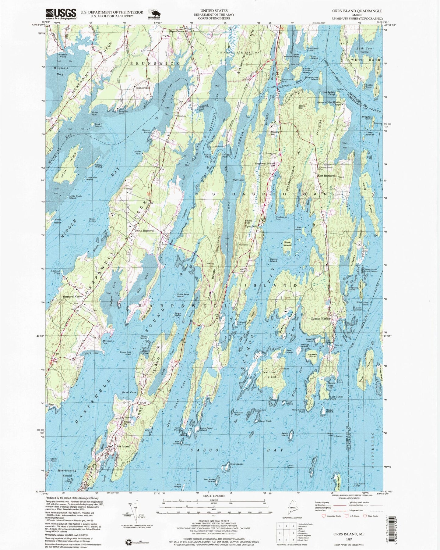
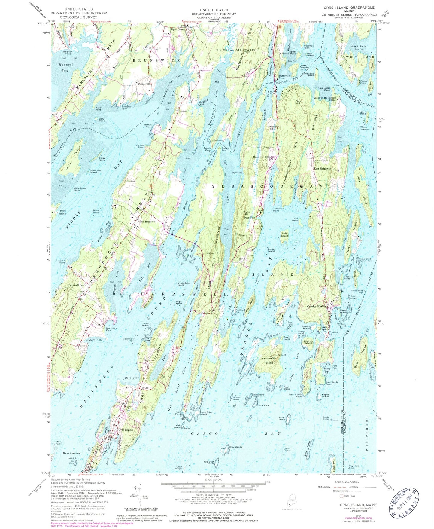
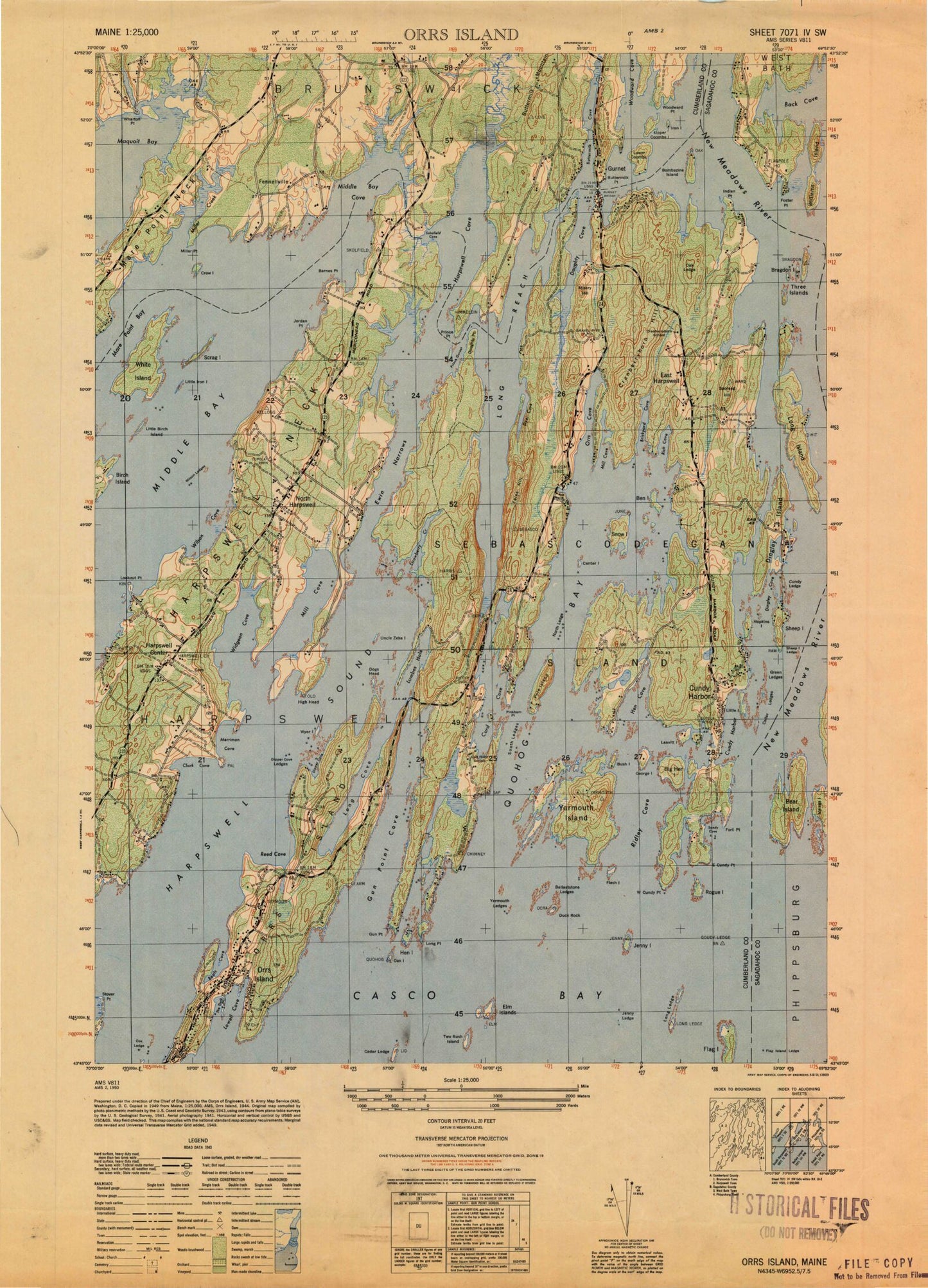
MyTopo
Classic USGS Orrs Island Maine 7.5'x7.5' Topo Map
Couldn't load pickup availability
Historical USGS topographic quad map of Orrs Island in the state of Maine. Typical map scale is 1:24,000, but may vary for certain years, if available. Print size: 24" x 27"
This quadrangle is in the following counties: Cumberland, Sagadahoc.
The map contains contour lines, roads, rivers, towns, and lakes. Printed on high-quality waterproof paper with UV fade-resistant inks, and shipped rolled.
Contains the following named places: Ballaststone Ledges, Barnes Point, Beals Cove, Bear Island, Ben Island, Bethel Point, Big Hen Island, Bombazine Island, Bragdon Island, Brickyard Cove, Bush Island, Buttermilk Cove, Buttermilk Mountain, Buttermilk Point, Card Cove, Cedar Ledges, Center Island, Clark Cove, Cox Ledge, Cranberryhorn Cemetery, Cranberryhorn Hill, Crow Island, Dingley Cove, Dingley Island, Dipper Cove, Dipper Cove Ledges, Dogs Head, Doughty Cove, Doughty Point, Duck Rock, Dyer Cove, Dyer Cove, East Cundy Point, East Harpswell, Elm Islands, Ewin Narrows, Fales Hill, Flag Island, Flag Island Ledge, Flash Island, Fort Point, Foster Point, George Island, Goudy Ledge, Green Ledges, Gun Point, Gun Point Cove, Harpswell Center, Harpswell Cove, Harpswell Community School, Harpswell Neck, Harpswell Sound, Hen Cove, Hen Island, Hen Island, Hopkins Island, Indian Point, Iron Island, Jenny Island, Jenny Ledge, Jordan Point, Leavitt Island, Little Birch Island, Little Iron Island, Little Island, Lombos Hole, Long Cove, Long Island, Long Ledge, Long Point Island, Long Reach, Long Reach Mountain, Lookout Point, Lowell Cove, Lower Coombs Island, Malaga Island, Mare Brook, Merepoint Neck, Merriman Cove, Middle Bay, Middle Bay Cove, Mill Cove, Miller Creek, Miller Point, Misery Hill, New Meadows River, North Harpswell, North Ledge, Oak Island, Oak Ledge, Oak Ledge Camp, Orrs Cove, Orrs Hill, Pinkham Point, Pole Island, Prince Gurnet, Quahog Bay, Queen of the Mission Chapel, Reed Cove, Rich Cove, Ridley Cove, Rogue Island, Sandy Cove, Serag Island, Sheep Island, Sheep Island Ledge, Sheep Island North Ledges, Simpson Point, Skolfield Cove, Snow Island, South Ledges, Stover Point, Strawberry Creek, The Dock, Three Islands, Tondreaus Point, Two Bush Island, Uncle Zeke Island, Union Church, Upper Coombs Island, West Cundy Point, Wharton Point, White Island, Widgeon Cove, Williams Island, Wilson Cove, Wilson Ledges, Woodward Cove, Wyer Island, Yarmouth Island, Yarmouth Ledges, Cundy Ledge, Gurnet Strait, Dyer Corner, Pennellville, High Head, Cundy Harbor, Sebascodegan Island, Cundys Harbor, Orrs Island, Orrs Island, Prince Point, Clark Ledge, Elm Ledge, Merriman Ledges, Middle Rock, North Jenny Ledge, Stoop Ledges, Cundy Points, Wilson Pond Dam, Wilson Pond, East Harpswell Free Will Baptist Church, Gun Point School (historical), Gumet (historical), Gurnet Bridge, Harpswell Historical Society Building, Harpswell Meetinghouse, Harpswell Town Offices, High Head Yacht Club, Holbrooks Marina, Harpswell Post Office, Orrs Island Campground, Orrs Island Post Office, Orrs-Bailey Yacht Club, Pennellville Historic District, Watsons Marina, Orrs Island Fire Station, Cundys Harbor Fire Department, Harpswell Sheriff's Office - Substation, Old Harpswell Common Burying Ground, Hillcrest Cemetery, Pennell Cemetery, Skolfield Cemetery, Skolfield Doyle Cemetery, Orr`s Island Library, Cundys Harbor Library, James Dunning Cemetery, Orrs Island Cemetery, Ballaststone Ledges, Barnes Point, Beals Cove, Bear Island, Ben Island, Bethel Point, Big Hen Island, Bombazine Island, Bragdon Island, Brickyard Cove, Bush Island, Buttermilk Cove, Buttermilk Mountain, Buttermilk Point, Card Cove, Cedar Ledges, Center Island, Clark Cove, Cox Ledge, Cranberryhorn Cemetery, Cranberryhorn Hill, Crow Island, Dingley Cove, Dingley Island, Dipper Cove, Dipper Cove Ledges, Dogs Head, Doughty Cove, Doughty Point, Duck Rock, Dyer Cove, Dyer Cove, East Cundy Point, East Harpswell, Elm Islands, Ewin Narrows, Fales Hill, Flag Island, Flag Island Ledge, Flash Island, Fort Point, Foster Point, George Island, Goudy Ledge, Green Ledges, Gun Point, Gun Point Cove, Harpswell Center, Harpswell Cove, Harpswell Community School, Harpswell Neck, Harpswell Sound, Hen Cove, Hen Island, Hen Island, Hopkins Island, Indian Point, Iron Island