MyTopo
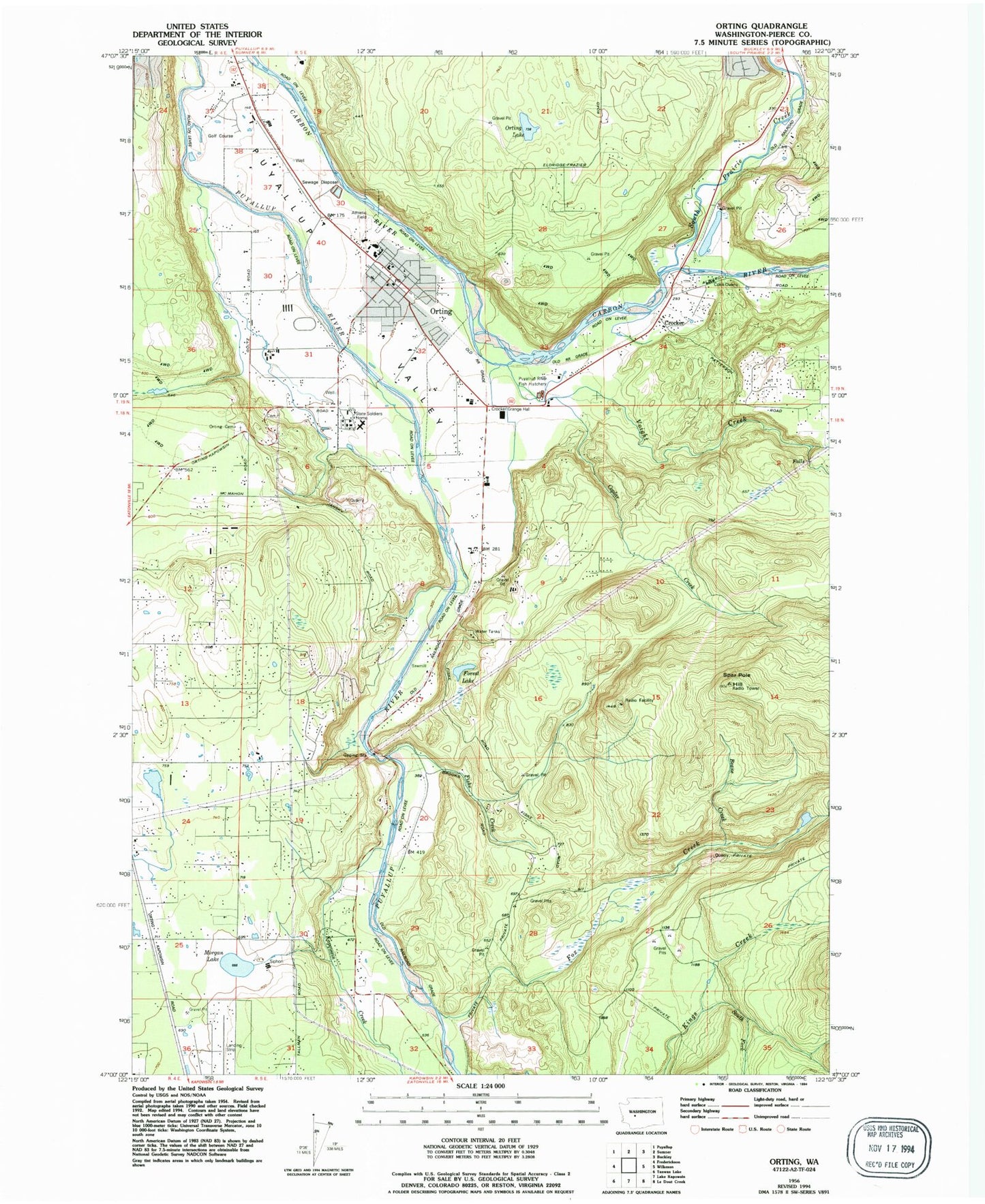
Classic USGS Orting Washington 7.5'x7.5' Topo Map
Couldn't load pickup availability
Historical USGS topographic quad map of Orting in the state of Washington. Map scale may vary for some years, but is generally around 1:24,000. Print size is approximately 24" x 27"
This quadrangle is in the following counties: Pierce.
The map contains contour lines, roads, rivers, towns, and lakes. Printed on high-quality waterproof paper with UV fade-resistant inks, and shipped rolled.
Contains the following named places: Beane Creek, City of Orting, Coplar Creek, Croker, Fiske Creek, Forest Lake, Fox Creek, High Cedars Golf Club, Kapowsin Creek, Kapowsin Field, Morgan Lake, Mountain View Estates Mobile Home Park, Orting, Orting Cemetery, Orting High School, Orting Lake, Orting Middle School, Orting Police Department, Orting Post Office, Orting Primary School, Orting Sewage Treatment Plant, Pierce County, Pierce County Fire District 18 / Orting Valley Fire and Rescue Station 1, Pierce County Fire District 18 / Orting Valley Fire and Rescue Station 2, Pierce County Fire District 18 / Orting Valley Fire and Rescue Station 3, Pierce County Fire District 18 / Orting Valley Fire and Rescue Station 40 Headquarters, Ptarmigan Ridge Intermediate School, Puyallup River Fish Hatchery, Puyallup River Junction, Soldiers Pond, South Fork Kings Creek, South Prairie Creek, Spar Pole Hill, State Soldiers Home, Tanwax, Tehaleh Census Designated Place, Voight Creek, ZIP Code: 98360