MyTopo
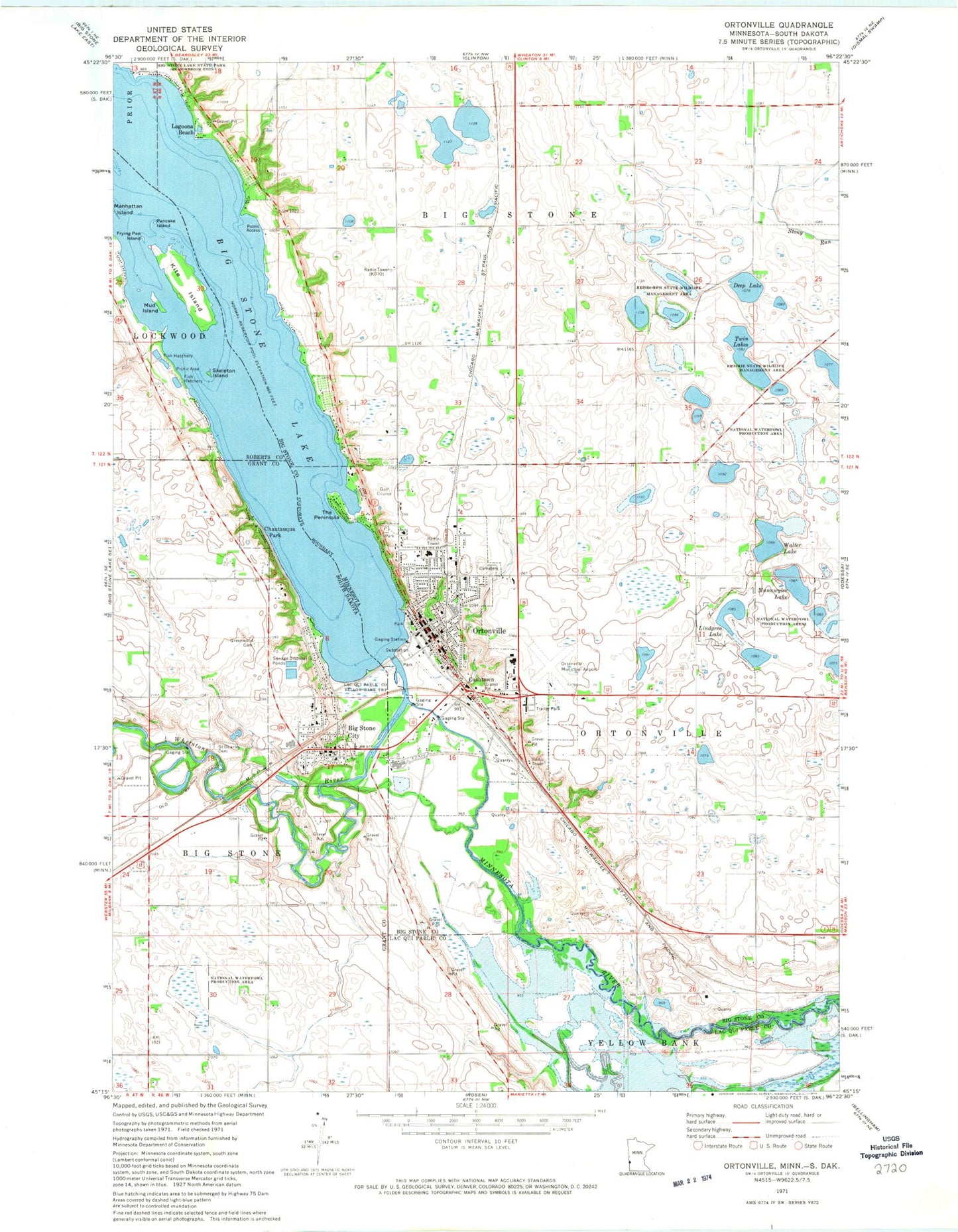
Classic USGS Ortonville Minnesota 7.5'x7.5' Topo Map
Couldn't load pickup availability
Historical USGS topographic quad map of Ortonville in the states of Minnesota, South Dakota. Map scale may vary for some years, but is generally around 1:24,000. Print size is approximately 24" x 27"
This quadrangle is in the following counties: Big Stone, Grant, Lac qui Parle, Roberts.
The map contains contour lines, roads, rivers, towns, and lakes. Printed on high-quality waterproof paper with UV fade-resistant inks, and shipped rolled.
Contains the following named places: Big Stone City, Big Stone City Community Center, Big Stone City Elementary School, Big Stone City Fire Department, Big Stone City Middle School, Big Stone City Police Department, Big Stone City Post Office, Big Stone County Courthouse, Big Stone County Historical Society Museum, Big Stone County Sheriff's Office, Big Stone Lake Dam, Cashtown, Central Park, Chautauqua Park, Church of Saint John, City of Big Stone City, City of Ortonville, Cliffs Park, Congregational United Church, Deep Lake, First Assembly of God Church, First English Lutheran Church, Frying Pan Island, Grant County Mini-Library, Greenwood Cemetery, Hilltop Manor Mobile Home Park, Iron Monument, KBAA-FM (Ortonville), KDIO-AM (Ortonville), Kingdom Hall of Jehovahs Witnesses, Kite Island, Lagoona Beach, Lakeshore RV Park, Lakeside Park, Lindgren Lake, Mound Cemetery, Mud Island, Munnwyler Lake, New Life Community Baptist Church, Nielson Park, Northside Medical Center, Northside Park, Ortonville, Ortonville Ambulance Service, Ortonville Area Health Services Ortonville Hospital, Ortonville City Hall, Ortonville City Public Library, Ortonville Fire and Rescue Department, Ortonville Golf Course, Ortonville High School, Ortonville Municipal Airport-Martinson Field, Ortonville Police Department, Ortonville Post Office, Ortonville Region Historical Marker, Pancake Island, Peninsula Park, Reisdorph State Wildlife Management Area, Riverside Park, Saint Charles Cemetery, School Number 22, Sioux Historic Park, Skeleton Island, State Line - Ortonville Wayside Park, The Peninsula, Township of Big Stone, Township of Ortonville, Trinity Lutheran Church, Twin Lakes, United Methodist Church, Walter Lake, Whetstone River, Zion Lutheran Church, ZIP Code: 56278