MyTopo
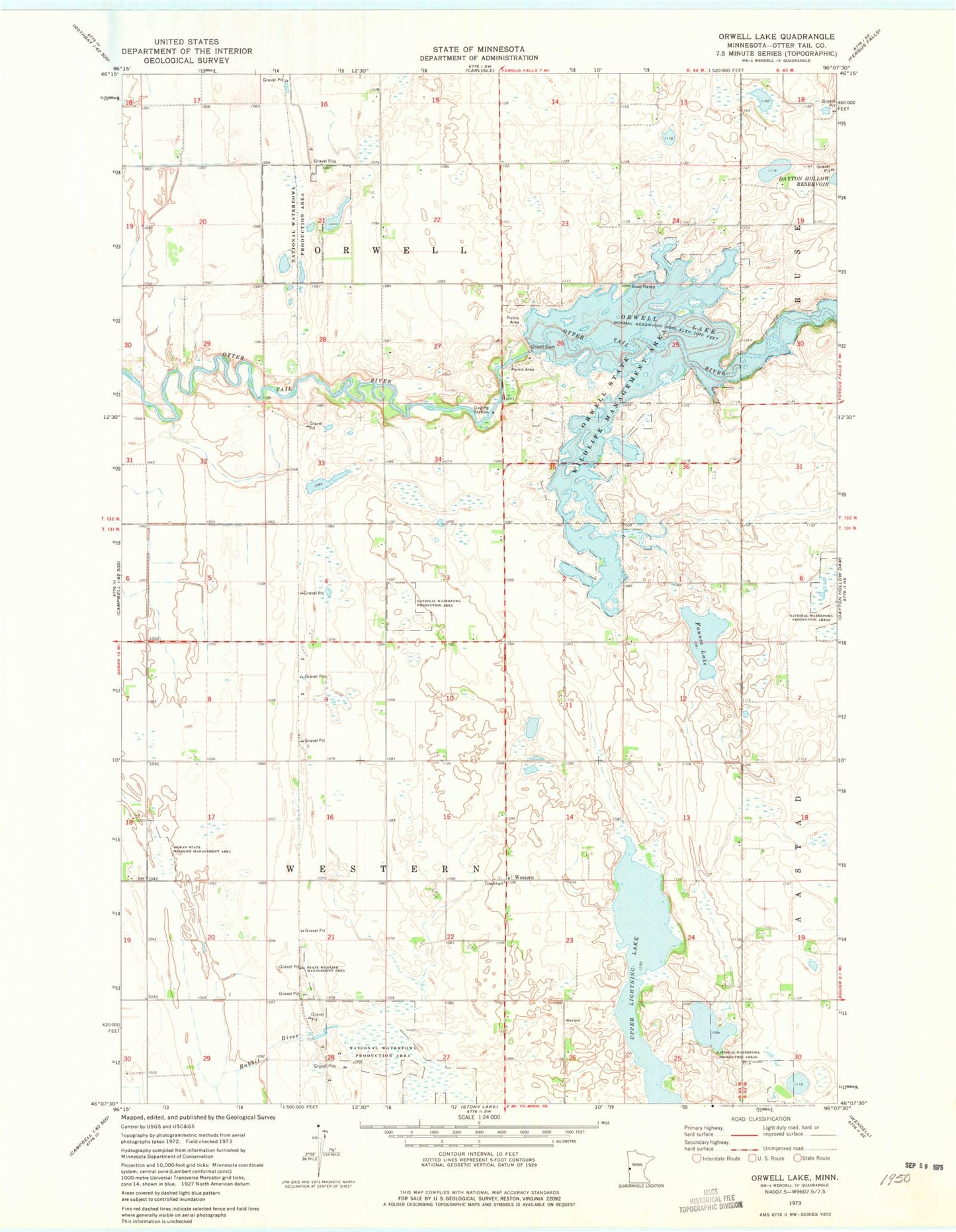
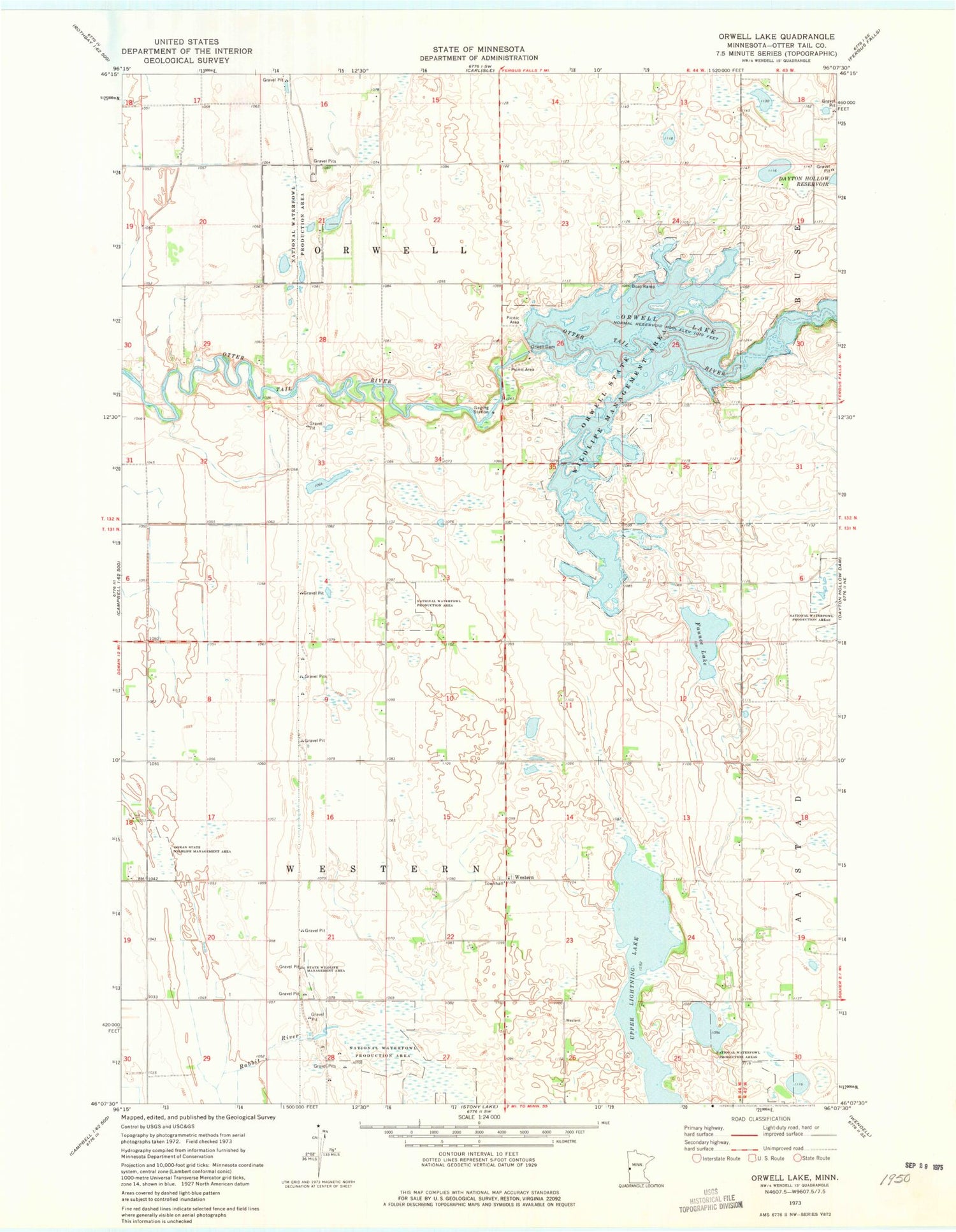
Classic USGS Orwell Lake Minnesota 7.5'x7.5' Topo Map
Couldn't load pickup availability
Historical USGS topographic quad map of Orwell Lake in the state of Minnesota. Map scale may vary for some years, but is generally around 1:24,000. Print size is approximately 24" x 27"
This quadrangle is in the following counties: Otter Tail.
The map contains contour lines, roads, rivers, towns, and lakes. Printed on high-quality waterproof paper with UV fade-resistant inks, and shipped rolled.
Contains the following named places: Doran State Wildlife Management Area, Emmanuel Lutheran Church Cemetery, Faunce Lake, Orwell Dam, Orwell Lake, Orwell Reservoir and Dam, Orwell State Wildlife Management Area, Roberts, Roberts Post Office, School Number 197, School Number 243, School Number 252, School Number 261, School Number 264, School Number 49, School Number 56, Township of Orwell, Township of Western, Western, Western Post Office, Western Presbyterian Cemetery, Western Presbyterian Church