MyTopo
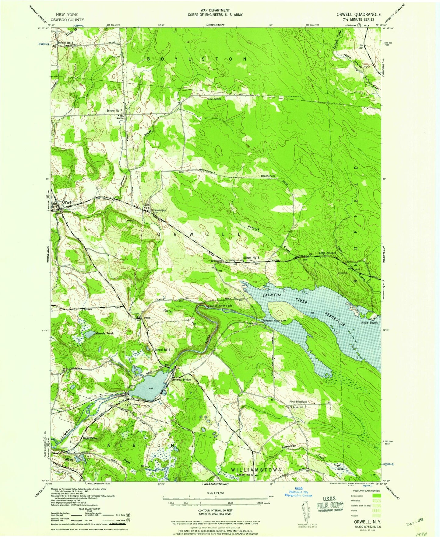
Classic USGS Orwell New York 7.5'x7.5' Topo Map
Couldn't load pickup availability
Historical USGS topographic quad map of Orwell in the state of New York. Typical map scale is 1:24,000, but may vary for certain years, if available. Print size: 24" x 27"
This quadrangle is in the following counties: Oswego.
The map contains contour lines, roads, rivers, towns, and lakes. Printed on high-quality waterproof paper with UV fade-resistant inks, and shipped rolled.
Contains the following named places: Beaverdam Brook, Beech Creek, Bennett Ridge, Coey Hill, Gowdy Pond, Hall Island, Jackson Pond, Lighthouse Hill, Little America, Lower Reservoir, Myers Hill, Pennock Brook, Pine Creek, Powerhouse School, Riverside Cemetery, Sage Pond, Salmon River Dam, Salmon River Falls, Salmon River Reservoir, Cottrell Creek, Orwell, Pine Meadows Creek, Tamarack Swamp, Beecherville, Chateaugay, New Scriba, Noble Shores, Pekin, Pine Meadows, Stillwater, Vorea, WSCP-FM (Pulaski), Town of Orwell, School Number 3 (historical), School Number 4 (historical), School Number 6 (historical), School Number 6 (historical), School Number 7 (historical), School Number 8 (historical), School Number 9 (historical), Pekin Hill Cemetery, Chateaugay Cemetery, Salmon River Fish Hatchery, Orwell Volunteer Fire Company, Heritage Hill Farm, Orwell Post Office, Vorea Community Church, Pine Meadows Wesleyan Church, Scotch Pine Manor Mobile Home Park, Cogswell Free Library