MyTopo
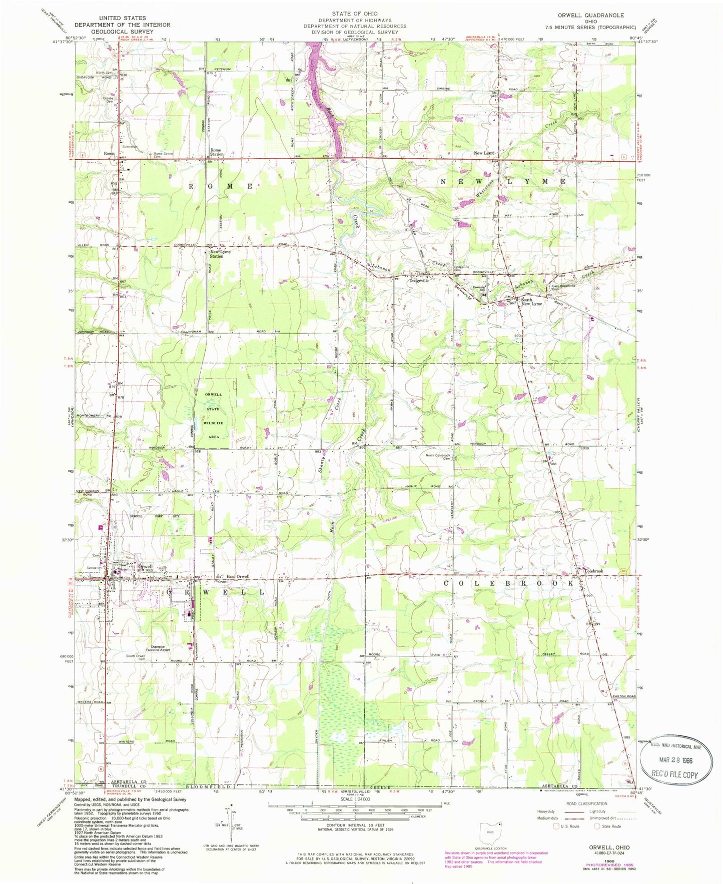
Classic USGS Orwell Ohio 7.5'x7.5' Topo Map
Couldn't load pickup availability
Historical USGS topographic quad map of Orwell in the state of Ohio. Map scale may vary for some years, but is generally around 1:24,000. Print size is approximately 24" x 27"
This quadrangle is in the following counties: Ashtabula, Trumbull.
The map contains contour lines, roads, rivers, towns, and lakes. Printed on high-quality waterproof paper with UV fade-resistant inks, and shipped rolled.
Contains the following named places: Asbury Park, Ashtabula County South Central Ambulance District, Benton Farms, Briarwood Farm, Champion Executive Airport, Colebrook, Colebrook Elementary School, Crosby Cemetery, Deeming School, Dodgeville, Dodgeville Cemetery, East Brownville Cemetery, East Orwell, East Orwell Post Office, Grand Valley Elementary School, Grand Valley High School, Humphries Farm, Hyde Cemetery, Kalas Farms, Lebanon Creek, Maple Lane Farm, Mate's Farms, New England Schoolhouse, New Lyme, New Lyme Station, New Lyme Station Post Office, North Cemetery, North Colebrook Cemetery, North Orwell Cemetery, Northside Farms, Orwell, Orwell Post Office, Orwell State Wildlife Area, Orwell Station, Orwell Village Police Department, Orwell Volunteer Fire Department, Rome, Rome Center Cemetery, Rome Post Office, Rome Station, Rome Volunteer Fire Department, Rome-Hartsgrove Elementary School, Shanty Creek, South New Lyme, South Orwell Cemetery, Stackhouse Farm, Teegarden Farm, Township of Colebrook, Township of New Lyme, Township of Orwell, Township of Rome, Village of Orwell, Whetstone Creek, ZIP Codes: 44076, 44085