MyTopo
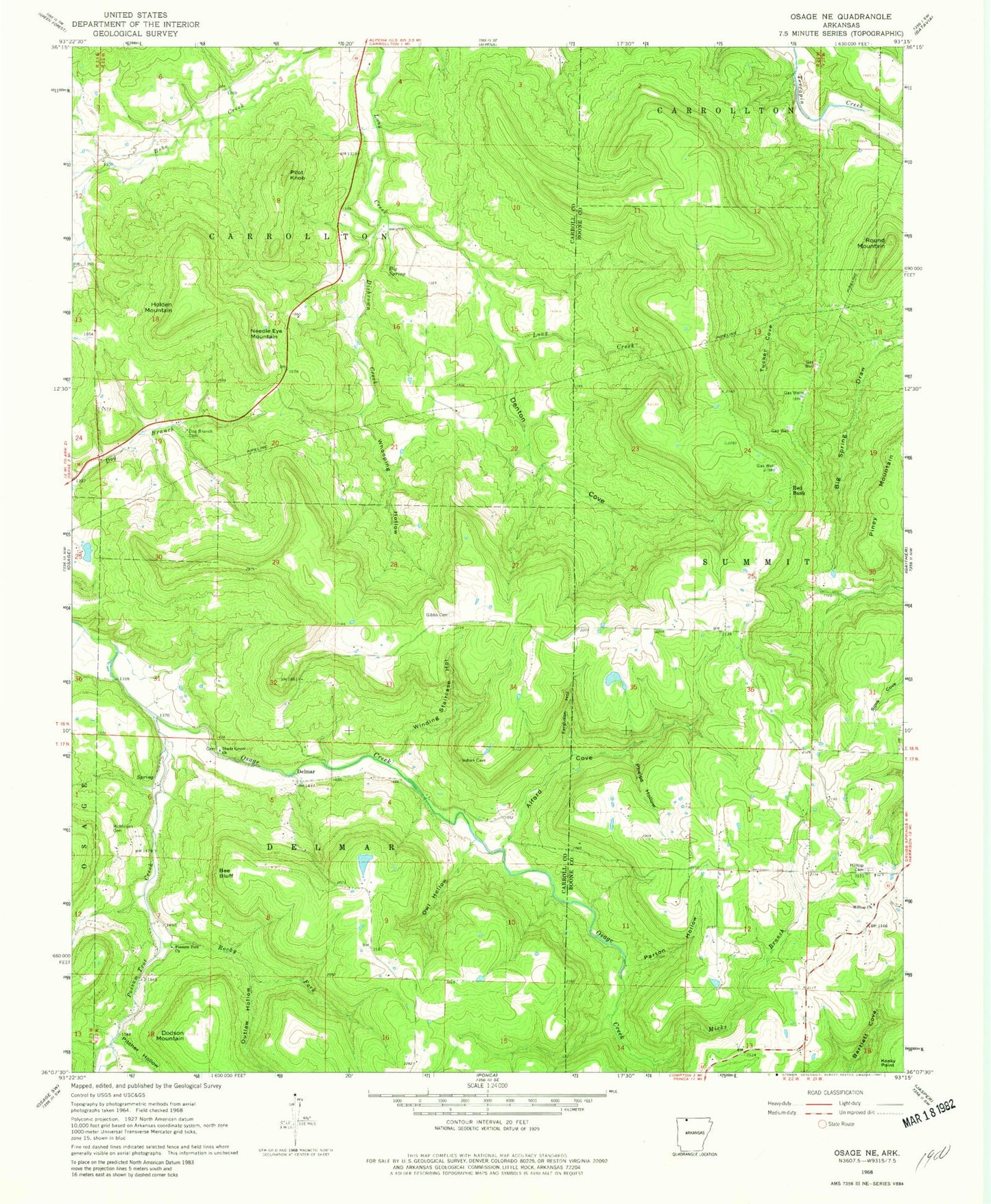
Classic USGS Osage NE Arkansas 7.5'x7.5' Topo Map
Couldn't load pickup availability
Historical USGS topographic quad map of Osage NE in the state of Arkansas. Map scale may vary for some years, but is generally around 1:24,000. Print size is approximately 24" x 27"
This quadrangle is in the following counties: Boone, Carroll.
The map contains contour lines, roads, rivers, towns, and lakes. Printed on high-quality waterproof paper with UV fade-resistant inks, and shipped rolled.
Contains the following named places: Alford Cove, Bee Bluff, Big Spring, Big Spring Draw, Brewer Lake, Brewer Lake Dam, Butler Cove, Delmar, Denton Cove, Dishrown Creek, Dodson Mountain, Dog Branch Cemetery, Ferguson Hollow, Gibbs Cemetery, Hill Top, Hill Top Church of Christ, Hill Top Fire Department Station 1, Hilltop Cemetery, Holden Mountain, Mc Million Cemetery, Micks Branch, Needle Eye Mountain, Outlaw Hollow, Owl Hollow, Parton Hollow, Phelps Hollow, Pilot Knob, Pitcher Hollow, Possum Trot Church, Possum Trot Creek, Red Bank, Rocky Fork, Round Mountain, Shady Grove Cemetery, Shady Grove Church, Township of Carrollton, Township of Delmar, Township of Summit, Tucker Cove, Whooping Hollow, Winding Staircase Hollow, ZIP Code: 72611