
MyTopo
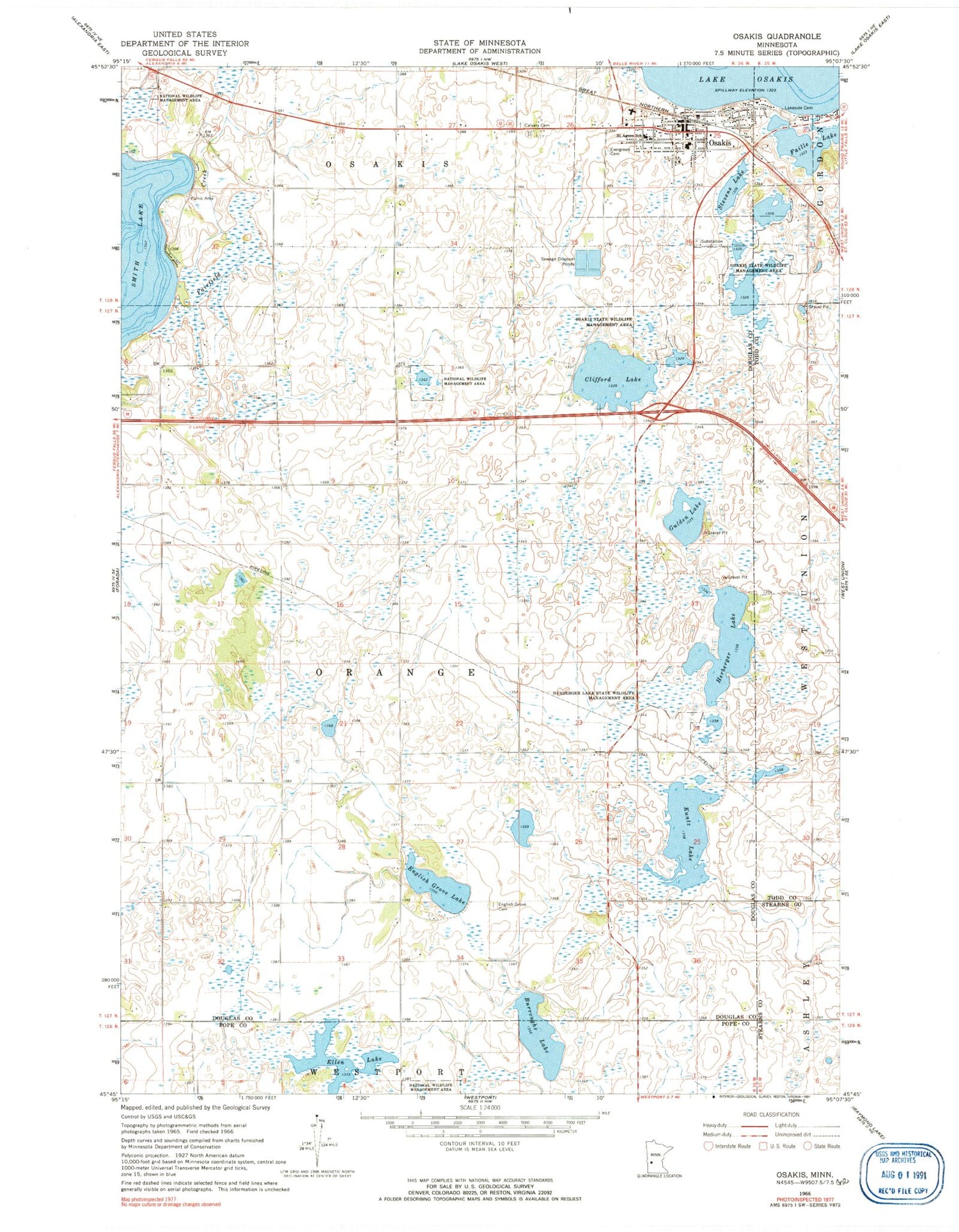
Classic USGS Osakis Minnesota 7.5'x7.5' Topo Map
Couldn't load pickup availability
Historical USGS topographic quad map of Osakis in the state of Minnesota. Map scale may vary for some years, but is generally around 1:24,000. Print size is approximately 24" x 27"
This quadrangle is in the following counties: Douglas, Pope, Stearns, Todd.
The map contains contour lines, roads, rivers, towns, and lakes. Printed on high-quality waterproof paper with UV fade-resistant inks, and shipped rolled.
Contains the following named places: Burroughs Lake, Calvary Cemetery, City of Osakis, Clifford Lake, Community Memorial Home, Ellen Lake, English Grove Cemetery, English Grove Lake, Evergreen Cemetery, Faille Lake, Gulden Lake, Herberger Lake, Herberger Lake State Wildlife Management Are, Immaculate Conception Church, Kuntz Lake, Lakes Area Charter School, Lakeside Cemetery, Osagi Park, Osakis, Osakis Athletic Fields, Osakis City Hall, Osakis Fire Department, Osakis Lutheran Church, Osakis Medical Clinic, Osakis Police Department, Osakis Post Office, Osakis Public School, Osakis State Wildlife Management Area, Osakis Visitor Heritage Center, Osakis Wayside Park, Presbyterian Church, Redeemer Lutheran Church, Saint Agnes School, Smith Lake, Smith Lake Resort and Campground, Stage Station Historical Marker, Stevens Lake, Todd County Waterfowl Production Area, Township of Orange, United Methodist Church


