MyTopo
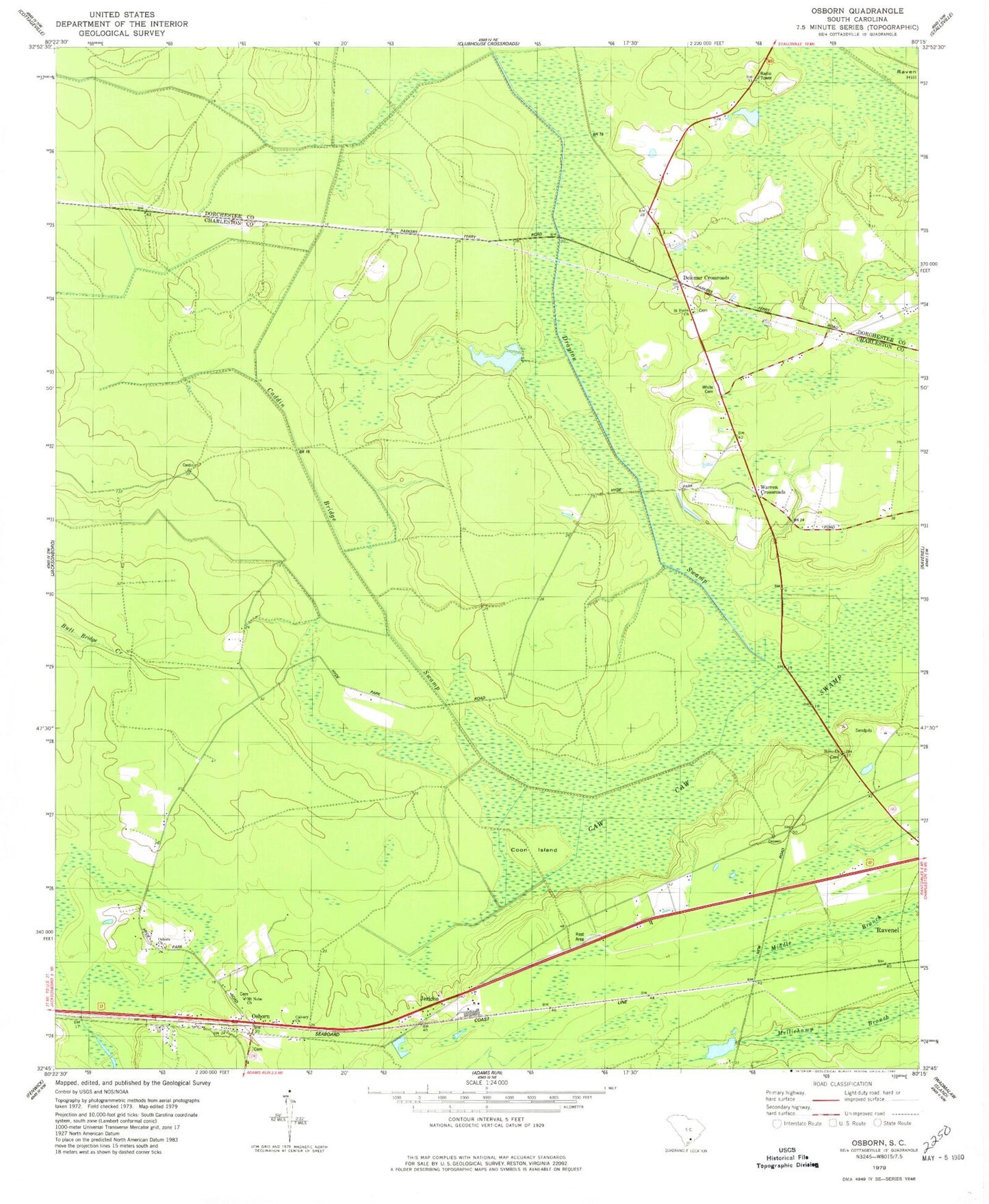
Classic USGS Osborn South Carolina 7.5'x7.5' Topo Map
Couldn't load pickup availability
Historical USGS topographic quad map of Osborn in the state of South Carolina. Map scale may vary for some years, but is generally around 1:24,000. Print size is approximately 24" x 27"
This quadrangle is in the following counties: Charleston, Dorchester.
The map contains contour lines, roads, rivers, towns, and lakes. Printed on high-quality waterproof paper with UV fade-resistant inks, and shipped rolled.
Contains the following named places: Boyle School, Caddin Bridge Swamp, Calvary Church, Capwells Crossroads, Coon Island, Delemar Crossroads, Delemars School, Drayton Swamp, Dwight School, Jericho, Judge Smith School, Mount Nebo Church, Osborn, Osborn Church, Ravenel, Ravenel-Hollywood Division, Rivens Backwater, Saint Pauls Church, Spring Grove Church, Spring Grove School, Stono Church, Warren Crossroads, White Cemetery, ZIP Codes: 29426, 29470