MyTopo
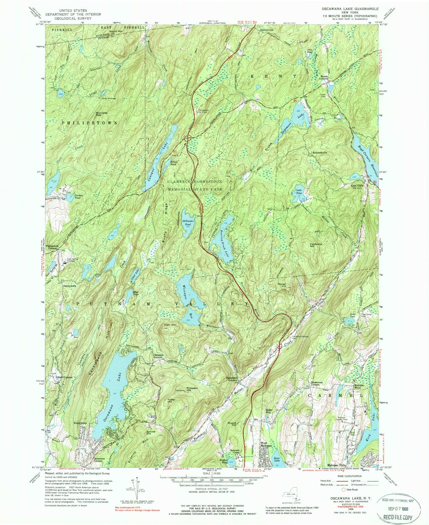
Classic USGS Oscawana Lake New York 7.5'x7.5' Topo Map
Couldn't load pickup availability
Historical USGS topographic quad map of Oscawana Lake in the state of New York. Typical map scale is 1:24,000, but may vary for certain years, if available. Print size: 24" x 27"
This quadrangle is in the following counties: Dutchess, Putnam.
The map contains contour lines, roads, rivers, towns, and lakes. Printed on high-quality waterproof paper with UV fade-resistant inks, and shipped rolled.
Contains the following named places: Bryant Hill, Bryant Pond, Bullet Hole, Bushy Ridge, California Hill, Camp Wiccopee, Candlewood Hill, Canopus Lake, Christian Corners, Clear Lake, Cold Spring Institute, Fahnestock Corners, Barrett Cemetery, Gilbert Corners, Granite Mountain, Hill Cemetery, Hortontown, Houseman Corners, John Pond, Jordan Pond, Kent Cliffs, Kiah Hill, Kirk Lake, Meads Corners, Moose Hill, Mud Lake, Nokomis Camp, Oscawana Corners, Oscawana Lake, Lake Ossi, Pelton Pond, Prospect Hill, Richardsville, Roaring Brook, Roaring Brook Lake, Sagamore Lake, Secor Lake, Spruce Hill, Stillwater Pond, Sunnybrook, Lake Tibet, Tinker Hill, Tompkins Corners, Tompkins Corners Cemetery, Trout Creek, Union and Halstead Cemetery, West Branch Canopus Creek, Black Pond Brook, Sand Spring Brook, Wiccopee Brook, Wiccopee Pass, Wiccopee Reservoir, Dennytown, Clarence Fahnestock Memorial State Park, Mahopac Mines, Fahnestock Ski Slope, Putnam Golf and Tennis Club, Mahopac Airport (historical), Town of Putnam Valley, Austin Road Elementary School, Foshay Corners, Red Mills Shopping Center, Bailey Cemetery, Tompkins Corners Methodist Church, Sheep Mountain, Dicktown (historical), Bailey Hill, Dick Hill, Black Ash Swamp, Cranberry Swamp, Sheep Mountain, Schoolhouse Number 2 (historical), Putnam Valley Fire Department Station 2, Barrett Hill, Prospect Hill, German Flats, Kent Volunteer Fire Department, Mahopac Falls Volunteer Fire Department Station 2, Split Rock Cascade