MyTopo
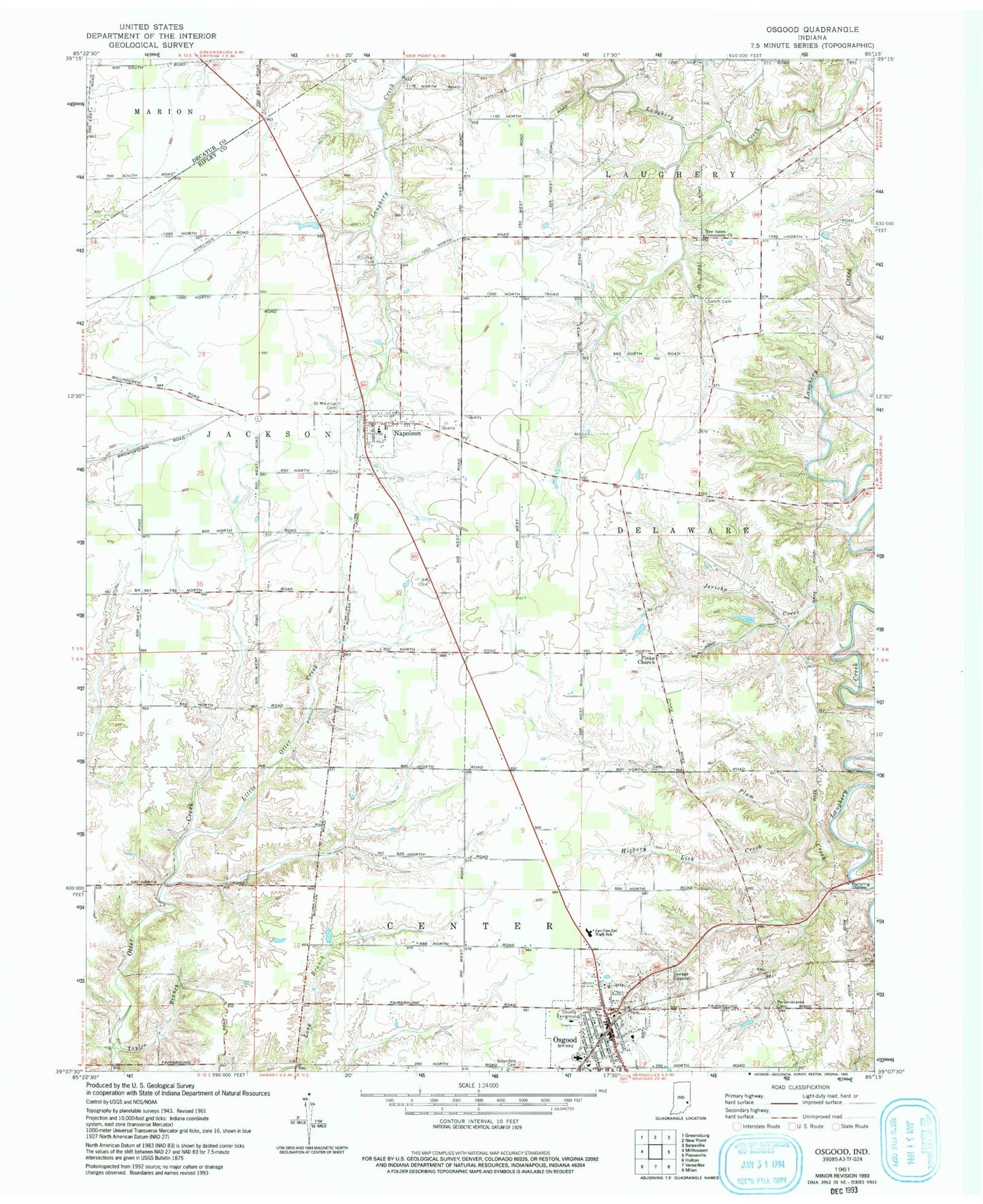
Classic USGS Osgood Indiana 7.5'x7.5' Topo Map
Couldn't load pickup availability
Historical USGS topographic quad map of Osgood in the state of Indiana. Map scale may vary for some years, but is generally around 1:24,000. Print size is approximately 24" x 27"
This quadrangle is in the following counties: Decatur, Ripley.
The map contains contour lines, roads, rivers, towns, and lakes. Printed on high-quality waterproof paper with UV fade-resistant inks, and shipped rolled.
Contains the following named places: Booher Cemetery, Finke Church, Greendale Cemetery, Hickory Lick Creek, Jac-Cen-Del Junior-Senior High School, Jericho Creek, Laugheryville, Little Otter Creek, Napoleon, Napoleon Elementary School, Napoleon Post Office, Napoleon Quarry, Napoleon Volunteer Fire Company, New Salem Community Church, Old Salem Cemetery, Osgood, Osgood Elementary School, Osgood Police Department, Osgood Post Office, Osgood Volunteer Fire Department, Perseverance Cemetery, Plum Creek, Ripley Creek, Saint Maurice Cemetery, Taylor Branch, Town of Napoleon, Town of Osgood, Township of Center, Township of Jackson, Vine Springs, Vine Springs Post Office, WRBI-FM (Batesville), ZIP Codes: 47034, 47037