MyTopo
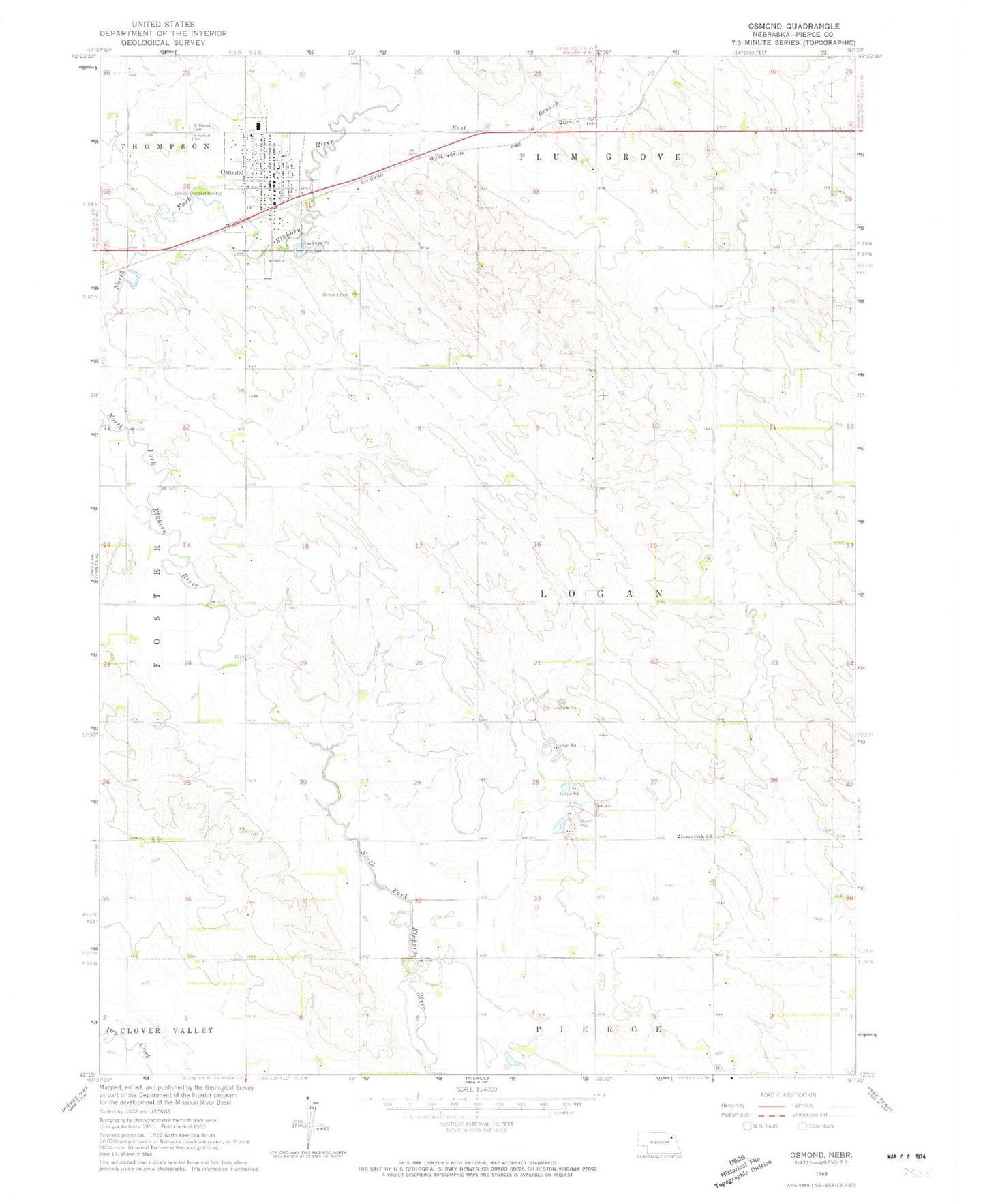
Classic USGS Osmond Nebraska 7.5'x7.5' Topo Map
Couldn't load pickup availability
Historical USGS topographic quad map of Osmond in the state of Nebraska. Map scale may vary for some years, but is generally around 1:24,000. Print size is approximately 24" x 27"
This quadrangle is in the following counties: Pierce.
The map contains contour lines, roads, rivers, towns, and lakes. Printed on high-quality waterproof paper with UV fade-resistant inks, and shipped rolled.
Contains the following named places: Battle Creek Farmers Co-op Elevator, City of Osmond, East Branch North Fork Elkhorn River, Immanuel Cemetery, Immanuel Lutheran Church, Immanuel Lutheran Preschool, Logan Election Precinct, Logan Pride School, Osmond, Osmond Ambulance Service, Osmond Cemetery, Osmond City Police Department, Osmond General Hospital, Osmond Post Office, Osmond Public Library, Osmond Public Schools, Osmond Rural Fire Department, Osmond United Methodist Church, Pierce County, Saint Mary Elementary School, Saint Mary of the Seven Dolors Church, Saint Marys Cemetery, Township of Logan, Township of Plum Creek, ZIP Code: 68765