MyTopo
Classic USGS Osseo Wisconsin 7.5'x7.5' Topo Map
Couldn't load pickup availability
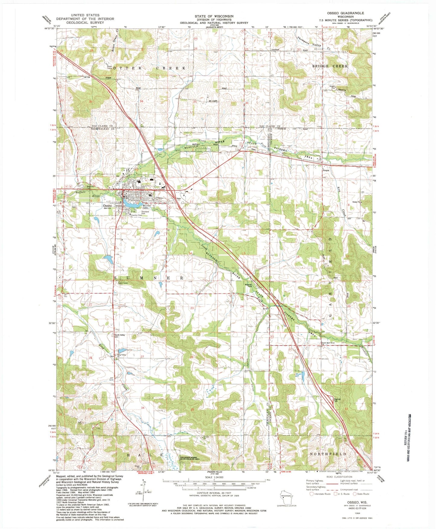
Historical USGS topographic quad map of Osseo in the state of Wisconsin. Map scale may vary for some years, but is generally around 1:24,000. Print size is approximately 24" x 27"
This quadrangle is in the following counties: Eau Claire, Jackson, Trempealeau.
The map contains contour lines, roads, rivers, towns, and lakes. Printed on high-quality waterproof paper with UV fade-resistant inks, and shipped rolled.
Contains the following named places: 0.3 Reservoir, 0.47 Reservoir, 54758, Churchview School, City of Osseo, Golden Valley, Golden Valley School, Johnson H1199 Dam, Kay Creek, Kings Valley Lutheran Church, Martha Lake, North Fork Buffalo River, Oak Grove School, Osseo, Osseo - Fairchild Elementary School, Osseo - Fairchild High School, Osseo Club Pond, Osseo Dam, Osseo Hospital and Clinic, Osseo Middle School, Osseo Police Department, Osseo Post Office, Osseo Rod and Gun Club Dam, Osseo Rural Volunteer Fire Department, Pride School, Requa, Rindahl Creek, Skoyen G-9503 Dam, South Beef River Lutheran Church, South Fork Buffalo River, South Valley Cemetery, South Valley School, Stoddard Park, Town of Sumner, Yule School