MyTopo
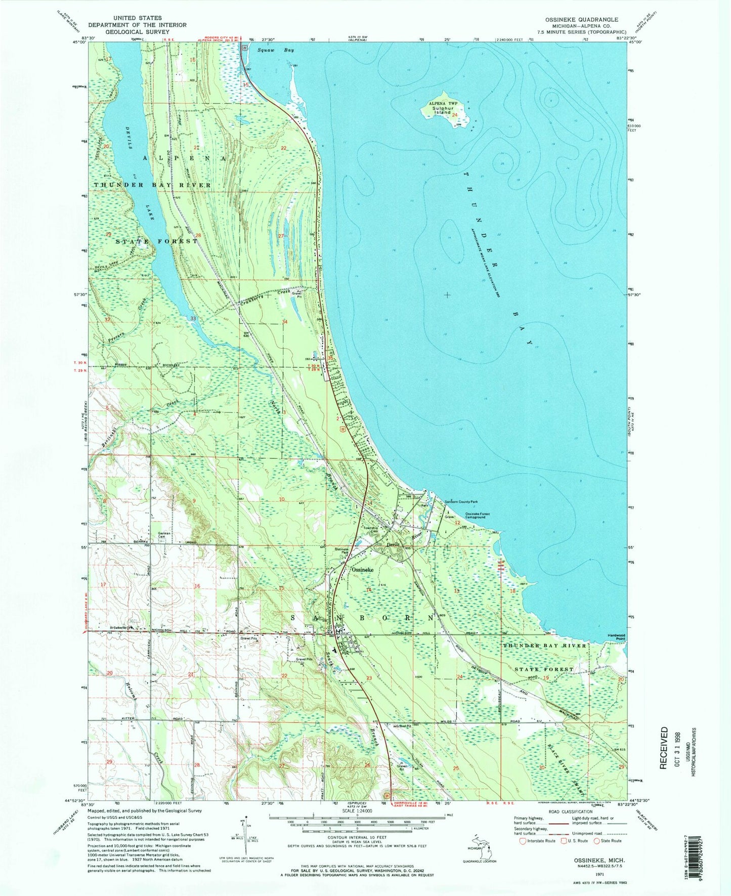
Classic USGS Ossineke Michigan 7.5'x7.5' Topo Map
Couldn't load pickup availability
Historical USGS topographic quad map of Ossineke in the state of Michigan. Map scale may vary for some years, but is generally around 1:24,000. Print size is approximately 24" x 27"
This quadrangle is in the following counties: Alpena.
The map contains contour lines, roads, rivers, towns, and lakes. Printed on high-quality waterproof paper with UV fade-resistant inks, and shipped rolled.
Contains the following named places: Alcona Health Center, Berlinski Creek, Cranberry Creek, Devils Lake, Devils River, German Cemetery, Good Shepherd Lutheran Church, Hardwood Point, North Branch Devils River, Northland Baptist Church, Ossineke, Ossineke Census Designated Place, Ossineke Forest Campground, Ossineke Park, Ossineke Post Office, Ossineke Station, Ossineke United Methodist Church, Precore Creek, Riverview Estates Mobile Home Park, Saint Catherine Church, Saint Catherine's Cemetery, Sanborn Country Park, Sanborn School, Sanborn Township Cemetery, Sanborn Township Fire Department, South Branch Devils River, Sulphur Island, Township of Sanborn, ZIP Code: 49766