MyTopo
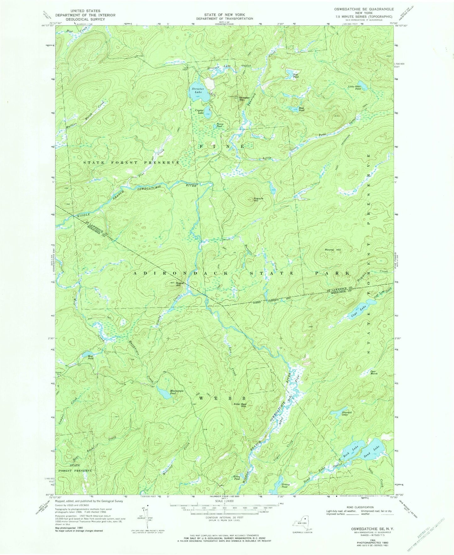
Classic USGS Oswegatchie SE New York 7.5'x7.5' Topo Map
Couldn't load pickup availability
Historical USGS topographic quad map of Oswegatchie SE in the state of New York. Map scale may vary for some years, but is generally around 1:24,000. Print size is approximately 24" x 27"
This quadrangle is in the following counties: Herkimer, St. Lawrence.
The map contains contour lines, roads, rivers, towns, and lakes. Printed on high-quality waterproof paper with UV fade-resistant inks, and shipped rolled.
Contains the following named places: Alder Bed Flow, Alder Bed Mountain, Bassetts Creek, Cage Lake, Coyer Creek, Crystal Lake, Deer Marsh, Emerald Lake, Francis Hill, Glasby Creek, Grassy Pond, Kelley Pond, Lees Creek, Little Otter Pond, Little Otter Pond Outlet, Maple Hill, Massawepie Creek, Massawepie Pond, Moncrief Creek, Mud Pond, Pansy Pond, Pine Pond, Pins Creek, Rock Lake, Round Hill, Sand Lake, Sitz Creek, Streeter Lake, Streeter Lake Outlet, Streeter Mountain, Wolf Creek, Wolf Pond, ZIP Code: 13690