MyTopo
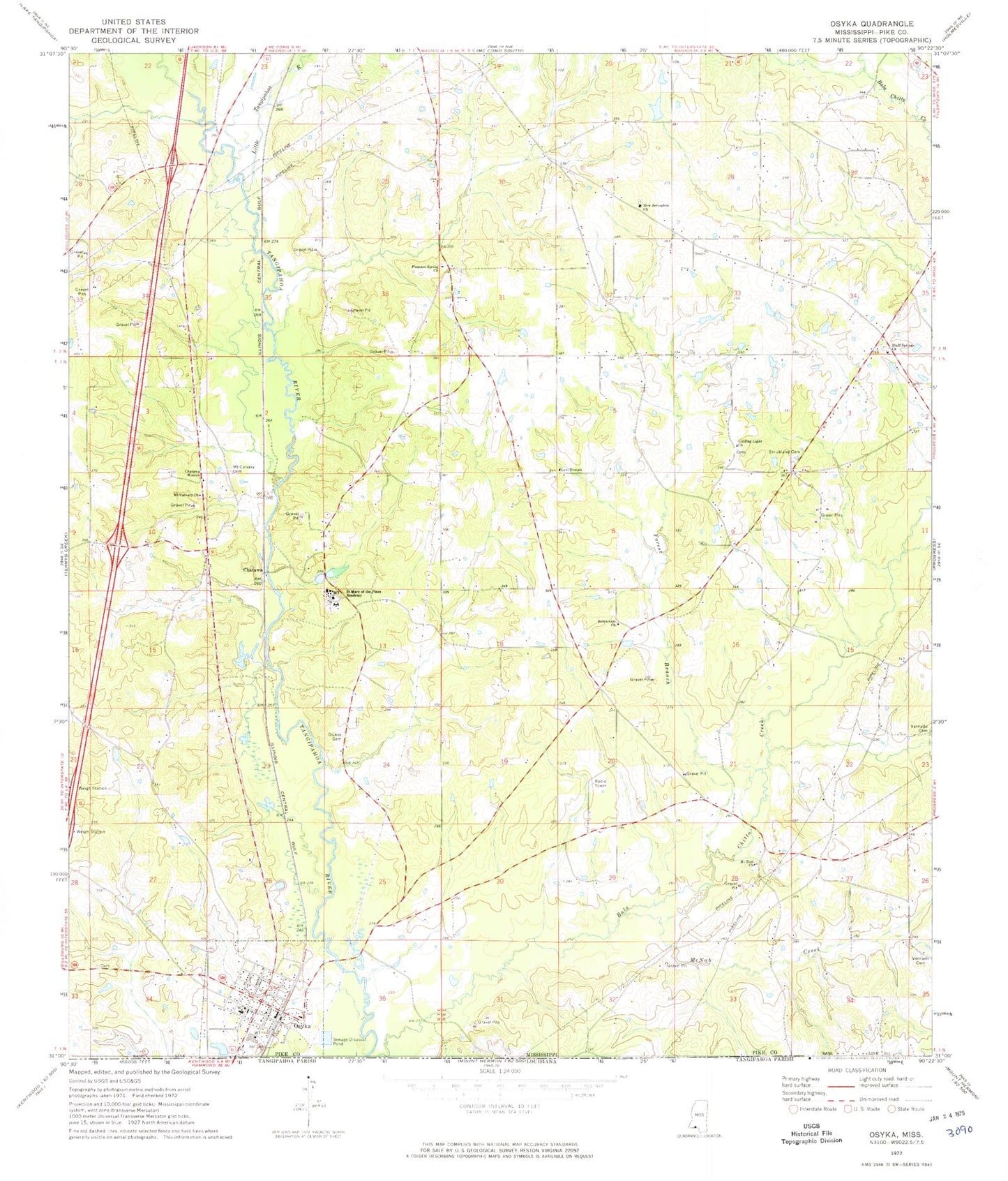
Classic USGS Osyka Mississippi 7.5'x7.5' Topo Map
Couldn't load pickup availability
Historical USGS topographic quad map of Osyka in the state of Mississippi. Map scale may vary for some years, but is generally around 1:24,000. Print size is approximately 24" x 27"
This quadrangle is in the following counties: Pike, Tangipahoa.
The map contains contour lines, roads, rivers, towns, and lakes. Printed on high-quality waterproof paper with UV fade-resistant inks, and shipped rolled.
Contains the following named places: Alton Roberts Cemetery, Ann Tyler Cemetery, Ard Cemetery, Ball Lake Dam, Bethlehem Church, Bluff Springs Cemetery, Bluff Springs Church, Centerville Consolidated School, Chatawa, Chatawa Mission, Cutrer Cemetery, Dickey Cemetery, Dykes Cemetery, Felder Cemetery, Ford Cemetery, Forest Branch, Fulham Cemetery, Guiding Light Cemetery, Guiding Light Church, Hinson - Knippers Cemetery, Kelly Church, Kennedy Cemetery, Knapp Cemetery, Levi Temple, Little Tangipahoa River, McGehee Cemetery, McNab Creek, McNabb Cemetery, Mount Calvary Cemetery, Mount Calvary Church, Mount Zion Cemetery, Mount Zion Church, New Jerusalem Church, Osyka, Osyka Baptist Church, Osyka Cemetery, Osyka Elementary School, Osyka Police Department, Osyka Post Office, Ott Lake Dam, Phelps Cemetery, Pleasant Spring Church, Prescot School, Prescott Cemetery, Rayborn - Easley Cemetery, Reeves Lake Dam, Rhodus Cemetery, Rice Cemetery, Rural Osyka Volunteer Fire Department, Saint Mary of the Pines Academy, Saint Mary of the Pines Catholic Church, Saint Mary of the Pines Cemetery, Sandifer Cemetery, Simmons Cemetery, Slade Cemetery, Slaven Cemetery, Stephens, Strickland Cemetery, Supervisor District 5, Tate Cemetery, Town of Osyka, Varnado Cemetery, Wilson Cemetery, Wolverton Cemetery, ZIP Code: 39652