MyTopo
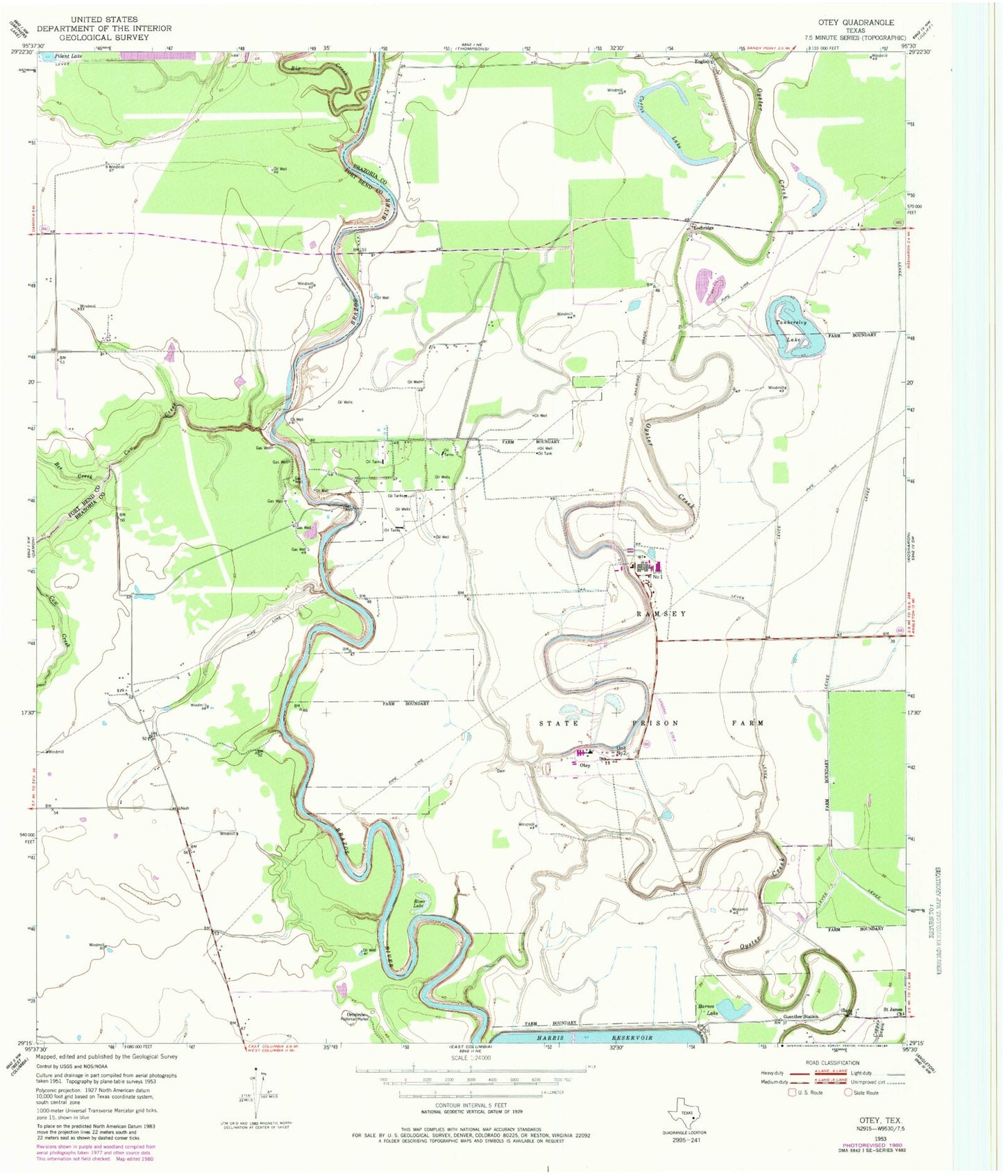
Classic USGS Otey Texas 7.5'x7.5' Topo Map
Couldn't load pickup availability
Historical USGS topographic quad map of Otey in the state of Texas. Map scale may vary for some years, but is generally around 1:24,000. Print size is approximately 24" x 27"
This quadrangle is in the following counties: Brazoria, Fort Bend.
The map contains contour lines, roads, rivers, towns, and lakes. Printed on high-quality waterproof paper with UV fade-resistant inks, and shipped rolled.
Contains the following named places: Barnes Lake, Bee Creek, Bethelder Baptist Church, Big Creek, Coffee Lake, Cow Creek, English, Genther Station, Hale Ranch State Park Reservoir Number 8 Dam, Lochridge, Mount Olive Baptist Church, Orozimbo, Otey, River Lake, Saint James Church, Tankersley Lake, Texas Department of Criminal Justice A M Mac Stringfellow Unit, Texas Department of Criminal Justice C T Terrell Unit, Texas Department of Criminal Justice W F Ramsey Unit