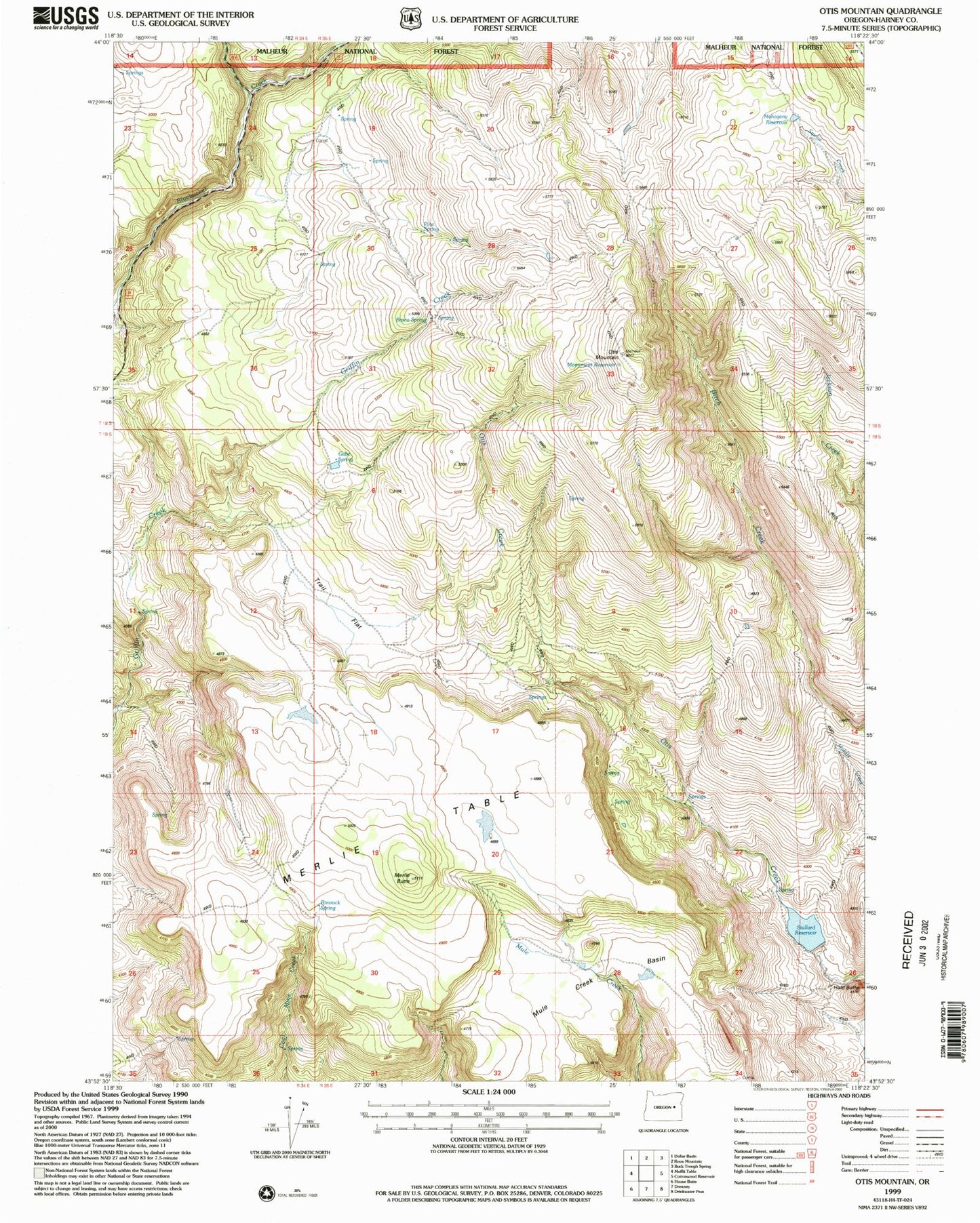
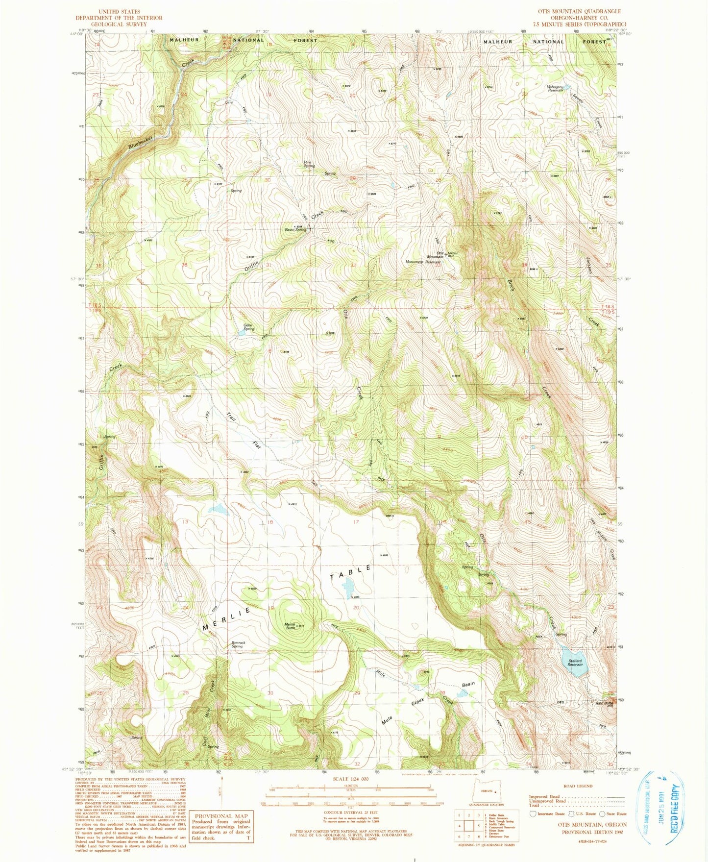
MyTopo
Classic USGS Otis Mountain Oregon 7.5'x7.5' Topo Map
Regular price
$16.95
Regular price
Sale price
$16.95
Unit price
per
Couldn't load pickup availability
Historical USGS topographic quad map of Otis Mountain in the state of Oregon. Map scale may vary for some years, but is generally around 1:24,000. Print size is approximately 24" x 27"
This quadrangle is in the following counties: Harney.
The map contains contour lines, roads, rivers, towns, and lakes. Printed on high-quality waterproof paper with UV fade-resistant inks, and shipped rolled.
Contains the following named places: Basco Spring, Gabe Spring, Hald Butte, Mahogany Reservoir, Merlie Butte, Merlie Table, Monument Reservoir, Mule Creek Basin, Otis Mountain, Pine Spring, Rimrock Spring, Stallard Dam, Stallard Reservoir, Trail Flat