MyTopo
Classic USGS Otisco Valley New York 7.5'x7.5' Topo Map
Couldn't load pickup availability
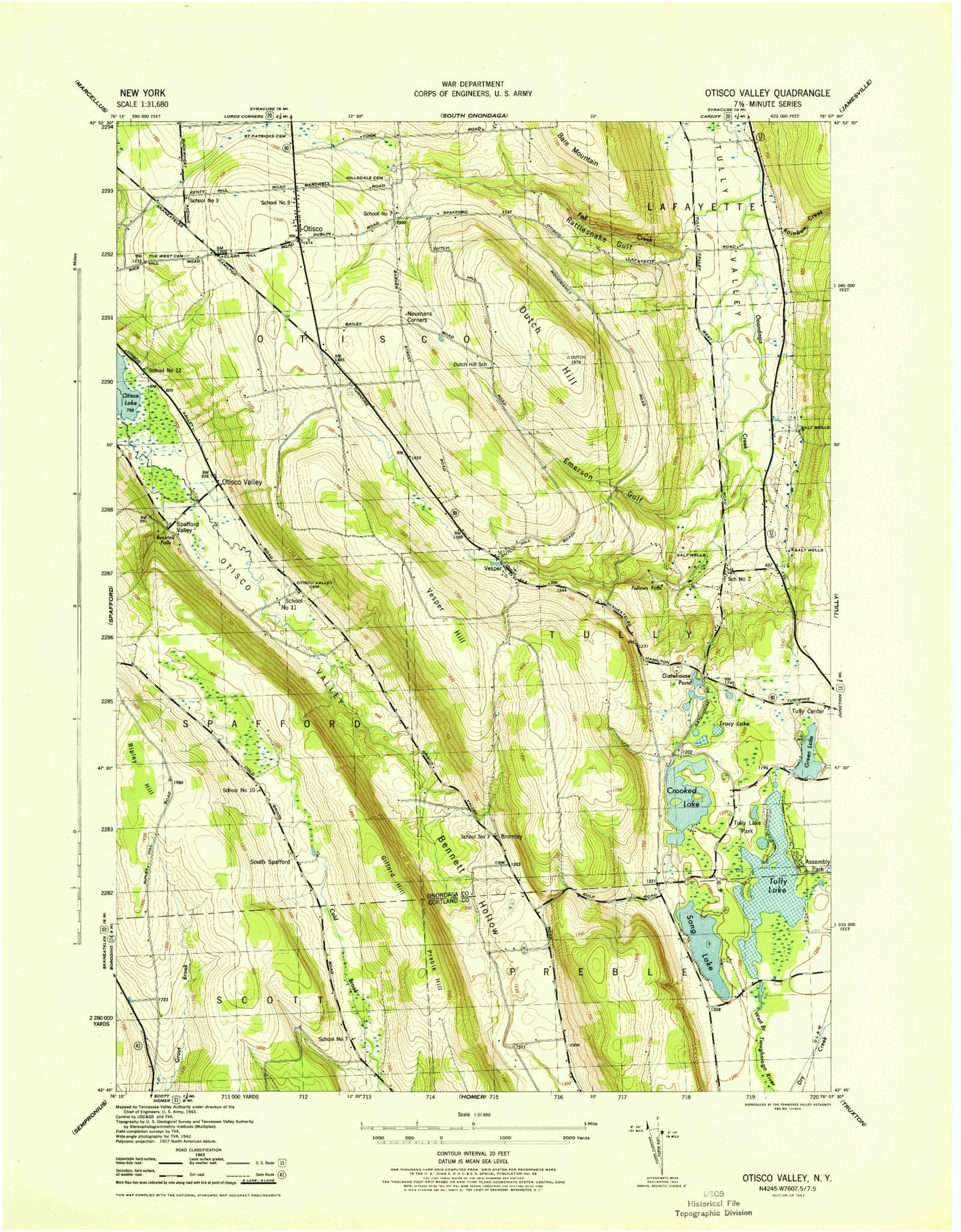
Historical USGS topographic quad map of Otisco Valley in the state of New York. Map scale may vary for some years, but is generally around 1:24,000. Print size is approximately 24" x 27"
This quadrangle is in the following counties: Cortland, Onondaga.
The map contains contour lines, roads, rivers, towns, and lakes. Printed on high-quality waterproof paper with UV fade-resistant inks, and shipped rolled.
Contains the following named places: Assembly Park, Bare Mountain, Bennett Hollow, Bromley, Bromley Cemetery, Bucktail Falls, Camp Hoover, Christian Hollow Cemetery, Cold Brook Valley Cemetery, Crooked Lake, Dutch Hill, Dutch Hill School, Emerson Gulf, Fellows Falls, Gatehouse Pond, Gifford Hill, Green Lake, Hillsdale Cemetery, Mary Christmas Tree Farm, Neumans Corners, Otisco, Otisco Fire Department, Otisco Valley, Preble Hill, Rainbow Creek, Rattlesnake Gulf, Ripley Hill, Royal Acres, Saint Patricks Cemetery, School Number 10, School Number 11, School Number 12, School Number 2, School Number 3, School Number 7, Song Lake, South Spafford, Spafford Creek, Spafford Hollow Cemetery, Spafford Valley, The West Cemetery, Town of Otisco, Town of Tully, Tracy Lake, Tully Lake, Tully Lake Park, Tully Valley, Vesper, Vesper Cemetery, Vesper Hill, Vesper Hills Golf Club, Vesper United Methodist Church, ZIP Code: 13141