MyTopo
Classic USGS Otisville Michigan 7.5'x7.5' Topo Map
Couldn't load pickup availability
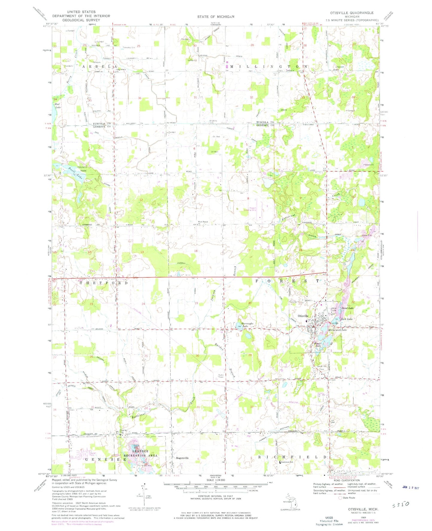
Historical USGS topographic quad map of Otisville in the state of Michigan. Map scale may vary for some years, but is generally around 1:24,000. Print size is approximately 24" x 27"
This quadrangle is in the following counties: Genesee, Tuscola.
The map contains contour lines, roads, rivers, towns, and lakes. Printed on high-quality waterproof paper with UV fade-resistant inks, and shipped rolled.
Contains the following named places: Adams Drain, Arbela Township Cemetery, Averill Drain, Barden Branch, Buell Drain, Buell Lake, Buell Lake County Park, Burns Drain, Burroughs Lake, Clew Post Office, Coe Drain, Community Bible Church, Covenant Hills Campground, Dock Lake, Drudge Drain, East Arbela Church, East Thetford Post Office, Emmanuel Baptist Church, Forest Township Fire Department, Frost Drain, Grass Roots Airport, Hopkins Cemetery, Jackson Branch, McCormick Lake, Methodist United Church, Misner Drain, Mount Nebo Church, Mud Lake, Nunn Drain, Otisville, Otisville Assembly of God Church, Otisville Church of Christ, Otisville Elementary School, Otisville Police Department, Otisville Post Office, Otisville Station, Otisville United Methodist Church, Parker Scothan Drain, Pettit Park, Picnic Lake, Rogersville Station, Saint Francis Xavier Church, Saint Timothy Lutheran Church, Sand Lake, Smith Hill Cemetery, Smith Hill Cemetery Historical Marker, Southwest School, Thetford and Arbela Drain, Torrey Drain, Township of Forest, Village of Otisville, West Forest Church, Wilbur Drain, ZIP Code: 48463