MyTopo
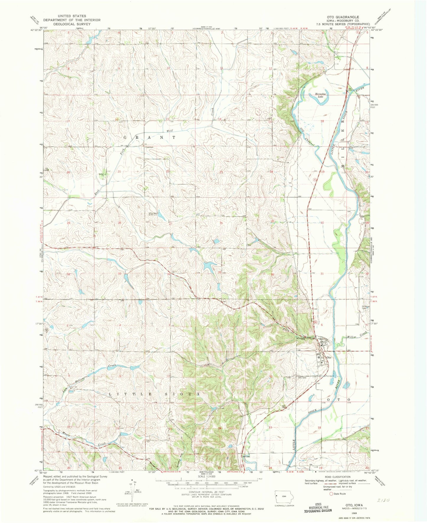
Classic USGS Oto Iowa 7.5'x7.5' Topo Map
Couldn't load pickup availability
Historical USGS topographic quad map of Oto in the state of Iowa. Map scale may vary for some years, but is generally around 1:24,000. Print size is approximately 24" x 27"
This quadrangle is in the following counties: Woodbury.
The map contains contour lines, roads, rivers, towns, and lakes. Printed on high-quality waterproof paper with UV fade-resistant inks, and shipped rolled.
Contains the following named places: Bethel Church, City of Oto, Fern Creek, Horseshoe Lake, Inkpaduta Historical Marker, Inkpaduta River Access, Miller Creek, Oak Ridge Conservation Area, Old Channel Little Sioux River, Oto, Oto Cemetery, Oto City Hall, Oto Community Ambulance Service, Oto Community Volunteer Fire Department, Oto Post Office, Peiro Bethel Cemetery, Piero Post Office, Saint Mary's Catholic Church, Saint Marys Cemetery, Township of Grant, Township of Little Sioux, United Church of Christ, ZIP Codes: 51004, 51044