MyTopo
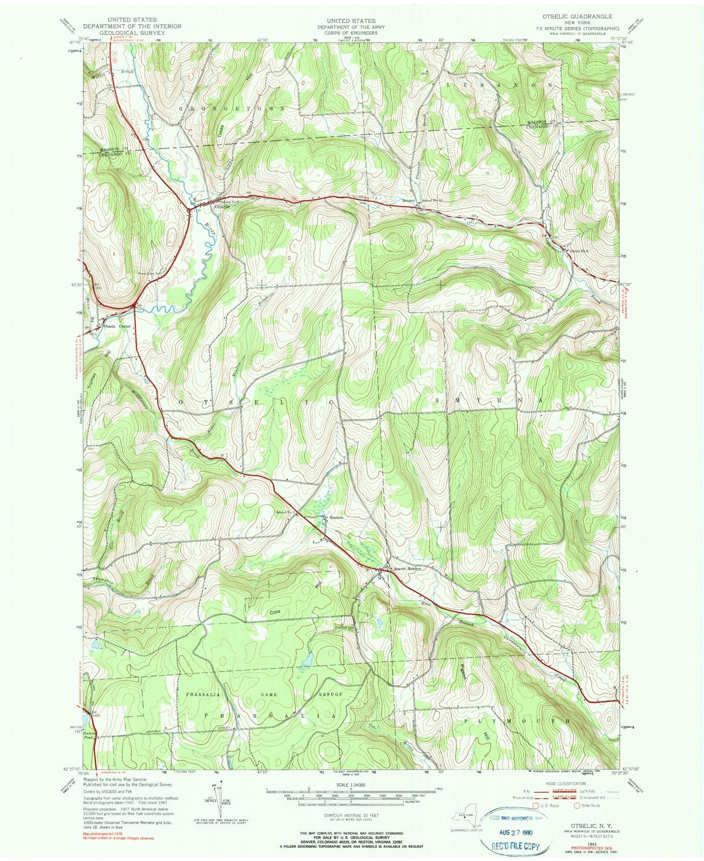
Classic USGS Otselic New York 7.5'x7.5' Topo Map
Couldn't load pickup availability
Historical USGS topographic quad map of Otselic in the state of New York. Typical map scale is 1:24,000, but may vary for certain years, if available. Print size: 24" x 27"
This quadrangle is in the following counties: Chenango, Madison.
The map contains contour lines, roads, rivers, towns, and lakes. Printed on high-quality waterproof paper with UV fade-resistant inks, and shipped rolled.
Contains the following named places: Alder Meadow Brook, Beaver Meadow, Cole Hill, Cole Hill Cemetery, Mann Brook, Maple Grove Cemetery, Middletown Brook, Muller Brook, Otselic, Otselic Center, Perkins Pond, Pharsalia Game Refuge, Pigeon Hill, Coit Brook, Bonney, Stanbro, School Number 1 (historical), School Number 14 (historical), School Number 2 (historical), School Number 6 (historical), Town of Otselic, Bonney Cemetery, West Smyrna Baptist Church