MyTopo
Classic USGS Otter Chain Ponds Maine 7.5'x7.5' Topo Map
Couldn't load pickup availability
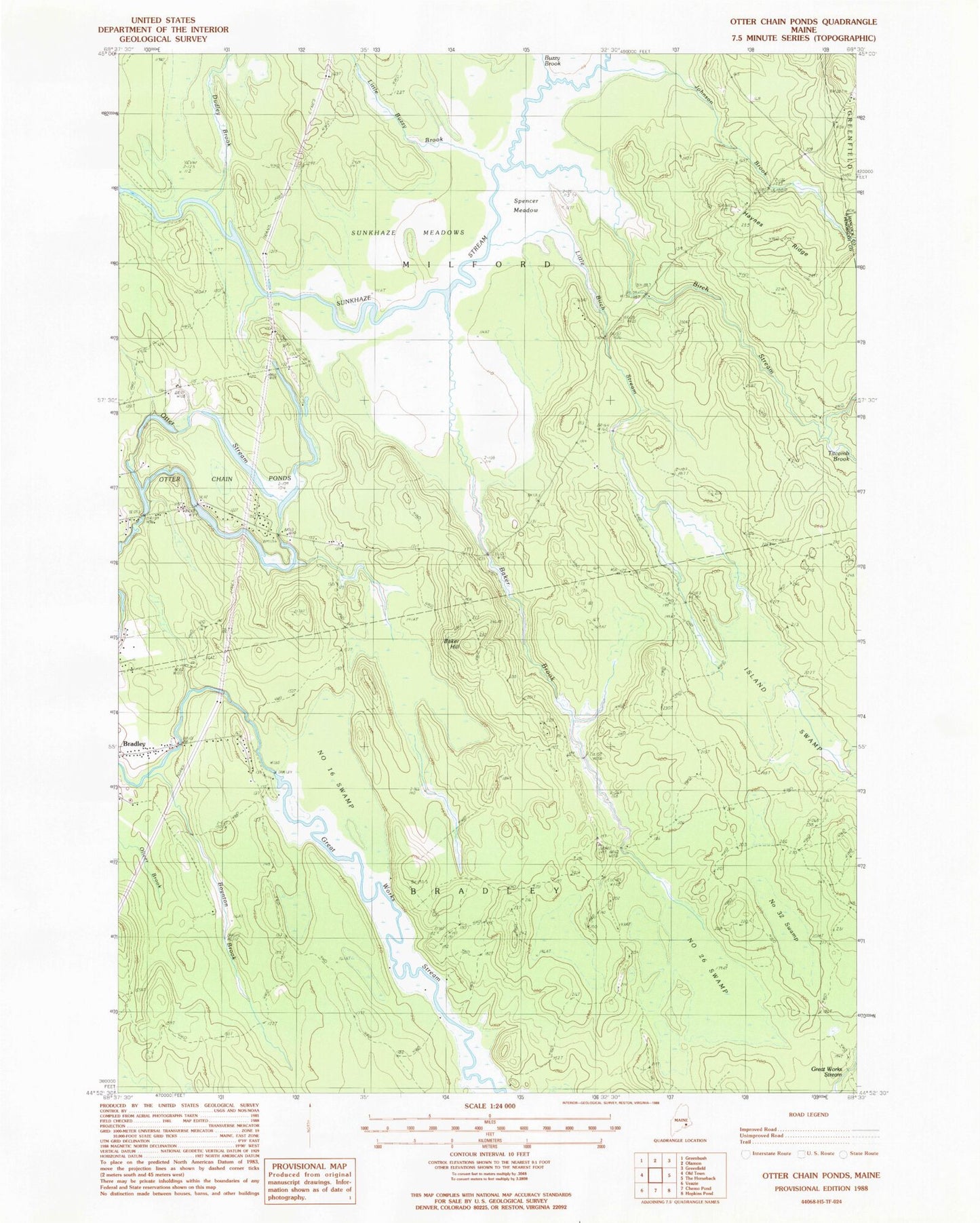
Historical USGS topographic quad map of Otter Chain Ponds in the state of Maine. Map scale may vary for some years, but is generally around 1:24,000. Print size is approximately 24" x 27"
This quadrangle is in the following counties: Hancock, Penobscot.
The map contains contour lines, roads, rivers, towns, and lakes. Printed on high-quality waterproof paper with UV fade-resistant inks, and shipped rolled.
Contains the following named places: Baker Brook, Baker Hill, Birch Stream, Boynton Brook, Bradley Census Designated Place, Buzzy Brook, Dudley Brook, Great Works Stream, Great Works Stream Dam, Haynes Ridge, Island Swamp, John Baker Camp, Johnson Brook, Little Birch Stream, Little Buzzy Brook, Number Sixteen Swamp, Number Thirty-two Swamp, Number Twenty-six Swamp, Old Gold Mine Trail, Otter Chain Ponds, Spencer Meadow, Sunkhaze Meadows, Sunkhaze Meadows National Wildlife Refuge, Titcomb Brook, Town of Bradley, Town of Milford, Viola Rand Elementary School, ZIP Code: 04461