MyTopo
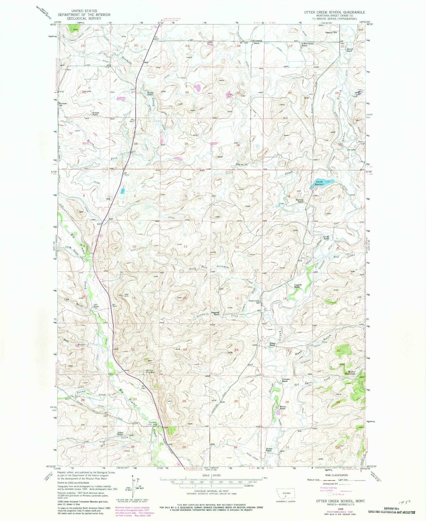
Classic USGS Otter Creek School Montana 7.5'x7.5' Topo Map
Couldn't load pickup availability
Historical USGS topographic quad map of Otter Creek School in the state of Montana. Map scale may vary for some years, but is generally around 1:24,000. Print size is approximately 24" x 27"
This quadrangle is in the following counties: Sweet Grass.
The map contains contour lines, roads, rivers, towns, and lakes. Printed on high-quality waterproof paper with UV fade-resistant inks, and shipped rolled.
Contains the following named places: 01N14E15DAAB01 Well, 02N14E15____01 Well, 02N14E15CBCA01 Well, 02N14E16____01 Well, 02N14E22____01 Well, 02N14E22C___01 Well, 02N14E34A___01 Well, 02N15E05D___01 Well, 02N15E06____01 Well, 02N15E08CAAC01 Well, 02N15E18____01 Well, 03N14E24____01 Well, 59011, Auwater Ditch, Bear Gulch, Big Timber Creek Canal, Bjorndal Ranch, Branae Ranch, Cain Dam, Cosgriff Ranch, D McCormick Ranch, Dry Creek, Ellison Ranch, Glasston School, Huyser Ranch, J McCormick Ranch, Kortum Ranch, Kremper Ranch, Lavold Dam, Lavold Ranch, Lavold Reservoir, Lien Gulch, Lien Ranch, Long Gulch, Mattice Homestead, Murray Ranch, Nash Gulch, Nelson Ranch, North Fork Sevenmile Creek, North of the Yellowstone Division, Old Daves Creek, Otter Creek School, Papez Number 1 Dam, Papez Number 2 Dam, Sevenmile Creek, Sherod Ranch, Smoky Dam, Songstad Ranch, South Fork Tenmile Creek, Swamp Creek, Tangen Draw, Tenmile Creek, Tenmile Ditch, Wild Rose School