MyTopo
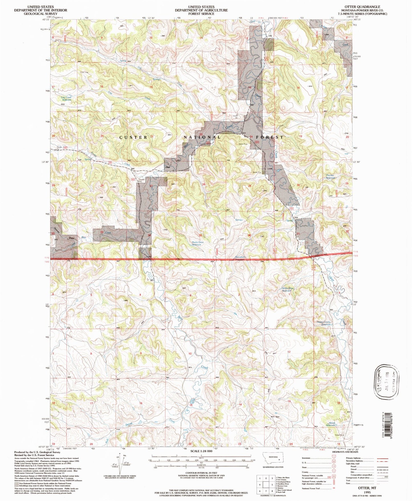
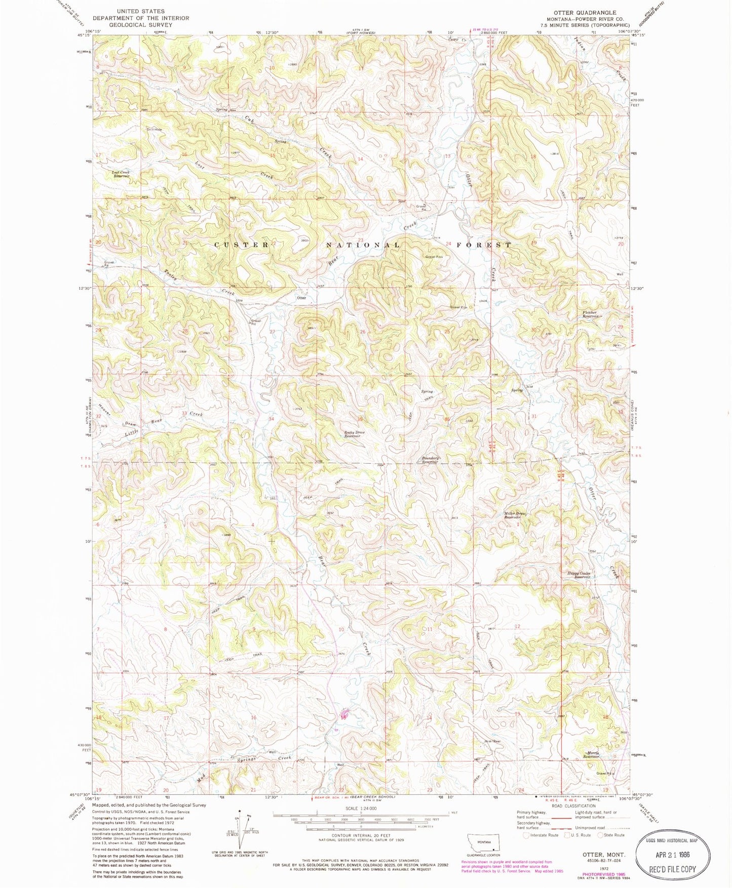
Classic USGS Otter Montana 7.5'x7.5' Topo Map
Couldn't load pickup availability
Historical USGS topographic quad map of Otter in the state of Montana. Map scale may vary for some years, but is generally around 1:24,000. Print size is approximately 24" x 27"
This quadrangle is in the following counties: Powder River.
The map contains contour lines, roads, rivers, towns, and lakes. Printed on high-quality waterproof paper with UV fade-resistant inks, and shipped rolled.
Contains the following named places: 07S45E13DCCC01 Well, 07S45E27AADA01 Well, 07S45E32DCBA01 Well, 07S45E32DCBA02 Well, 07S45E32DCBA03 Well, 07S45E34BDAB01 Well, 07S46E31BADC01 Spring, 08S45E03BAAB01 Spring, 08S45E03DAAC01 Spring, 08S45E04ABAA01 Well, 08S45E04ACCD01 Spring, 08S45E04DCCB01 Spring, 08S45E05CBBC01 Well, 08S45E08DBAA01 Spring, 08S45E08DCBB01 Well, 08S45E10ABCB01 Well, 08S45E11ADDA01 Well, 08S45E13BCAA01 Spring, 08S45E14DBBA01 Spring, 08S45E14DDAC01 Well, 08S45E15CAAB01 Well, 08S45E15DBBB01 Spring, 08S45E16AACA01 Spring, 08S45E16ABAA01 Spring, 08S45E16DBCB01 Well, 08S45E16DBCB02 Well, 08S45E16DDCB01 Well, 08S45E17AADC01 Spring, 08S45E20AACD01 Well, 08S45E20BDAB01 Well, 08S45E21ABBC01 Spring, 08S45E22BAAA01 Well, 08S46E01BAAA01 Well, Bear Creek, Boundary Reservoir, Bradshaw Creek, Camp Creek, Colester Draw, Cub Creek, Fletcher Reservoir, Happy Coulee Reservoir, Hoover Draw, Little Bear Creek, Lost Creek, Lost Creek Reservoir, Miller Draw, Miller Draw Reservoir, Morris Reservoir, Mud Springs Creek, Otter, Otter Post Office, Rocky Draw Reservoir, Tooley Creek