MyTopo
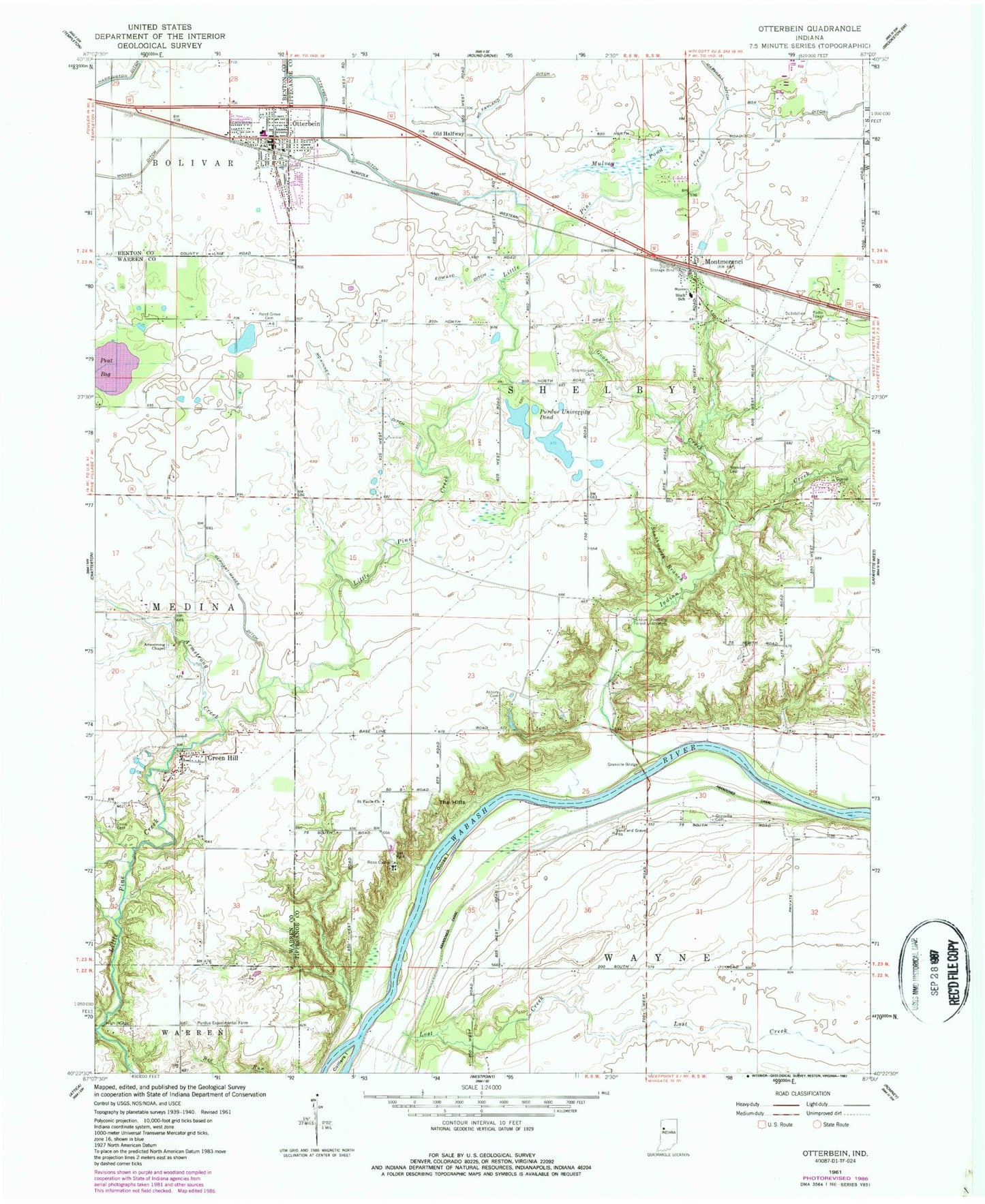
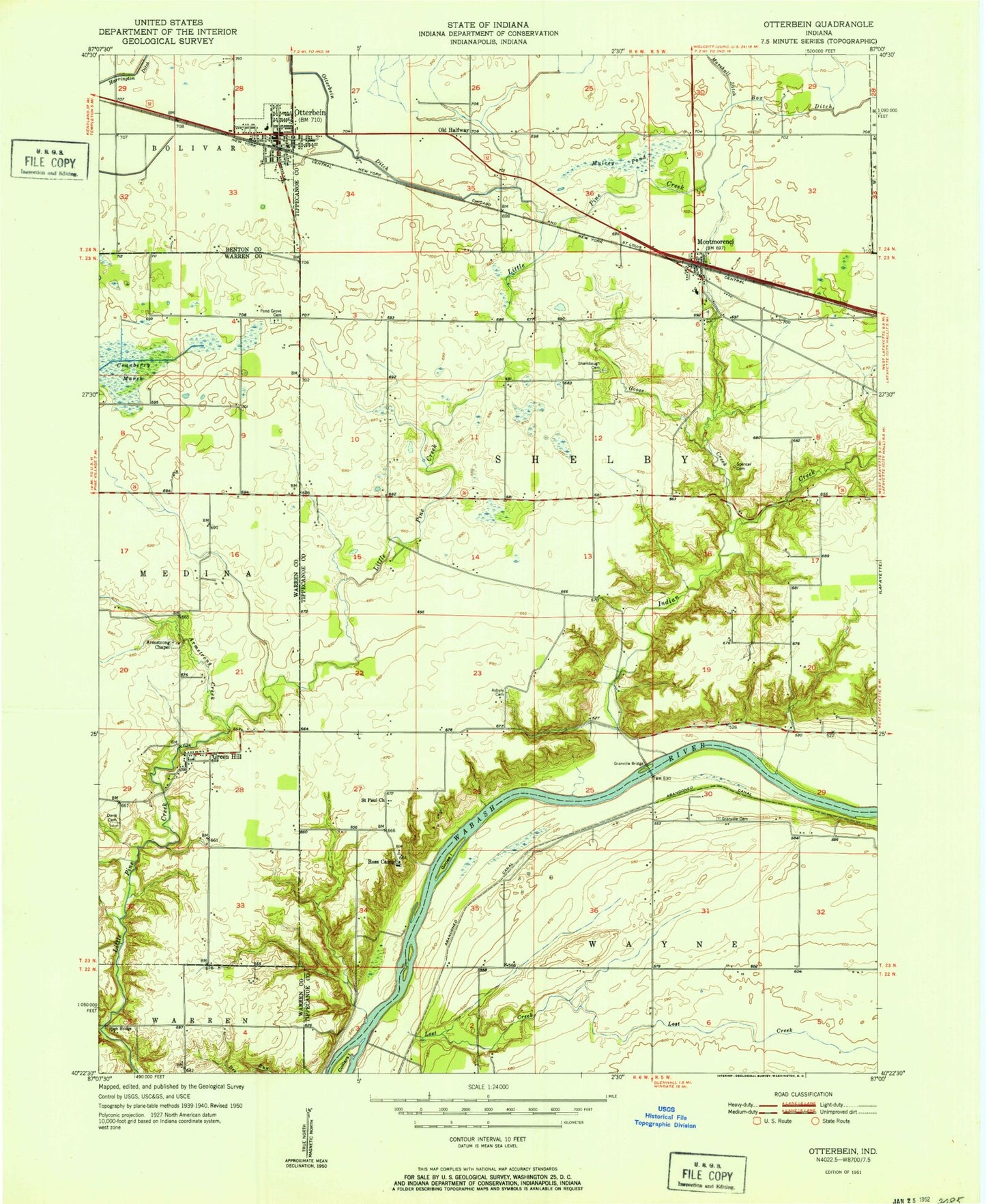
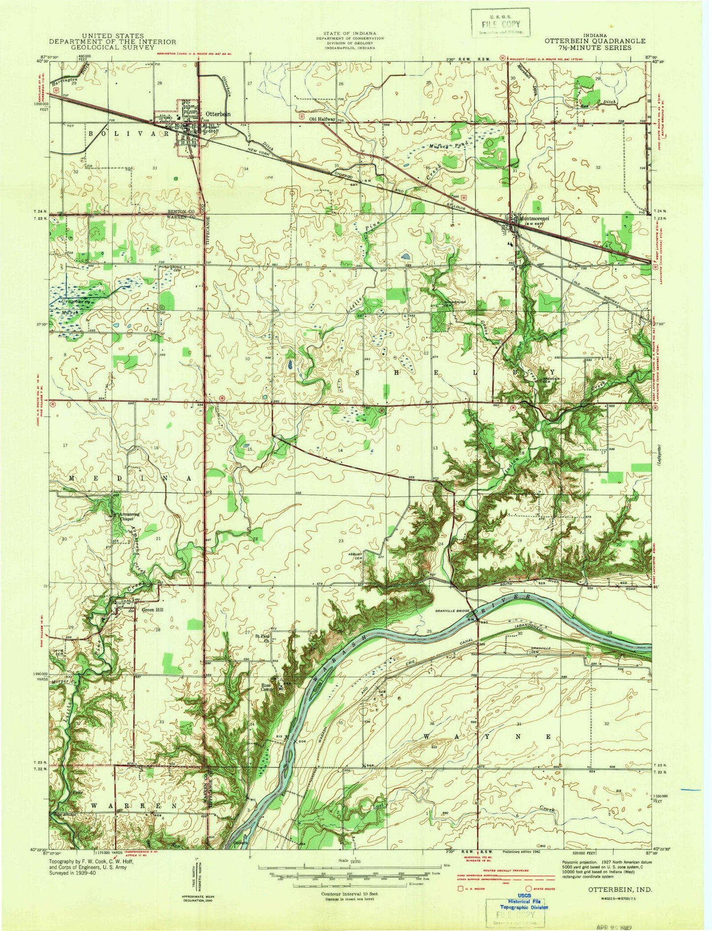
Classic USGS Otterbein Indiana 7.5'x7.5' Topo Map
Couldn't load pickup availability
Historical USGS topographic quad map of Otterbein in the state of Indiana. Typical map scale is 1:24,000, but may vary for certain years, if available. Print size: 24" x 27"
This quadrangle is in the following counties: Benton, Tippecanoe, Warren.
The map contains contour lines, roads, rivers, towns, and lakes. Printed on high-quality waterproof paper with UV fade-resistant inks, and shipped rolled.
Contains the following named places: Armstrong Chapel, Armstrong Creek, Asbury Cemetery, Box Ditch, Colliers Island, Cranberry Marsh, Davis Cemetery, Edward Ditch, Gephart-Mageet Ditch, Goose Creek, Goose Island, Grandville Bridge, Granville Cemetery, Green Hill, High Bridge, Indian Creek, Lost Creek, McFarland Ditch, McKinney Ditch, Montmorenci, Mulvey Pond, Old Halfway, Otterbein, Otterbein Ditch, Pond Grove Cemetery, Purdue Experimental Farm, Ross Camp, Saint Pauls Church, Shambaugh Cemetery, Southworth Branch, Spencer Cemetery, Otterbein Elementary School, Granville Bridge, Purdue University Forest Laboratory, Purdue University Pond, Township of Shelby, Town of Otterbein, Montmorenci Census Designated Place, Otterbein Volunteer Fire Department, Bloomer's Greenhouse, Otterbein Town Police Department, Otterbein Post Office, Green Hill Census Designated Place, Armstrong Chapel, Armstrong Creek, Asbury Cemetery, Box Ditch, Colliers Island, Cranberry Marsh, Davis Cemetery, Edward Ditch, Gephart-Mageet Ditch, Goose Creek, Goose Island, Grandville Bridge, Granville Cemetery, Green Hill, High Bridge, Indian Creek, Lost Creek, McFarland Ditch, McKinney Ditch, Montmorenci, Mulvey Pond, Old Halfway, Otterbein, Otterbein Ditch, Pond Grove Cemetery, Purdue Experimental Farm, Ross Camp, Saint Pauls Church, Shambaugh Cemetery, Southworth Branch, Spencer Cemetery, Otterbein Elementary School, Granville Bridge, Purdue University Forest Laboratory, Purdue University Pond, Township of Shelby, Town of Otterbein, Montmorenci Census Designated Place, Otterbein Volunteer Fire Department, Bloomer's Greenhouse, Otterbein Town Police Department, Otterbein Post Office, Green Hill Census Designated Place