MyTopo
Classic USGS Otterville West Missouri 7.5'x7.5' Topo Map
Couldn't load pickup availability
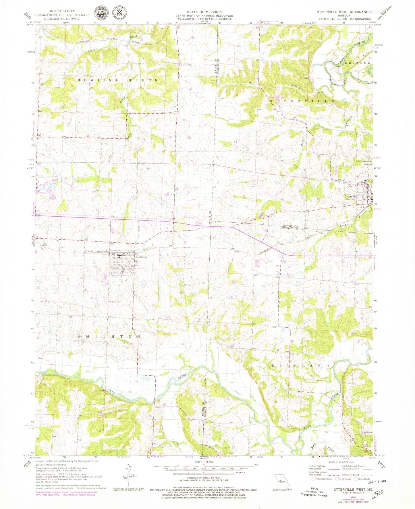
Historical USGS topographic quad map of Otterville West in the state of Missouri. Map scale may vary for some years, but is generally around 1:24,000. Print size is approximately 24" x 27"
This quadrangle is in the following counties: Cooper, Morgan, Pettis.
The map contains contour lines, roads, rivers, towns, and lakes. Printed on high-quality waterproof paper with UV fade-resistant inks, and shipped rolled.
Contains the following named places: Arator School, Bethlehem Church, Brushy School, City of Otterville, City of Smithton, Clear Branch, Dick Monsees Dam, Harlan Branch, Haw Creek, Hermora Lake, Klein School, Lake Creek, Lake of the Ozarks Planning Region, Little Shaver Creek, Monsees Lake, Otterville, Otterville Elementary School, Otterville High School, Otterville Post Office, Providence Church, Rubydo Lake Dam, Selken Lake Dam, Smithton, Smithton Cemetery, Smithton Elementary School, Smithton High School, Smithton Police Department, Smithton Post Office, Smithton Volunteer Fire Protection Association, Steele Lake Dam, Stony Point School, Township of Otterville, Township of Smithton, ZIP Code: 65350