MyTopo
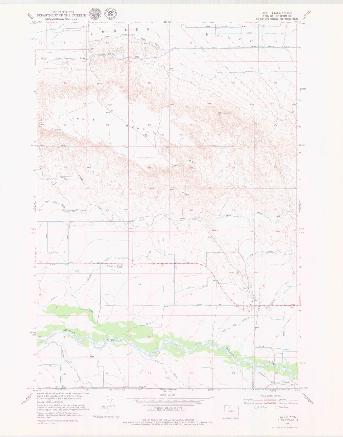
Classic USGS Otto Wyoming 7.5'x7.5' Topo Map
Couldn't load pickup availability
Historical USGS topographic quad map of Otto in the state of Wyoming. Map scale may vary for some years, but is generally around 1:24,000. Print size is approximately 24" x 27"
This quadrangle is in the following counties: Big Horn.
The map contains contour lines, roads, rivers, towns, and lakes. Printed on high-quality waterproof paper with UV fade-resistant inks, and shipped rolled.
Contains the following named places: Bench Canal Dam, Bench Canal Reservoir, Bighorn Basin, Delbert Jones Dam, Delbert Jones Reservoir, Fairview Canal, Grout Ditch, Highline Ditch, J F W Ditch, Otto, Otto Cemetery, Otto Post Office, Perkins Ditch, South Lateral Bench Canal, Stringtown School, Webster Creek, Wood and Burnett Ditch, ZIP Code: 82434