MyTopo
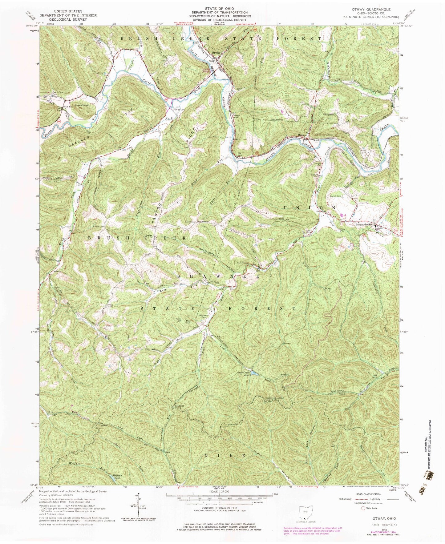
Classic USGS Otway Ohio 7.5'x7.5' Topo Map
Couldn't load pickup availability
Historical USGS topographic quad map of Otway in the state of Ohio. Typical map scale is 1:24,000, but may vary for certain years, if available. Print size: 24" x 27"
This quadrangle is in the following counties: Scioto.
The map contains contour lines, roads, rivers, towns, and lakes. Printed on high-quality waterproof paper with UV fade-resistant inks, and shipped rolled.
Contains the following named places: Alum Rock, Bear Creek, Beech Fork, Beech Fork Cemetery, Beech Fork Church, Branham Cemetery, Buttermilk Hollow, Canada Run, East Branch McCullough Creek, Euton Cemetery, Garvin Cemetery, Garvin Cemetery, Henley, Henley Church, Hills Church, Honey Hollow, Jewett Cemetery, Kinney Cemetery, Left Fork Bear Creek, Little Spruce Run, Moon Cemetery, Oppy Cemetery, Oswego Church, Oswego Ridge, Parker Cemetery, Rock Lick Hollow, Saw Pit Run, Scantling Run, Slate Run, Smith Cemetery, South Fork Scioto Brush Creek, Spruce Run, Stony Run, Straight Fork Bear Creek, Sugarcamp Run, Thornton Cemetery, Wolfden Lake, Jones Knob, Union Elementary School, Pine Flat School (historical), Otway Elementary School, Otway Bridge, Oswego School (historical), Berkley School (historical), Jones School (historical), Noxel School (historical), Rocky Fork School (historical), Spruce Run School (historical), Watts Run, Rocky Fork, Lombardsville, Otway, Bloody Run, Davis Run, Long Fork Bear Creek, Right Fork Bear Creek, Bear Creek Lake Dam, Bear Creek Lake, Copperhead Lookout Tower, Yellowbird Farm Airport (historical), Township of Brush Creek, Township of Union, Oswego Cemetery, Otway Cemetery, Lombardville Post Office (historical), Otway Post Office, Village of Otway, Union Township Volunteer Fire Department, Union Township Volunteer Fire Department, Otway Fire Department