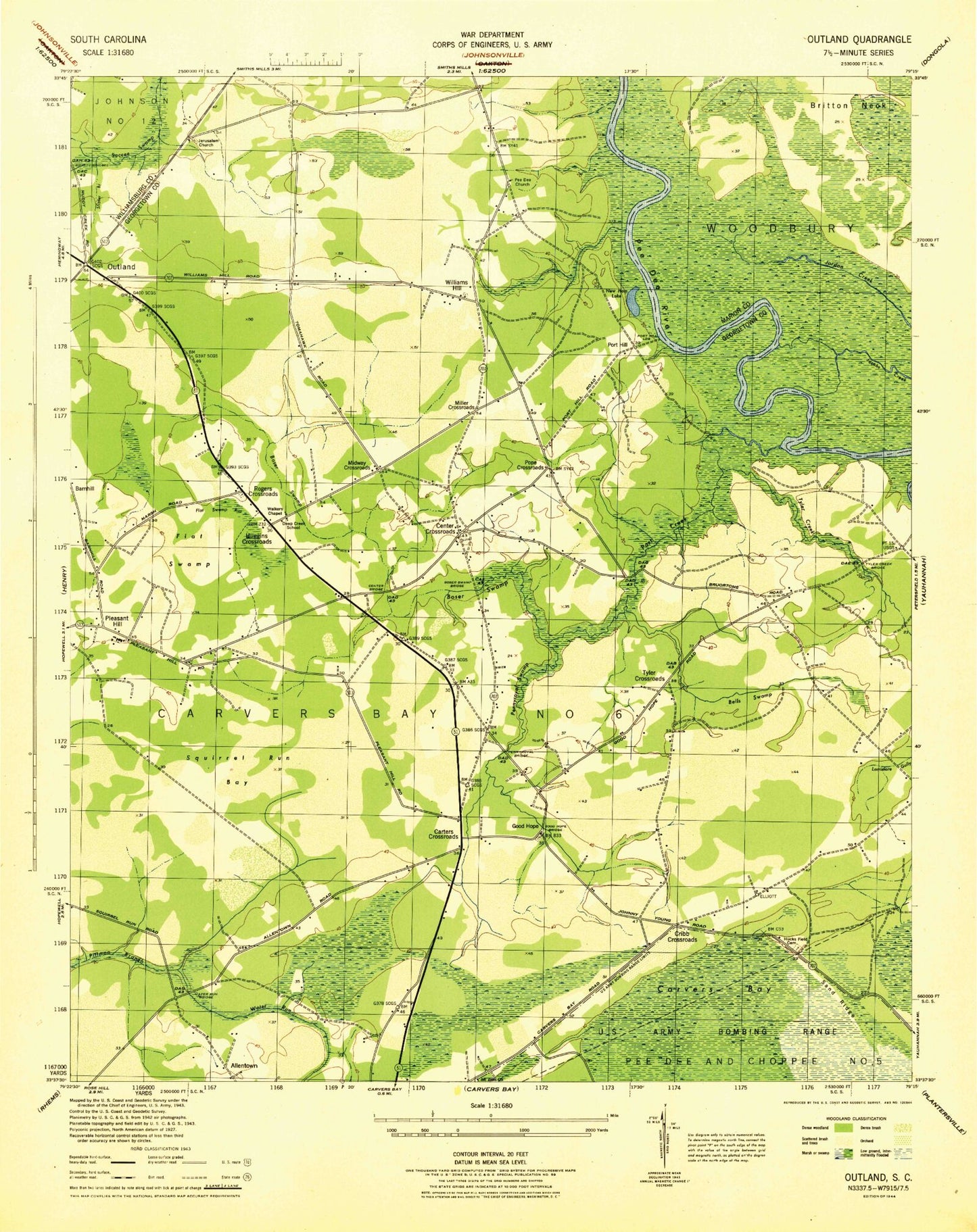
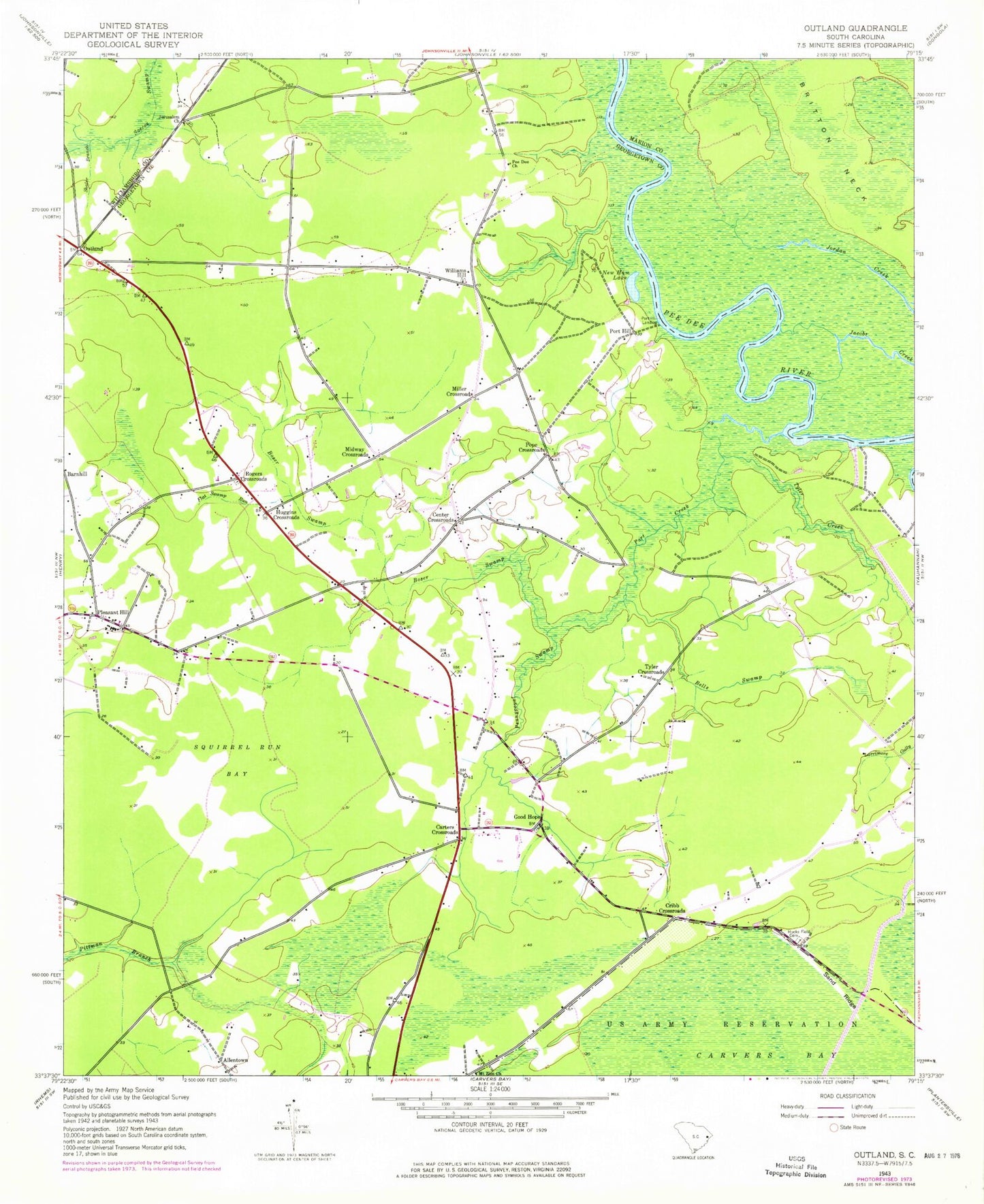
MyTopo
Classic USGS Outland South Carolina 7.5'x7.5' Topo Map
Couldn't load pickup availability
Historical USGS topographic quad map of Outland in the state of South Carolina. Map scale may vary for some years, but is generally around 1:24,000. Print size is approximately 24" x 27"
This quadrangle is in the following counties: Georgetown, Marion, Williamsburg.
The map contains contour lines, roads, rivers, towns, and lakes. Printed on high-quality waterproof paper with UV fade-resistant inks, and shipped rolled.
Contains the following named places: Allentown, Bells Swamp, Boser Swamp, Britton Neck, Carters Church, Carters Crossroads, Center Church, Center Crossroads, Cribb Crossroads, Deep Creek Elementary School, Flat Swamp Run, Georgetown Fire Department Station 4, Good Hope, Good Hope Church, Hucks Field Cemetery, Huggins Crossroads, Jerusalem Cemetery, Jerusalem Church, Midway Crossroads, Miller Crossroads, Mount Zion Church, New Ham Lake, Outland, Outland Church of God, Pee Dee Church, Pennyroyal Swamp, Pleasant Hill, Pleasant Hill Church, Pleasant Hill Elementary, Pleasant Hill High School, Pleasant Hill Middle School, Pleasant Hill-Folly Grove Division, Pope Crossroads, Port Creek, Port Hill, Port Hill Landing, Rogers Crossroads, Sand Ridge, Shaler Branch, Squirrel Run Bay, Tyler Creek, Tyler Crossroads, Walkers Church, Williams Hill, Williams Hill Church, WLGI-FM (Hemingway)