MyTopo
Classic USGS Outlaw Hill Arizona 7.5'x7.5' Topo Map
Regular price
$16.95
Regular price
Sale price
$16.95
Unit price
per
Couldn't load pickup availability
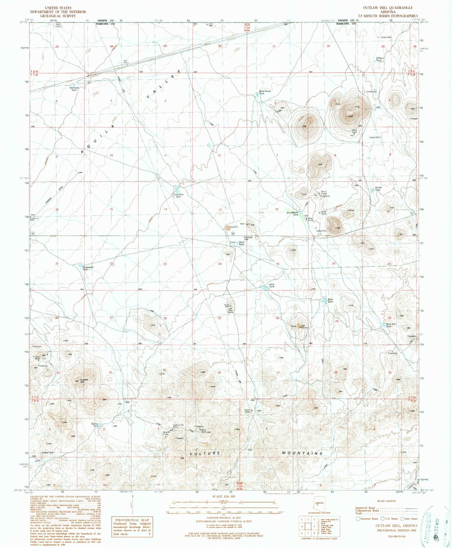
Historical USGS topographic quad map of Outlaw Hill in the state of Arizona. Map scale may vary for some years, but is generally around 1:24,000. Print size is approximately 24" x 27"
This quadrangle is in the following counties: Maricopa, Yavapai.
The map contains contour lines, roads, rivers, towns, and lakes. Printed on high-quality waterproof paper with UV fade-resistant inks, and shipped rolled.
Contains the following named places: Aguila Valley, Cornelius Tank, Divide Tank, Forepaugh Airport, Forepaugh Tank, Jerry Tank, Lucky Cuss Mine, Mine Tank, O'Haco Tank, Outlaw Hill, Outlaw Tank, Quail Tank, Railroad Tank, Six-shooter Tank, Sunrise Mine, Twin Joe Tank, Wild Horse Tank, ZIP Code: 85390