MyTopo
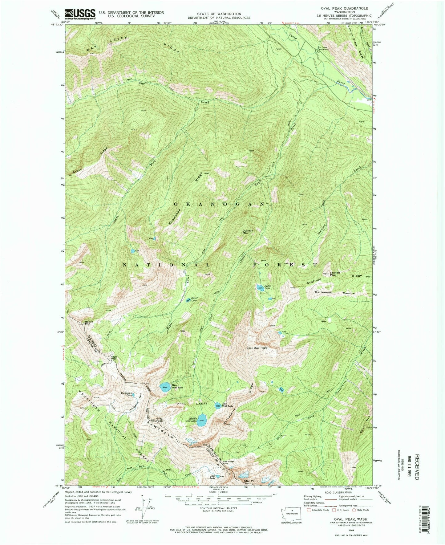
Classic USGS Oval Peak Washington 7.5'x7.5' Topo Map
Couldn't load pickup availability
Historical USGS topographic quad map of Oval Peak in the state of Washington. Typical map scale is 1:24,000, but may vary for certain years, if available. Print size: 24" x 27"
This quadrangle is in the following counties: Chelan, Okanogan.
The map contains contour lines, roads, rivers, towns, and lakes. Printed on high-quality waterproof paper with UV fade-resistant inks, and shipped rolled.
Contains the following named places: West Oval Lake, Battle Mountain, Buttermilk Meadow, Buttermilk Ridge, Duckbill Mountain, Duffy Lake, Eagle Creek, Eagle Pass, East Oval Lake, Fish Creek Pass, Gray Peak, Horseshoe Basin, Middle Oval Lake, Oval Creek, Oval Lakes, Oval Peak, Sawtooth Ridge, Scaffold Peak, Scaffold Ridge, Silver Lake, Snowshoe Ridge, South Fork War Creek, Spirit Mountain, Star Lake, Star Peak, Tuckaway Lake, War Creek, War Creek Campground, Spirit Peak, Lake Chelan-Sawtooth Wilderness, Courtney Peak