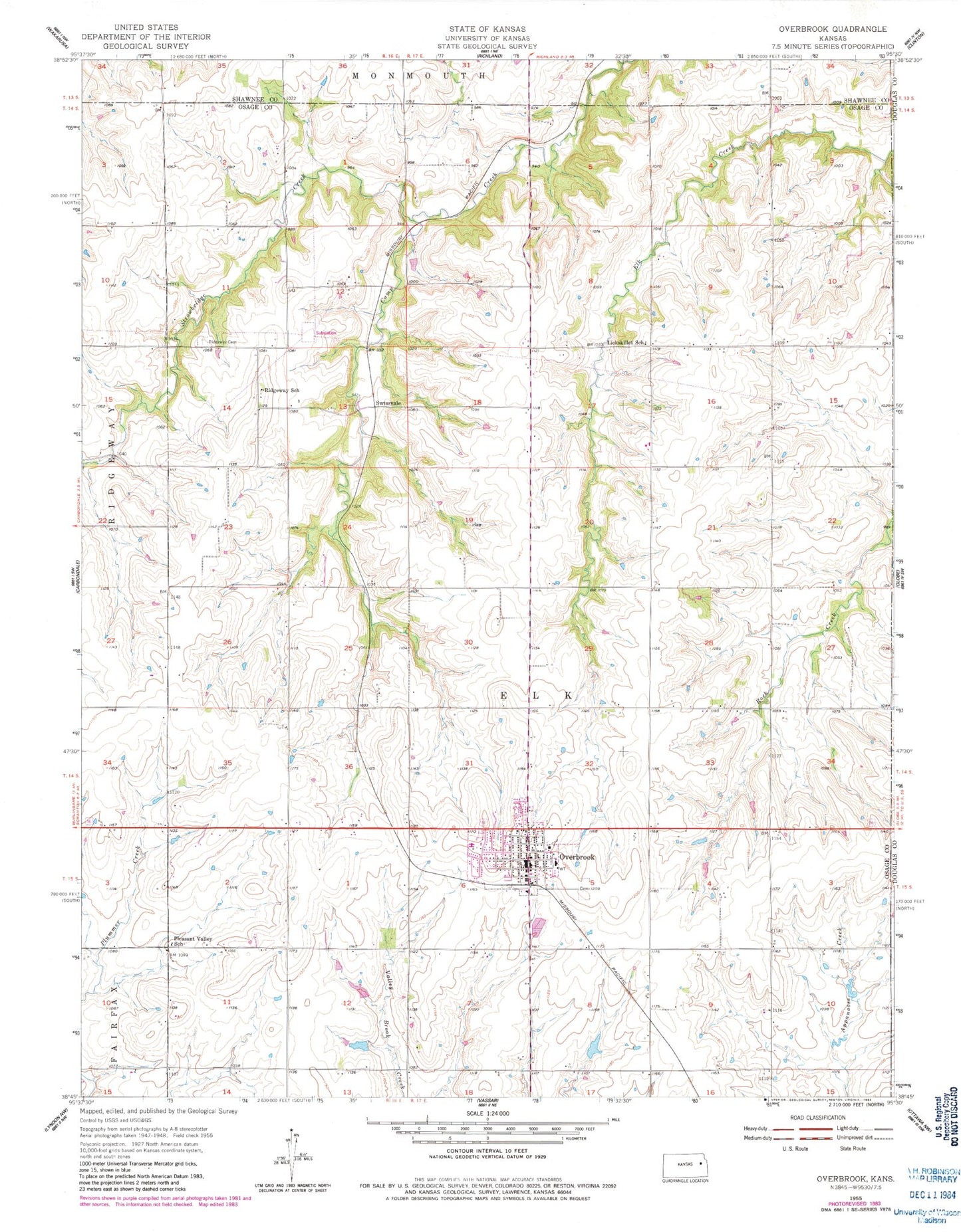
MyTopo
Classic USGS Overbrook Kansas 7.5'x7.5' Topo Map
Couldn't load pickup availability
Historical USGS topographic quad map of Overbrook in the state of Kansas. Map scale may vary for some years, but is generally around 1:24,000. Print size is approximately 24" x 27"
This quadrangle is in the following counties: Douglas, Osage, Shawnee.
The map contains contour lines, roads, rivers, towns, and lakes. Printed on high-quality waterproof paper with UV fade-resistant inks, and shipped rolled.
Contains the following named places: City of Overbrook, Grace Community Church, Hidden Springs Golf Course, Kinney, Lickskillet School, Osage County Fire District 4 Overbrook, Overbrook, Overbrook Attendance Center, Overbrook Bible Church, Overbrook Cemetery, Overbrook City Hall, Overbrook Fairgrounds, Overbrook Police Department, Overbrook Post Office, Overbrook Public Library, Overbrook Sewer Treatment Plant, Overbrook United Methodist Church, Overbrook Water Tower, Pleasant Valley School, Ridgeway Cemetery, Ridgeway School, Snoopys Airport, Strowbridge Creek, Swissvale, Township of Elk, ZIP Code: 66524