MyTopo
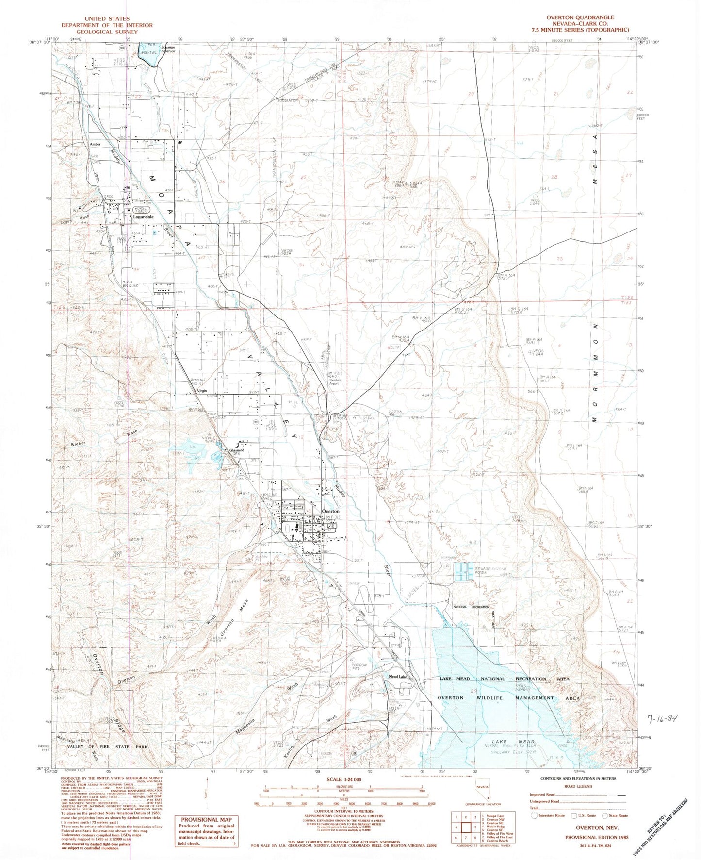
Classic USGS Overton Nevada 7.5'x7.5' Topo Map
Couldn't load pickup availability
Historical USGS topographic quad map of Overton in the state of Nevada. Map scale may vary for some years, but is generally around 1:24,000. Print size is approximately 24" x 27"
This quadrangle is in the following counties: Clark.
The map contains contour lines, roads, rivers, towns, and lakes. Printed on high-quality waterproof paper with UV fade-resistant inks, and shipped rolled.
Contains the following named places: Amber, Angel Ranch, Bowman Dam, Camp Overton, Capalapa Ranch, Clark County Fire Department - Overton Station 74, Clark County Logandale Fire Station 73, Community College of Southern Nevada Moapa Valley Center, Fort Saint Joseph, Glassand, Grant Bowler Park, Grant M Bowler Elementary School, Honeybee Dam, Honeybee Reservoir, Kaolin, Kaolin Post Office, Kaolin Wash, Las Vegas Metropolitan Police Department - Overton, Lewis Ranch, Logan Township, Logan Wash, Logandale, Logandale Church, Logandale Post Office, Lost City Museum, Lyon Mack Park, Mack Lyon Middle School, Magnesite Wash, Mead Lake, Mead Lake Post Office, Mesa House, Mill Number 1-Pond A Dam, Mill Number 1-Pond B Dam, Mill Number 2-Pond A Dam, Mill Number 2-Pond B Dam, Mill Number 2-Pond C Dam, Mill Number 2-Pond D Dam, Mill Number 2-Pond E Dam, Moapa Valley, Moapa Valley Census Designated Place, Moapa Valley Community Center, Moapa Valley High School, Old Overton, Overton, Overton Mesa, Overton Museum, Overton Park, Overton Pool, Overton Post Office, Overton Wash, Patterson Ranch, Perkins Field, Pueblo, Saint Joseph, Saint Joseph Post Office, Simonsville, Southern Nevada Memorial Hospital, Swamp Spring, Ute Perkins Elementary School, Virgin, Wells, Wieber Wash