
MyTopo
Classic USGS Ovett SE Mississippi 7.5'x7.5' Topo Map
Couldn't load pickup availability
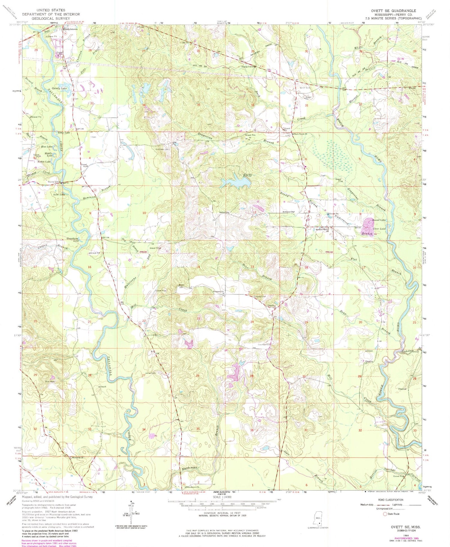
Historical USGS topographic quad map of Ovett SE in the state of Mississippi. Map scale may vary for some years, but is generally around 1:24,000. Print size is approximately 24" x 27"
This quadrangle is in the following counties: Perry.
The map contains contour lines, roads, rivers, towns, and lakes. Printed on high-quality waterproof paper with UV fade-resistant inks, and shipped rolled.
Contains the following named places: B Conway Lake Dam, Bear Branch, Bethel Church, Blue Lake, Bogue Homo Creek Boat Ramp, Bogue Homo Creek Mississippi Highway 42 Bridge, Buck Creek, Buck Creek Church, Burch Cemetery, Buzzard Branch, Carter Branch, Chatman Branch, Clear Lake, Courthey Cemetery, D C Leach Lake Dam, Dry Branch, Eddy Lake, Flat Branch, Frances Branch, Gandy Lake, Gandy Lake Dam, Grantham Lake, Grapevine Branch, Hammock Branch, Harper Branch, Hickory Grove Church, Holiness Church, Hood Branch, Hurricane Bay, Izola Lake, James Cemetery, McGilvary Cemetery, Memorial Church, Merritt Springs Branch, Middle Lake, Mill Creek, Nicholson Branch, Pitts Branch, Prospect Cemetery, Prospect Church, Providence Church, Ready Branch, Round Lake, Rubin Lake, Runnelstown Volunteer Fire Department Station 2, Sapp Branch, Sportsman Lake, Sportsman Lake Dam, Supervisor District 2, Tallahalla Creek Mississippi Highway 42 Bridge, Thomas Creek, Underwood Branch, Vernon McDonnell Pond Dam, White Branch, Young Mobile Home Park


