
MyTopo
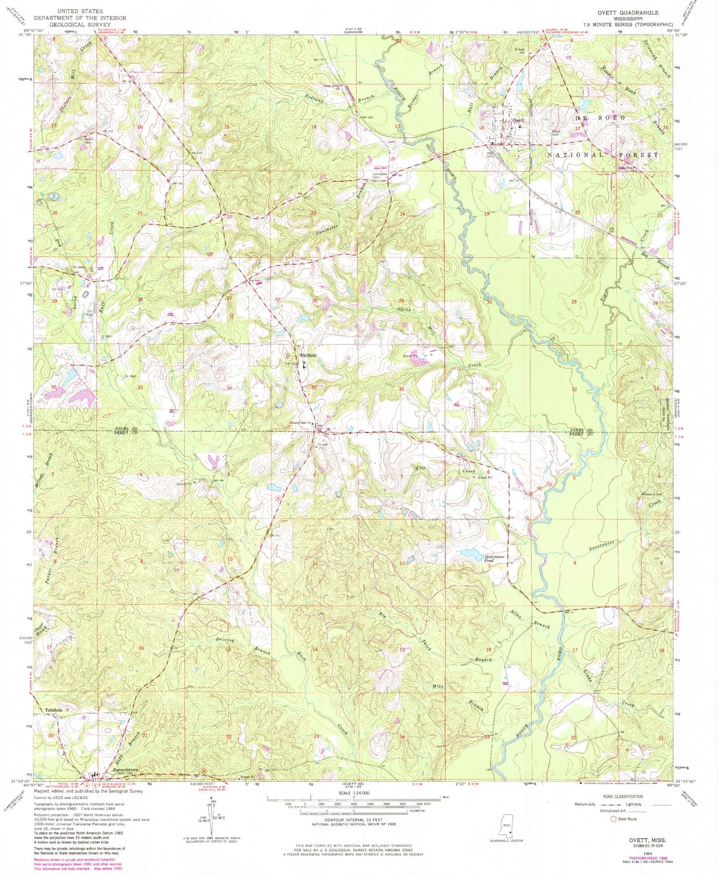
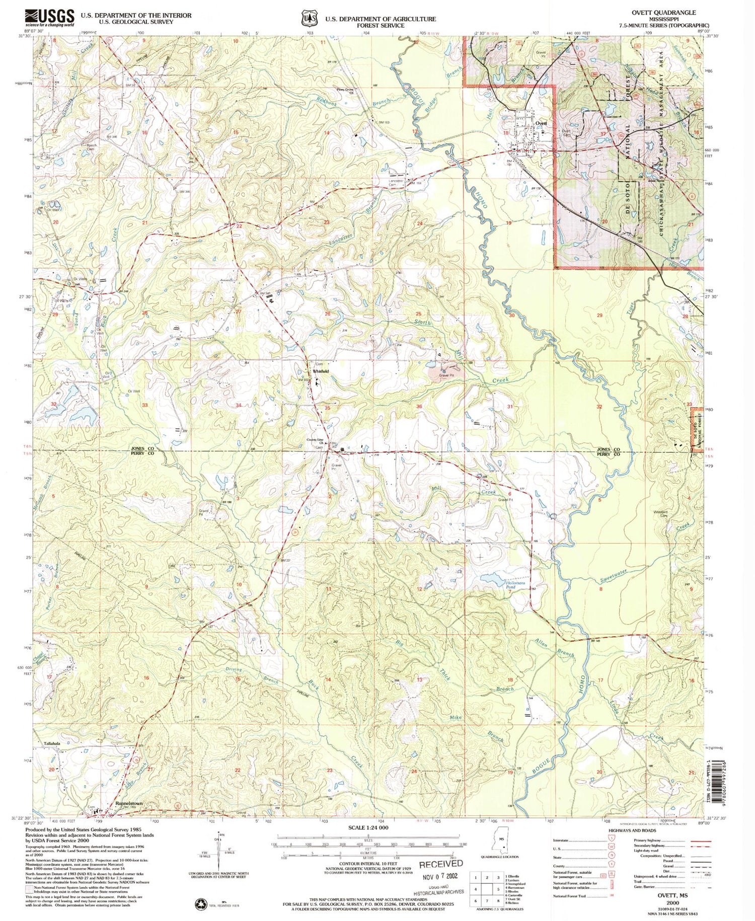
Classic USGS Ovett Mississippi 7.5'x7.5' Topo Map
Couldn't load pickup availability
Historical USGS topographic quad map of Ovett in the state of Mississippi. Map scale may vary for some years, but is generally around 1:24,000. Print size is approximately 24" x 27"
This quadrangle is in the following counties: Jones, Perry.
The map contains contour lines, roads, rivers, towns, and lakes. Printed on high-quality waterproof paper with UV fade-resistant inks, and shipped rolled.
Contains the following named places: Allan Branch, Baylss Branch, Beech Cemetery, Big Thick Branch, Bridge Branch, Carl Hollomans Pond Dam, County Line Baptist Church, County Line Cemetery, Driving Branch, Dry Prong, Faith Baptist Church, Fox, Hall Branch, Hog Branch, Hollomans Mills, Hollomans Pond, Hull Mill, Jesus Name Church, Lancaster Branch, Lancaster Cemetery, Linda Creek, McInnis Mill, Mike Branch, Mill Creek, Ovett, Ovett Baptist Church, Ovett Cemetery, Ovett Census Designated Place, Ovett Post Office, Ovett School, Ovett Volunteer Fire Department, Piney Grove Church, Redbank Branch, Runnelstown, Runnelstown Census Designated Place, Runnelstown Elementary School, Runnelstown First Baptist Church, Runnelstown Volunteer Fire Department, Smith Mill Creek, Sweetwater Creek, Tallahala, Tiger Creek, Vickers Lake Dam, Welcome Home Jesus Name Church, Whitfield, Whitfield Baptist Church, Whitfield Line School, Woodard Cemetery, ZIP Code: 39464