MyTopo
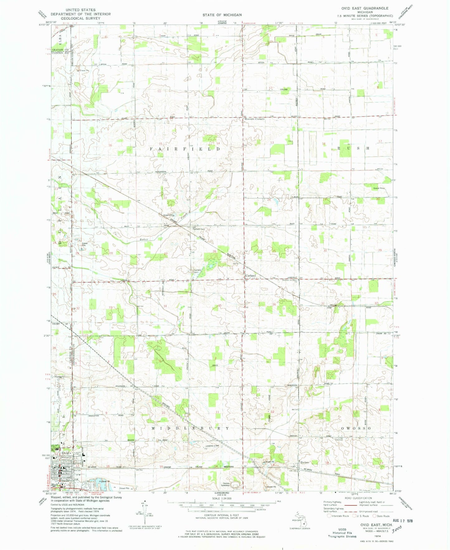
Classic USGS Ovid East Michigan 7.5'x7.5' Topo Map
Couldn't load pickup availability
Historical USGS topographic quad map of Ovid East in the state of Michigan. Map scale may vary for some years, but is generally around 1:24,000. Print size is approximately 24" x 27"
This quadrangle is in the following counties: Clinton, Gratiot, Shiawassee.
The map contains contour lines, roads, rivers, towns, and lakes. Printed on high-quality waterproof paper with UV fade-resistant inks, and shipped rolled.
Contains the following named places: Bower Farm, Brethren in Christ Church, Burton, Burton Post Office, Burton Station, Carland, Carland Post Office, Carland Station, Church of the Living Word, City of Ovid, David Drain, Fairfield Cemetery, First Baptist Church of God, First Congregational Church of Ovid Historical Marker, George D. Sowers House Historical Marker, Green Meadow Farms, Gumaer Memorial Park, Holy Family Catholic Church, Hoovers Corners, Jan's Second Lake Campground, Latz Farm, Leonard Elementary School, Long's Dairy Farm, Maple Grove Cemetery, Old Fairfield Cemetery, Ovid, Ovid - Middlebury Fire and Emergency Services Authority, Ovid Main Street Clinic, Ovid Police Department, Ovid Post Office, Ovid Public Library, Ovid Station, Owosso Speedway, Township of Fairfield, United Church of Ovid, Van Berhoof Farm, Village of Ovid Historical Marker, William's Farms, Ziola Farms, ZIP Code: 48831