MyTopo
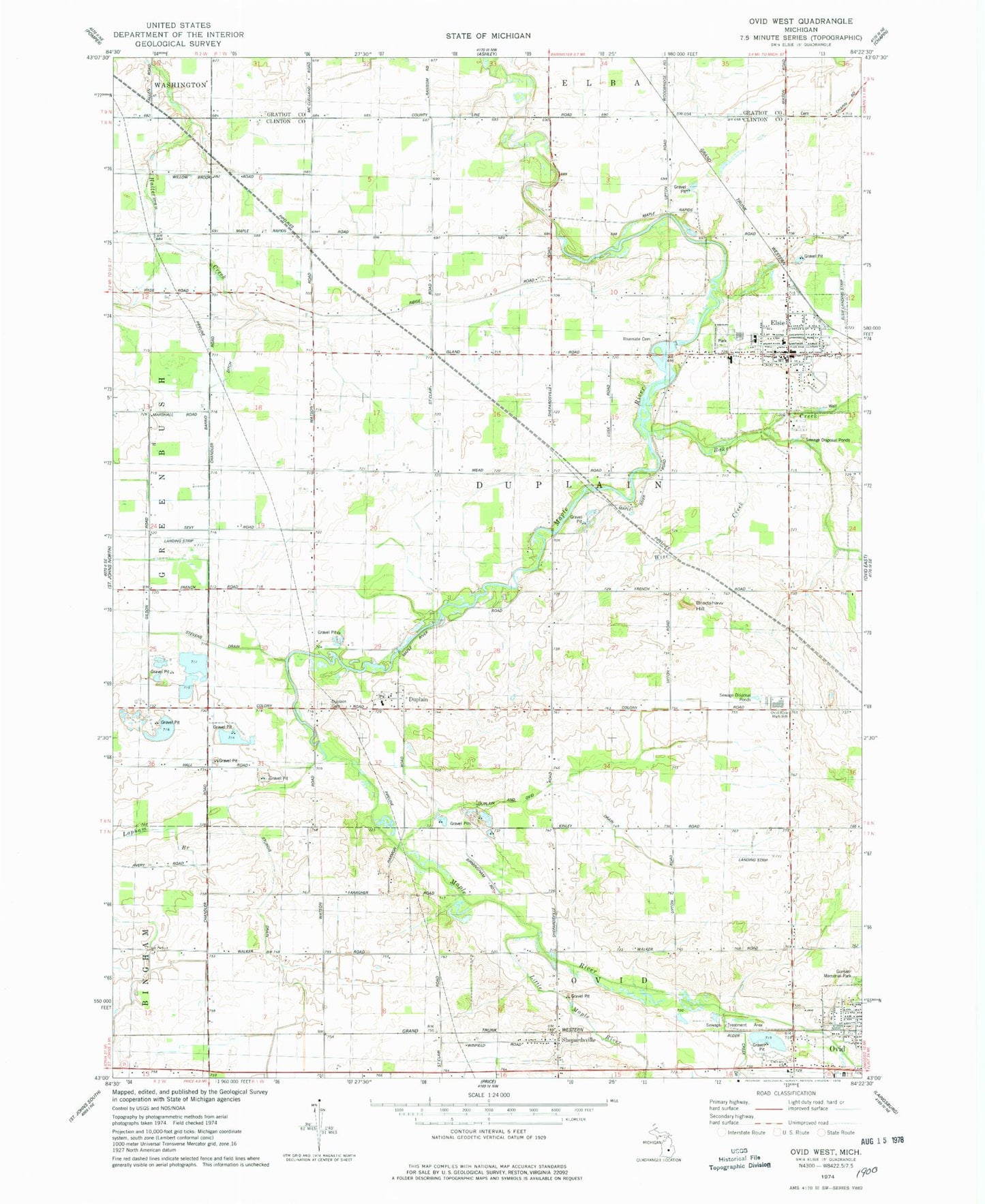
Classic USGS Ovid West Michigan 7.5'x7.5' Topo Map
Couldn't load pickup availability
Historical USGS topographic quad map of Ovid West in the state of Michigan. Map scale may vary for some years, but is generally around 1:24,000. Print size is approximately 24" x 27"
This quadrangle is in the following counties: Clinton, Gratiot.
The map contains contour lines, roads, rivers, towns, and lakes. Printed on high-quality waterproof paper with UV fade-resistant inks, and shipped rolled.
Contains the following named places: A and M Farms, A and S Farms, Al Jo Farms, Alder Creek Drain, Baker Creek, Barrio Ditch, Bear Foote Farm, Bernath Farm, Bradshaw Hill, Calvary Church, Duplain, Duplain and Ovid Drain, Duplain Cemetery, Duplain Church of Christ, Duplain Post Office, Duplain Township Elsie Village Cemetery, E B Ridge Dairy, EE Knight Elementary School, Elsie, Elsie Area Ambulance Service, Elsie Area Fire Department and Rescue, Elsie Family Health Care Center, Elsie Police Department, Elsie Post Office, Elsie Public Library, Elsie Station, Elsie Village Hall, Fabus Farms, Fenmore Baptist Church, Ford Cemetery, Kiesling Farms, Kurncz Farms, Lakeside Golf Course, Little Maple River, Mae Shady Nursery, Maple Valley Farms, Nash Farms, Ovid-Elsie High School, Peck Farms, Reha Farms, Riverside Cemetery, Rochester Colony Historical Marker, Rochester Lake, Schiffer Acres Airport, Shepardsville, Shepardsville Post Office, Shepardsville United Methodist Church, Shephardsville Station, Stevens Drain, Sturgis Drain, Taylor Farm, Township of Duplain, Tripp Creek Airport, United Methodist Church, Village of Elsie, Wadell Farms, Wise Creek, WoeS-FM (Ovid-Elsie)