MyTopo
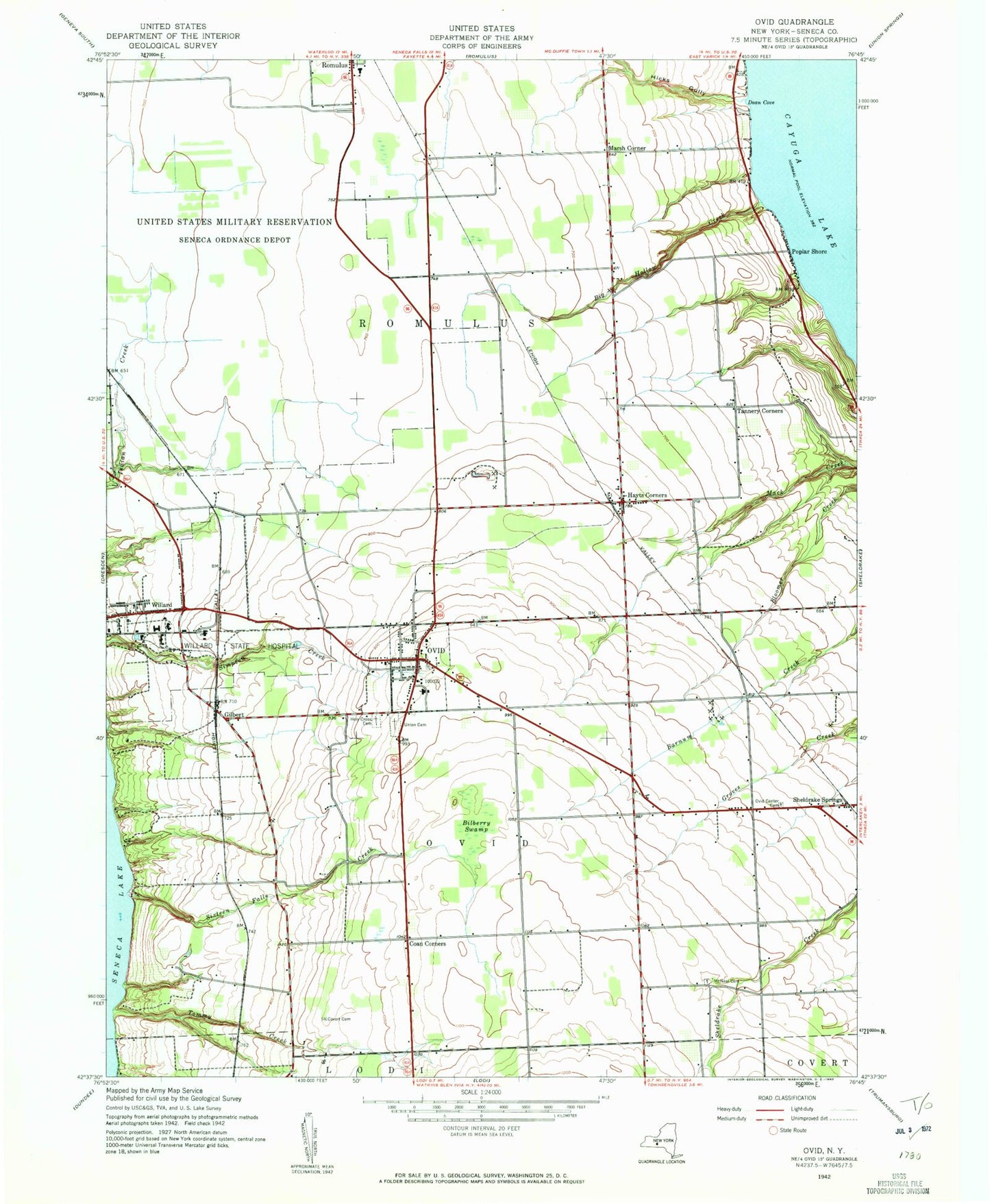
Classic USGS Ovid New York 7.5'x7.5' Topo Map
Couldn't load pickup availability
Historical USGS topographic quad map of Ovid in the state of New York. Typical map scale is 1:24,000, but may vary for certain years, if available. Print size: 24" x 27"
This quadrangle is in the following counties: Seneca.
The map contains contour lines, roads, rivers, towns, and lakes. Printed on high-quality waterproof paper with UV fade-resistant inks, and shipped rolled.
Contains the following named places: Big Hollow Creek, Bilberry Swamp, Camp Babcock Hovey, Central School, Coan Corners, Covert Cemetery, Dean Cove, Hayt Corners, Hicks Gully, Holy Cross Cemetery, McNeal Cemetery, Ovid, Ovid Center Cemetery, Poplar Beach, Sheldrake Springs, Sixteen Falls Creek, Tannery Corners, Tommy Creek, Ovid Union Cemetery, Willard, Willard State Hospital, Gilbert, Marsh Corner, Johnsons Creek, Ovid Airport, Town of Ovid, Town of Romulus, School Number 1 (historical), Village of Ovid, Old Ovid Village Cemetery, Buttonwood Grove Winery, Holy Cross Catholic Church, Ovid Federated Church, Martha Manor Farm, Sned Acres Family Campground, Bonavista State Golf Club, Seneca Community Church, Edith B Ford Memorial Library, South Seneca Middle School, South Seneca High School, Ovid Fire Department, South Seneca Community Volunteer Ambulance Corps, Five Points Correctional Facility, Ovid Post Office, Willard Post Office