MyTopo
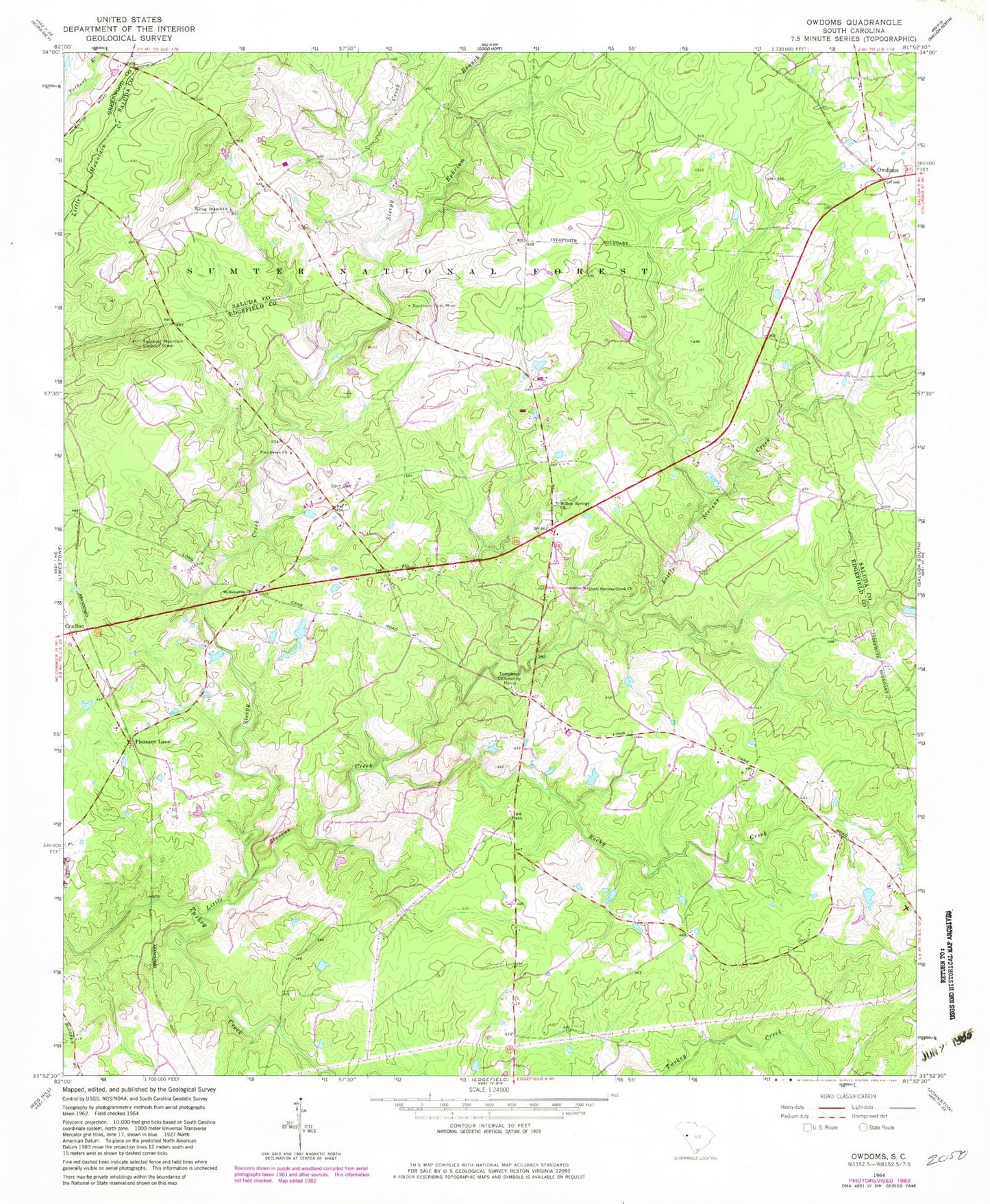
Classic USGS Owdoms South Carolina 7.5'x7.5' Topo Map
Couldn't load pickup availability
Historical USGS topographic quad map of Owdoms in the state of South Carolina. Typical map scale is 1:24,000, but may vary for certain years, if available. Print size: 24" x 27"
This quadrangle is in the following counties: Edgefield, Greenwood, Saluda.
The map contains contour lines, roads, rivers, towns, and lakes. Printed on high-quality waterproof paper with UV fade-resistant inks, and shipped rolled.
Contains the following named places: Willow Springs School (historical), Tompkins School (historical), Long Cane School (historical), Faulkner Mountain School (historical), Johnson School (historical), Oak Grove School (historical), Dorn Cemetery, Ephriam Branch, Little Stevens Creek, McKendree Church, Owdoms, Rocky Creek, Sleepy Creek, Southern Gold Mine, Spring Branch Church, Tompkins Community House, Willow Springs Church, Pittsburg School (historical), Faulkner Mountain Lookout Tower, Little Stevens Creek Church, Pine Grove Church, Pleasant Lane, Meeting Street, Tompkins Cross Roads, Northside Volunteer Fire Department